Edgar Springs, Missouri
| Edgar Springs, Missouri | |
|---|---|
| City | |
 Location of Edgar Springs, Missouri | |
| Coordinates: 37°42′3″N 91°51′58″W / 37.70083°N 91.86611°WCoordinates: 37°42′3″N 91°51′58″W / 37.70083°N 91.86611°W | |
| Country | United States |
| State | Missouri |
| County | Phelps |
| Area[1] | |
| • Total | 0.65 sq mi (1.68 km2) |
| • Land | 0.65 sq mi (1.68 km2) |
| • Water | 0 sq mi (0 km2) |
| Elevation | 1,207 ft (368 m) |
| Population (2010)[2] | |
| • Total | 208 |
| • Estimate (2012[3]) | 206 |
| • Density | 320.0/sq mi (123.6/km2) |
| Time zone | Central (CST) (UTC-6) |
| • Summer (DST) | CDT (UTC-5) |
| ZIP code | 65462 |
| Area code(s) | 573 |
| FIPS code | 29-21214[4] |
| GNIS feature ID | 0749801[5] |
Edgar Springs is a city in Phelps County, Missouri, United States. The population was 208 at the 2010 census. As of the 2000 census, Edgar Springs is the closest town to the mean center of U.S. population, the theoretical center of the United States based on population. The exact point lies about 2.8 miles east of the town at 37°41'49.15" North, 91°48'34.44" West (37.6969870, -91.8095670).
Geography
Edgar Springs is located at 37°42′3″N 91°51′58″W / 37.70083°N 91.86611°W (37.700927, -91.865995).[6]
According to the United States Census Bureau, the city has a total area of 0.65 square miles (1.68 km2), all of it land.[1]
Demographics
| Historical population | |||
|---|---|---|---|
| Census | Pop. | %± | |
| 1880 | 48 | — | |
| 1980 | 271 | — | |
| 1990 | 215 | −20.7% | |
| 2000 | 190 | −11.6% | |
| 2010 | 208 | 9.5% | |
| Est. 2015 | 203 | [7] | −2.4% |
2010 census
As of the census[2] of 2010, there were 208 people, 87 households, and 58 families residing in the city. The population density was 320.0 inhabitants per square mile (123.6/km2). There were 112 housing units at an average density of 172.3 per square mile (66.5/km2). The racial makeup of the city was 95.67% White and 4.33% from two or more races. Hispanic or Latino of any race were 0.96% of the population.
There were 87 households of which 31.0% had children under the age of 18 living with them, 50.6% were married couples living together, 10.3% had a female householder with no husband present, 5.7% had a male householder with no wife present, and 33.3% were non-families. 27.6% of all households were made up of individuals and 13.8% had someone living alone who was 65 years of age or older. The average household size was 2.39 and the average family size was 2.88.
The median age in the city was 37.5 years. 23.1% of residents were under the age of 18; 11.1% were between the ages of 18 and 24; 27.9% were from 25 to 44; 25.1% were from 45 to 64; and 13% were 65 years of age or older. The gender makeup of the city was 47.1% male and 52.9% female.
2000 census
As of the census[4] of 2000, there were 190 people, 91 households, and 53 families residing in the city. The population density was 390.3 people per square mile (149.7/km²). There were 100 housing units at an average density of 205.4 per square mile (78.8/km²). The racial makeup of the city was 96.84% White, 2.11% Native American, 0.53% Asian, 0.53% from other races. Hispanic or Latino of any race were 2.63% of the population.
There were 91 households out of which 23.1% had children under the age of 18 living with them, 39.6% were married couples living together, 13.2% had a female householder with no husband present, and 40.7% were non-families. 38.5% of all households were made up of individuals and 24.2% had someone living alone who was 65 years of age or older. The average household size was 2.09 and the average family size was 2.74.
In the city the population was spread out with 21.6% under the age of 18, 6.3% from 18 to 24, 27.9% from 25 to 44, 23.7% from 45 to 64, and 20.5% who were 65 years of age or older. The median age was 41 years. For every 100 females there were 97.9 males. For every 100 females age 18 and over, there were 86.3 males.
The median income for a household in the city was $30,000, and the median income for a family was $30,781. Males had a median income of $25,625 versus $20,625 for females. The per capita income for the city was $12,672. None of the families and 4.9% of the population were living below the poverty line, including no under eighteens and 22.9% of those over 64.
Climate
Edgar Springs has a humid subtropical climate with cold winters and warm summers.
| Climate data for Edgar Springs | |||||||||||||
|---|---|---|---|---|---|---|---|---|---|---|---|---|---|
| Month | Jan | Feb | Mar | Apr | May | Jun | Jul | Aug | Sep | Oct | Nov | Dec | Year |
| Average high °F (°C) | 41 (5) |
47 (8) |
57 (14) |
68 (20) |
77 (25) |
84 (29) |
90 (32) |
89 (32) |
81 (27) |
70 (21) |
56 (13) |
45 (7) |
67.1 (19.4) |
| Average low °F (°C) | 20 (−7) |
25 (−4) |
33 (1) |
43 (6) |
52 (11) |
61 (16) |
66 (19) |
64 (18) |
56 (13) |
44 (7) |
35 (2) |
25 (−4) |
43.7 (6.5) |
| Average precipitation inches (mm) | 2.35 (59.7) |
2.53 (64.3) |
3.94 (100.1) |
4.49 (114) |
4.80 (121.9) |
4.44 (112.8) |
3.54 (89.9) |
3.25 (82.6) |
4.17 (105.9) |
3.72 (94.5) |
4.44 (112.8) |
3.43 (87.1) |
45.1 (1,145.5) |
| Source: [9] | |||||||||||||
Notable natives
- Mayme Ousley, first woman elected mayor of a town in Missouri, was born in Edgar Springs.[10]
References
- 1 2 "US Gazetteer files 2010". United States Census Bureau. Retrieved 2012-07-08.
- 1 2 "American FactFinder". United States Census Bureau. Retrieved 2012-07-08.
- ↑ "Population Estimates". United States Census Bureau. Retrieved 2013-05-30.
- 1 2 "American FactFinder". United States Census Bureau. Retrieved 2008-01-31.
- ↑ "US Board on Geographic Names". United States Geological Survey. 2007-10-25. Retrieved 2008-01-31.
- ↑ "US Gazetteer files: 2010, 2000, and 1990". United States Census Bureau. 2011-02-12. Retrieved 2011-04-23.
- ↑ "Annual Estimates of the Resident Population for Incorporated Places: April 1, 2010 to July 1, 2015". Retrieved July 2, 2016.
- ↑ "Census of Population and Housing". Census.gov. Retrieved June 4, 2015.
- ↑ "Average weather for Edgar Springs, Missouri". Weather.com. Retrieved July 31, 2013.
- ↑ "Information Sheet: Mayme Ousley Papers" (PDF). umsystem.edu. Retrieved 13 September 2015.
Municipalities and communities of Phelps County, Missouri, United States | ||
|---|---|---|
| Cities | 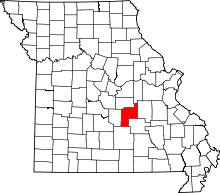 | |
| Townships |
| |
| Unincorporated communities | ||
| Ghost town |
| |