Edith Ronne Land
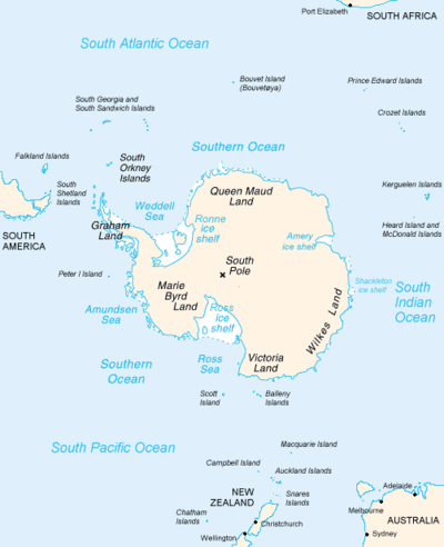
Edith Ronne Land is the portion of Antarctica bounded by Palmer Land and Ellsworth Land to the west, Queen Elizabeth Land to the south, and Coats Land to the east. Its geographical features include Filchner-Ronne Ice Shelf and Berkner Island, the second largest island of Antarctica, as well as several other islands rising from the ice shelf.
Edith Ronne Land was named by Chile for Edith Ronne who was first full member of an Antarctic team. She was also the wife of Commander Finn Ronne, USNR, leader of the Ronne Antarctic Research Expedition (RARE) in 1947–48.[1]
Past name usage
Originally the name was given in 1947 by Commander Finn Ronne to the land presumed to lie south of the large ice shelf he discovered at the head of Weddell Sea (which land corresponds to most of the present Queen Elizabeth Land). However, it was determined in 1957–58 that the ice shelf was larger than previously charted, extending southwards to preempt most of "Edith Ronne Land," and the US Advisory Committee on Antarctic Names officially approved in 1968 the name "Ronne Ice Shelf" for that large ice shelf instead (excluding Filchner Ice Shelf that lies between Berkner Island and Coats Land).[2][3]
Coordinates: 78°30′S 61°00′W / 78.500°S 61.000°W