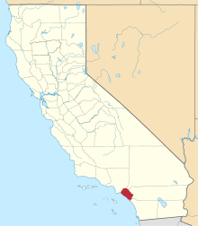
El Modena, California
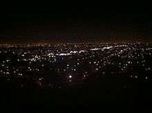
El Modena is an area around El Modena High School in the city of Orange, California. It is located near and east of the intersection of Hewes Street and Chapman Avenue. Much of the area was annexed by Orange in the 1960s and 1970s, but there is still an enclave of unincorporated county land to the east of the high school.
History
The town was historically a barrio [1] or colonia settled by Hispanics of Mexican heritage, as well some Californio and Spanish American settlers in the first half of the 19th century (1790-1850) before the annexation of California by the United States during the Mexican American War (1846-1848). In 1883 Quaker settlers arrived and established a local chapter of the Society of Friends.[2]
El Modena's agricultural days have had a rich cultural impact on the town's history. Between the time of its foundation in the 1880s to the suburban development boom in the late 1950s, El Modena was an area filled with citrus groves. Roses grown and shipped to Eastern markets were also a major part of the agricultural industry.[3] It is now fully urbanized with the majority of its residents being low to middle income families; the annexed areas of the city became upper income in the real estate booms of the 1990s and 2000s (decade). The original Quaker church still exists and currently operates as a Mexican restaurant.[4]
Like the trailer parks of western Santa Ana facing the Santa Ana River, and Panorama Heights within Orange and facing Tustin, the El Modena neighborhood is among the poorest parts of Orange County. By the 1970s, much of the older residential areas were poorly maintained: No paved streets, no gutters or sewer caps, poorly dimmed street lighting and mobile home parks without proper utilities. As time progressed, however, El Modena's living environment has gradually improved.[5]
The Southern Pacific formerly had an El Modena Station, located off La Veta Avenue, just south of the present-day La Veta Park.
Cultural Depictions
Kim Stanley Robinson's novel Pacific Edge is set in El Modena c. 2065.[6]
References
- ↑ Web Page: Old Town Is Gone, but Neighborhood Ties Remain
- ↑ David W. Kean, Wide Places in the California Roads: The encyclopedia of California's small towns and the roads that lead to them (Volume 1 of 4: Southern California Counties), p. 62
- ↑ David W. Kean, Wide Places in the California Roads: The encyclopedia of California's small towns and the roads that lead to them (Volume 1 of 4: Southern California Counties), p. 63
- ↑ David W. Kean, Wide Places in the California Roads: The encyclopedia of California's small towns and the roads that lead to them (Volume 1 of 4: Southern California Counties), p. 63
- ↑ Web Page: Cause for Celebration : With Gang Truce Holding, Life in El Modena Area Is More Livable
- ↑ Web Page: Pacific Edge: Three Californias (Three Californias Series)
External links
- El Modena Branch Orange Public Library
- El Modena Park
- 1920's postcard of David Hewes Realty Corporation in El Modena
- 1952 AAA map showing the location of pre-annexation El Modena
Coordinates: 33°47′16″N 117°48′31″W / 33.78778°N 117.80861°W