El Qanater El Khayreya
| El Qanater El Khayreya القناطر الخيرية | |
|---|---|
 | |
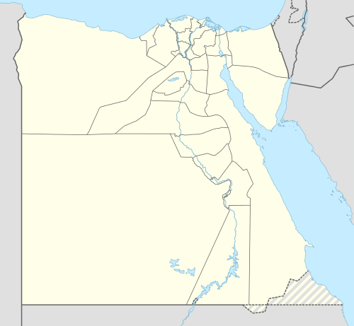 El Qanater El Khayreya Location in Egypt | |
| Coordinates: EG 30°11′37″N 31°07′55″E / 30.193583°N 31.132064°ECoordinates: EG 30°11′37″N 31°07′55″E / 30.193583°N 31.132064°E | |
| Country |
|
| Governorate | Qalyubia |
| Time zone | EST (UTC+2) |
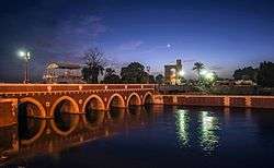
El Qanater El Khayreya (Arabic: القناطر الخيرية pronounced [elʔɑˈnɑːtˤeɾ elxæjˈɾejjæ], "the Benevolent Bridges") is a city in Qalyubia Governorate, Egypt. It is the location of the Delta Barrages, the first modern irrigation structure across the Nile, located at the apex of the Nile Delta. In the mid 1850s, when Viceroy Sa'id Pasha took over project construction he ordered a silver medal to be struck to mark the occasion. He then ordered the construction of a town near the incomplete barrage. Again the project would be bogged down due to financial problems; the original barrages were initially completed in 1862, and greatly improved in the 1880s under British rule. A new barrage structure was built slightly downstream in 1939.[1] The name of the city, is a reference to the structure and the river crossing it nonetheless provided.
Climate
Köppen-Geiger climate classification system classifies its climate as hot desert (BWh),[2] as the rest of Egypt.
| Climate data for El Qanater el Khayreyya | |||||||||||||
|---|---|---|---|---|---|---|---|---|---|---|---|---|---|
| Month | Jan | Feb | Mar | Apr | May | Jun | Jul | Aug | Sep | Oct | Nov | Dec | Year |
| Average high °C (°F) | 19.4 (66.9) |
20.9 (69.6) |
23.6 (74.5) |
27.9 (82.2) |
31.9 (89.4) |
34.3 (93.7) |
34.6 (94.3) |
34.4 (93.9) |
32.2 (90) |
30 (86) |
25.4 (77.7) |
21 (70) |
27.97 (82.35) |
| Daily mean °C (°F) | 13 (55) |
13.9 (57) |
16.5 (61.7) |
19.9 (67.8) |
23.8 (74.8) |
26.4 (79.5) |
27.5 (81.5) |
27.4 (81.3) |
25.2 (77.4) |
23.1 (73.6) |
19.1 (66.4) |
14.8 (58.6) |
20.88 (69.55) |
| Average low °C (°F) | 6.6 (43.9) |
7 (45) |
9.4 (48.9) |
12 (54) |
15.7 (60.3) |
18.5 (65.3) |
20.5 (68.9) |
20.4 (68.7) |
18.3 (64.9) |
16.2 (61.2) |
12.9 (55.2) |
8.6 (47.5) |
13.84 (56.98) |
| Average precipitation mm (inches) | 4 (0.16) |
5 (0.2) |
3 (0.12) |
1 (0.04) |
1 (0.04) |
0 (0) |
0 (0) |
0 (0) |
0 (0) |
1 (0.04) |
2 (0.08) |
5 (0.2) |
22 (0.88) |
| Source: Climate-Data.org (altitude: 18m)[2] | |||||||||||||
References
- ↑ Samir Raafat, The Delta Barrage, Cairo Times, August 21, 1997
- 1 2 "Climate: Al Qanatir al Khairiya - Climate graph, Temperature graph, Climate table". Climate-Data.org. Retrieved 2014-01-03.