Elafonisos
| Elafonisos Ελαφόνησος | |
|---|---|
 | |
 Elafonisos | |
|
Location within the region 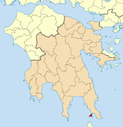 | |
| Coordinates: 36°29′N 22°57′E / 36.483°N 22.950°ECoordinates: 36°29′N 22°57′E / 36.483°N 22.950°E | |
| Country | Greece |
| Administrative region | Peloponnese |
| Regional unit | Laconia |
| Area | |
| • Municipality | 19.992 km2 (7.719 sq mi) |
| Highest elevation | 276 m (906 ft) |
| Lowest elevation | 0 m (0 ft) |
| Population (2011)[1] | |
| • Municipality | 1,041 |
| • Municipality density | 52/km2 (130/sq mi) |
| Time zone | EET (UTC+2) |
| • Summer (DST) | EEST (UTC+3) |
| Postal code | 230 53 |
| Area code(s) | 27340 |
| Vehicle registration | ΑΚΑ-Β-Ε-Ζ |
Elafonisos (Greek: Ελαφόνησος) is a small Greek island between the Peloponnese and Kythira. It lies off the coast of Cape Malea and Vatika. The area of the island is 19 square kilometres (7 square miles).
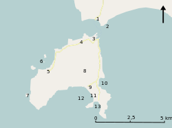
The population is between 300 and 350 during the winter but increases dramatically in the summer months. During July and August the number of tourist visitors reach over 3,000 per day (bringing with them some 1,600 cars). Many people visit the island for its light coloured, sandy beaches. Among the most well known of its beaches are Sarakiniko, Fragos (Simos) and Panagias Nissia, all filled with blue-green waters. The Main Inhabiting Families that run and manage the island are the Mentis, Psaromati, Barbarossa and Aronis families.
Elafonisos is by far the largest inhabited island in the Peloponnese archipelago, and the only one that is a separate municipality. There are also some archaeological discoveries to explore on the island and in the surrounding waters. The main church of the community is Agios Spyridon (Greek: Άγιος Σπυρίδων), which is built on a tiny separate piece of land which is connected by a bridge over shallow waters to the rest of the island. The community's land area also includes 3 km2 (1 sq mi) of the mainland consisting mainly of the famous Punta Beach.
On the nearby mainland, approximately 6.5 km (4.0 mi) east is Neapoli (Greek: Νεάπολη) of the municipality of Vatika. About 8.5 km (5.3 mi) south is Cape Frangos (Greek: Φράγκο) on the island of Kythira.
Historical population
| Year | Island population | Municipality population |
|---|---|---|
| 1981 | 611 | — |
| 1991 | 653 | 725 |
| 2001 | 625 | 745 |
| 2011 | 816 | 1,041 |
History
In antiquity, Elafonisos did not constitute an island but a peninsula with the name "Onou Gnathos" (Greek: Όνου Γνάθος) (Donkey's Jawbone) according to Pausanias.[2] Just off the coast of Elafonissos lies the archeological site of Pavlopetri, a sunken city dating back to the early 3rd millennium BC and thought to have been claimed by the sea around 1000 BC.[3]
References
- ↑ "Απογραφή Πληθυσμού - Κατοικιών 2011. ΜΟΝΙΜΟΣ Πληθυσμός" (in Greek). Hellenic Statistical Authority.
- ↑ Description of Greece book 3, chapter 22, section 10 "kalousi de Onou gnathon tên akran". (2.94), (1.97) and Strabo Geography (2.22), (2.71), (4.22), (4.28)
- ↑ Helena Smith in Athens (2009-10-16). "Lost Greek city that may have inspired Atlantis myth gives up secrets | Science". London: The Guardian. Retrieved 2013-03-26.
External links
| Wikimedia Commons has media related to Elafonissos. |
- Elafonisos Municipality(Greek)
- Elafonissos(English)
- Elafonisos
- Elafonisos Island
- Elafonisos - Lakonia
| Regional unit of Arcadia |  | |
|---|---|---|
| Regional unit of Argolis | ||
| Regional unit of Corinthia | ||
| Regional unit of Laconia | ||
| Regional unit of Messenia | ||
| ||