Ellerker
| Ellerker | |
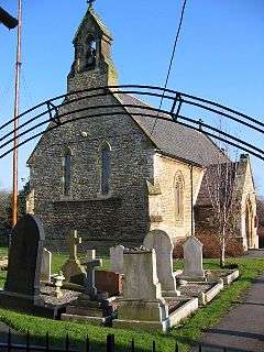 St Anne's Church |
|
 Ellerker |
|
| Population | 307 (2011 census)[1] |
|---|---|
| OS grid reference | SE920294 |
| – London | 155 mi (249 km) S |
| Civil parish | Ellerker |
| Unitary authority | East Riding of Yorkshire |
| Ceremonial county | East Riding of Yorkshire |
| Region | Yorkshire and the Humber |
| Country | England |
| Sovereign state | United Kingdom |
| Post town | BROUGH |
| Postcode district | HU15 |
| Dialling code | 01430 |
| Police | Humberside |
| Fire | Humberside |
| Ambulance | Yorkshire |
| EU Parliament | Yorkshire and the Humber |
| UK Parliament | Haltemprice and Howden |
Coordinates: 53°45′13″N 0°36′18″W / 53.753722°N 0.605031°W
Ellerker is a village and civil parish in the East Riding of Yorkshire, England. It is situated approximately 10 miles (16 km) west of Hull city centre and 13 miles (21 km) east of the market town of Howden. It lies 1 mile (1.6 km) south of the A63 road junction with the A1034 road.
According to the 2011 UK Census, Ellerker parish had a population of 307,[1] a decrease on the 2001 UK Census figure of 320.[2] Ellerker lies within the Parliamentary constituency of Haltemprice and Howden an area that mainly consists of middle class suburbs, towns and villages. The area is affluent and has one of the highest proportions of owner-occupiers in the country.[3]
'Ellerker' means a "marsh where alder trees grow", from Old English alor or aler "alder" and Old Norse kjarr "marsh". The name was recorded as Alrecher in the 11th century[4] and Alekirr in 1139. Same name as Orcher (Normandy, Aurichier 12th century).[4]
In 1823 Ellerker was in the parish of Brantingham and the Wapentake of Howdenshire. Village population was 249, including eight farmers, a corn miller, a shopkeeper, a tailor, a shoemaker, and a carpenter. Also listed in directories were three yeomen and a curate of the village church. Once a week a carrier operated from the village to Hull and Wilton.[5]
The village church is dedicated to St Anne and is designated as a Grade II listed building.[6]
Sir Rafe Ellerker is cited in Part 1 of title 'The Last Years of a Frontier' - DLW Tough, concerning his survey of the Border Marches 1541.
References
- 1 2 "Key Figures for 2011 Census: Key Statistics: Area: Ellerker CP (Parish)". Neighbourhood Statistics. Office for National Statistics. Retrieved 4 February 2013.
- ↑ "2001 Census: Key Statistics: Parish Headcounts: Area: Ellerker CP (Parish)". Neighbourhood Statistics. Office for National Statistics. Retrieved 15 May 2008.
- ↑ "Haltemprice and Howden". UK Polling Report. Retrieved 11 May 2015.
- 1 2 de Beaurepaire, François (1979). Les Noms des communes et anciennes paroisses de la Seine-Maritime (in French). Préface Marianne Mulon. Paris: A & J Picard with the support of CNRS. p. 164. ISBN 978-2708400405.
- ↑ Baines, Edward (1823). History, Directory and Gazetteer of the County of York. p. 201.
- ↑ Historic England. "Church of St Anne (1103352)". National Heritage List for England. Retrieved 23 March 2015.
- Gazetteer — A–Z of Towns Villages and Hamlets. East Riding of Yorkshire Council. 2006. p. 5.
External links
 Media related to Ellerker at Wikimedia Commons
- Ellerker in the Domesday Book