Ge'alya
| Ge'alya גְּאַלְיָה | |
|---|---|
 Ge'alya | |
| Coordinates: 31°53′5.63″N 34°45′57.96″E / 31.8848972°N 34.7661000°ECoordinates: 31°53′5.63″N 34°45′57.96″E / 31.8848972°N 34.7661000°E | |
| District | Central |
| Council | Gan Raveh |
| Affiliation | Moshavim Movement |
| Founded | 1948 |
| Founded by | Bulgarian immigrants |
| Population (2015)[1] | 992 |
| Website | www.gealya.co.il |
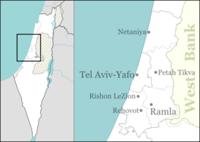
Ge'alya, sometimes written Galia (Hebrew: גְּאַלְיָה), is a moshav in central Israel. Located in the coastal plain and covering 2,000 dunams, it falls under the jurisdiction of Gan Raveh Regional Council. In 2015 it had a population of 992.
History
The moshav was founded in 1948 by new immigrants from Bulgaria, on land belonging to the Arab village of Qubayba, which was depopulated in 1948.[2]
It is located south of the ancient site of Tel Shalaf, where Iron Age artefacts have been found.[3] Tel Shalaf, is identified by some but not all scholars with the city of Eltekeh.[4] Eltekeh appeared in Sennacherib's Annals as the site of a battle between the Assyrians and Egyptians in 701 BCE, and in the Bible as a Levitical city within the first Dan tribal area (Joshua 19:44 and Joshua 21:23).[4][5]
References
- ↑ "List of localities, in Alphabetical order" (PDF). Israel Central Bureau of Statistics. Retrieved 16 October 2016.
- ↑ Khalidi, Walid (1992). All That Remains: The Palestinian Villages Occupied and Depopulated by Israel in 1948. Washington D.C.: Institute for Palestine Studies. p. 408. ISBN 0-88728-224-5.
- ↑ Yavne, Survey Map Israel Antiquities Authority
- 1 2 W. R. Gallagher (1999). Sennacherib's Campaign to Judah. Leifen: Brill. pp. 123–124.
- ↑ Carta's Official Guide to Israel and Complete Gazetteer to all Sites in the Holy Land. (3rd edition 1993) Jerusalem, Carta, p.163-164, ISBN 965-220-186-3 (English)
External links
- Official website (Hebrew)