Enfield Falls Canal
| Enfield Falls Canal | |
|---|---|
|
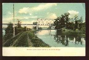
Windsor Locks Canal and railroad bridge (postcard mailed in 1909) | |
| Specifications | |
| Length | 5.25 miles (8.45 km) |
| Locks | 1 (north end); 3 (south end) |
| Status | Closed |
| Navigation authority | |
|
Enfield Falls Canal (Windsor Locks Canal) | |
| Nearest city | Windsor Locks, Connecticut |
| Area | 55 acres (22 ha) |
| Built | 1829 |
| NRHP Reference # | 76001998[1] |
| Added to NRHP | April 22, 1976 |
| History | |
| Construction began | 1827 |
| Date completed | November 11, 1829 |
| Geography | |
| Start point | 41°59′12″N 72°36′19″W / 41.9866°N 72.6053°W |
| End point | 41°55′01″N 72°37′29″W / 41.9169°N 72.6248°W |
Enfield Falls Canal (Windsor Locks Canal) is a canal that was built to circumvent the shallows at Enfield Falls (or Enfield Rapids) on the Connecticut River, en route either to or from Springfield, Massachusetts. It is situated along the west side of the river, adjacent to the towns of Suffield and Windsor Locks of Hartford County in the state of Connecticut, USA. Windsor Locks is named after the series of locks on the canal.
Prior to the opening of the canal, the scows or flat-bottomed boats which plied the Connecticut River could only ascend the falls by engaging local fallsmen to propel the craft forward utilizing set poles. One fallsman was required for each ton of cargo. Not only did the added labor costs make this method of overtaking the falls expensive, but the amount of cargo that could be transported was limited to approximately ten tons. Any additional freight had to be offloaded at Warehouse Point on the east bank and warehoused for later transport or carried around the falls by ox teams.
Construction

Construction of the canal commenced in 1827 and it was opened on November 11, 1829. The canal was 5 1⁄4 miles (8.4 km) long and had a vertical drop of 32 ft (9.8 m). The locks admitted craft up to 90 ft (27 m) long and 20 ft (6.1 m) wide. The canal was unique among canals of the era in that it was designed with structural reinforcement to facilitate steam tug boat traffic. The design of the canal included a massive head gate with apertures that could be opened and closed to precisely control water levels not only within the lock chambers but within the canal itself. The design feature supported the incorporator's dual intent to profit not only from tolls charged on canal traffic but from the sale of mill sites and the leasing of water rights to mill operators along the last mile of the canal bank.
Once the canal was opened, boats were able to carry much larger loads, and the anticipated steamboat services were introduced using newly designed vessels capable of passing through the lock chambers. By 1844 the Hartford and Springfield Railroad had started operation, and navigation on the Connecticut River gradually reduced. The profits realized from the sale of water rights proved to be the more lucrative of the canal's two purposes.
Today
Today the canal is closed to navigation and privately owned by the Ahlstrom Corporation,[2] which has a manufacturing facility adjacent to the canal.[3] The locks themselves still exist, but have not been usable since the 1970s.[4] Most of the towpath is open for hiking and cycling. The canal is listed in the National Register of Historic Places. According to a sign at on the Windsor Locks, CT gate near CT Route 190, the trail is open from dawn to dusk from April 1 until November 1.
See also
- National Register of Historic Places listings in Hartford County, Connecticut
- windsorlockshistory.com - an on-line listing of books, articles, maps and videos on the history of WIndsor Locks, including many on the canal.
- Windsor Locks Canal State Park Trail
- Windsor Locks Canal State Park Trail Connecticut Department of Energy and Environmental Protection
References
- ↑ National Park Service (2010-07-09). "National Register Information System". National Register of Historic Places. National Park Service.
- ↑ American Canal Society (2004). Enfield Falls Canal. Retrieved 17 August 2011 from Internet Archive.
- ↑ Ahstrom Corporation, Official Website. "Contact Us". Accessed March 11, 2012.
- ↑ "Don't Rebuild The Enfield Dam". Hartford Courant. Hartford Courant. Retrieved 15 December 2014.
- The Rise and Fall of the Canal and the Factories Along it, by Dr. Melvin D. Montemerlo, July 25, 2016
- [http://www.windsorlockshistory.com/ is an online listing of articles, books, videos and maps on the history of Windsor Locks history, many of which can be downloaded. The histories of Windsor and of Windsor Locks are inextricably intertwined.]
- Connecticut Heritage (Dorothy A. DeBisschop). The Canal at Windsor Locks. Retrieved January 20, 2006.
| Topics | |
|---|---|
| Lists by states |
|
| Lists by insular areas | |
| Lists by associated states | |
| Other areas | |
| |