Erez
| Erez | |
|---|---|
 Erez | |
| Coordinates: 31°33′35.63″N 34°33′57.95″E / 31.5598972°N 34.5660972°ECoordinates: 31°33′35.63″N 34°33′57.95″E / 31.5598972°N 34.5660972°E | |
| District | Southern |
| Council | Sha'ar HaNegev |
| Affiliation | Kibbutz Movement |
| Founded |
1949 (original location) 1950 (current location) |
| Founded by | Noar Oved members |
| Population (2015)[1] | 487 |
| Website | www.erez.org.il |
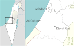
Erez (Hebrew: אֶרֶז, lit. Cedar), is a kibbutz in south-western Israel. Located in the north-western Negev around 18 kilometres south of Ashkelon, it falls under the jurisdiction of Sha'ar HaNegev Regional Council. In 2015 it had a population of 487.
History
Erez is named after the first nucleus that settled the kibbutz. They were members of the Noar Oved nucleus from Petah Tikva. They originally settled on ground in the area of Or HaNer in 1949. However, in 1950 they were resettled in its current location on land belonging to the depopulated Arab village of Dimra.[2]
Economy
The kibbutz has three main industries; agriculture (arable and fruit farming as well as animal husbandry), manufacturing (the "Erez Thermoplastics Products" company manufactures plastic covered materials) and research and development.
See also
References
| Wikimedia Commons has media related to Erez. |
- ↑ "List of localities, in Alphabetical order" (PDF). Israel Central Bureau of Statistics. Retrieved 16 October 2016.
- ↑ Khalidi, Walid (1992), All That Remains: The Palestinian Villages Occupied and Depopulated by Israel in 1948, Washington D.C.: Institute for Palestine Studies, p. 94, ISBN 0-88728-224-5
External links
- Official website (Hebrew)