Etinan
| Etinan | |
|---|---|
| Local Government Area (L.G.A) | |
 Etinan Location in Nigeria | |
| Coordinates: 4°51′0″N 7°50′0″E / 4.85000°N 7.83333°ECoordinates: 4°51′0″N 7°50′0″E / 4.85000°N 7.83333°E | |
| Country |
|
| State | Akwa-Ibom State |
| Time zone | WAT (UTC+1) |
Etinan is located within the south eastern part of Nigeria and constitutes one of the Local Government Areas in the oil rich Akwa Ibom State. Known for its agricultural and arts craft products, the area forms one of the most peaceful locations in the West African State of Nigeria.
Etinan is also home to the famous Peacock Paints Industries and NIFOR, Akwa Ibom State Zonal Office
Within Etinan LGA, is the village of Ikot Itina where the prominent entrepreneur Late John Dickson Uwak is from, Mbioto hometown of the former Akwa Ibom state governor Late Obong Akpan Isemin and the village of Ikot Udo Abia, which was part of the route of the African slave trade.
Historical Background
Following the recommendations of the Akilu commission of Inquiry into the administrative structure of the then South Eastern State, Etinan Local Government was created in 1976 out of the former Uyo Division with Etinan as its headquarters.
People & Culture
The area is mainly inhabited by the Iman Ibom people who are characteristically dynamic, imaginative, industrious and intelligent. They generally speak Ibibio language and have a rich cultural heritage. Some of the cultural societies found here are Ekpo, Ekong, Ebre and Idiong. A greater percentage of the people are Christians although some forms of African traditional religion are practiced by few people. Their culture is reflected and displayed through dances, arts, and crafts. The main occupation of the people centres around farming and petty trading. Crops cultivated include yams, cassava, cocoyam and maize. Small scale manufacturing is also carried out by the people. A number of the people also engage in wine tapping, crafts-making, wood-carving, sculpture and baking.
Geographical Location & Climate
Etinan Local Government Area is located on latitude 05001’N and longitude 07054’E. It is 26 kilometres South of Uyo, the Akwa Ibom State capital and 24 kilometres North of Eket. It shares common boundaries with Onna, Nsit Ibom, Mkpat Enin, Abak and Uyo Local Government Areas. The entire local government area lies in the tropical rain forest belt and has two distinct seasons – the rainy season and the dry season. The vegetation is evergreen.
Tourism
Etinan is known for its arts craft products, the area forms one of the most peaceful locations in the West African State of Nigeria. private section driven hospitality, e.g. hotels, clubs and gardens.
MAJOR ORGANIZATIONS
Mboho Ndito Imanibom (MNII) A socio- Cultural/Political Organization which was formed through the divine will of God from already existing Associations viz; 1.Etinan Local Government Welfare Association (ELWA) Eket Chapter 2. " " ' " " " Ibeno Chapter 3. Imanibom Community Port Harcourt Rivers State 4. Imanibom Peoples Forum Aba, Abia State These four Associations came together to form the prestigious "MBOHO NDITO IMANIBOM"
Natural Resources
Large deposits of mineral resources such as clay, glass, sand and sharp sand. Agricultural resources include palm produce, cassava and yam.
Commerce
Large deposits of mineral resources such as clay, glass, sand and sharp sand. Agricultural resources include palm produce, cassava and yam.
Population
Males Females TOTAL: 89,907 79,377 169,284 according to 2006 National Census
External links
- [Official website of the Akwa Ibom State Representative for Etinan Local Government Area - Honourable Samuel Ikon: http://www.etinanconstituency.org]
State capital: Uyo | ||
| LGAs | 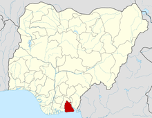 | |