Fabius (village), New York
| Fabius, New York | |
|---|---|
| Village | |
_highlighted.svg.png) Location in Onondaga County and the state of New York. | |
| Coordinates: 42°50′8″N 75°59′7″W / 42.83556°N 75.98528°WCoordinates: 42°50′8″N 75°59′7″W / 42.83556°N 75.98528°W | |
| Country | United States |
| State | New York |
| County | Onondaga |
| Area | |
| • Total | 0.4 sq mi (1.0 km2) |
| • Land | 0.4 sq mi (1.0 km2) |
| Population (2010) | |
| • Total | 352 |
| • Density | 910/sq mi (350/km2) |
| Time zone | Eastern (EST) (UTC-5) |
| • Summer (DST) | EDT (UTC-4) |
| FIPS code | 36-24867 |
Fabius is a village in Onondaga County, New York, United States. The population was 352 at the 2010 census. It is part of the Syracuse Metropolitan Statistical Area. The village is near the center of the town of Fabius and is south of Syracuse.
History
The village is within the former Central New York Military Tract and was originally called "Franklinville." Fabius became an incorporated village in 1880. Fabius was named for Quintus Fabius Maximus Verrucosus, a Roman soldier and politician.
The Fabius Village Historic District was listed on the National Register of Historic Places in 2000.[1]
Geography
Fabius is located at 42°50′7″N 75°59′6″W / 42.83528°N 75.98500°W (42.835551, -75.98515).[2]
According to the United States Census Bureau, the village has a total area of 0.4 square miles (1.0 km²), of which all is land.
The village is at the intersection of New York State Route 80 and New York State Route 91.
Demographics
| Historical population | |||
|---|---|---|---|
| Census | Pop. | %± | |
| 1870 | 378 | — | |
| 1880 | 405 | 7.1% | |
| 1890 | 312 | −23.0% | |
| 1900 | 387 | 24.0% | |
| 1910 | 344 | −11.1% | |
| 1920 | 240 | −30.2% | |
| 1930 | 267 | 11.3% | |
| 1940 | 308 | 15.4% | |
| 1950 | 369 | 19.8% | |
| 1960 | 378 | 2.4% | |
| 1970 | 374 | −1.1% | |
| 1980 | 367 | −1.9% | |
| 1990 | 310 | −15.5% | |
| 2000 | 355 | 14.5% | |
| 2010 | 352 | −0.8% | |
| Est. 2015 | 348 | [3] | −1.1% |
As of the census[5] of 2000, there were 355 people, 127 households, and 92 families residing in the village. The population density was 885.6 people per square mile (342.7/km²). There were 137 housing units at an average density of 341.8 per square mile (132.2/km²). The racial makeup of the village was 98.03% White, 1.41% Native American, 0.28% Asian, and 0.28% from two or more races. Hispanic or Latino of any race were 2.25% of the population.
There were 127 households out of which 38.6% had children under the age of 18 living with them, 60.6% were married couples living together, 9.4% had a female householder with no husband present, and 26.8% were non-families. 22.0% of all households were made up of individuals and 7.9% had someone living alone who was 65 years of age or older. The average household size was 2.80 and the average family size was 3.23.
In the village the population was spread out with 31.5% under the age of 18, 5.1% from 18 to 24, 29.9% from 25 to 44, 23.1% from 45 to 64, and 10.4% who were 65 years of age or older. The median age was 36 years. For every 100 females there were 85.9 males. For every 100 females age 18 and over, there were 92.9 males.
The median income for a household in the village was $52,321, and the median income for a family was $55,417. Males had a median income of $39,844 versus $26,500 for females. The per capita income for the village was $17,994. About 4.0% of families and 5.5% of the population were below the poverty line, including 12.7% of those under age 18 and none of those age 65 or over.
Notable people
- James J. Belden, former US Congressman
References
- ↑ National Park Service (2009-03-13). "National Register Information System". National Register of Historic Places. National Park Service.
- ↑ "US Gazetteer files: 2010, 2000, and 1990". United States Census Bureau. 2011-02-12. Retrieved 2011-04-23.
- ↑ "Annual Estimates of the Resident Population for Incorporated Places: April 1, 2010 to July 1, 2015". Retrieved July 2, 2016.
- ↑ "Census of Population and Housing". Census.gov. Retrieved June 4, 2015.
- ↑ "American FactFinder". United States Census Bureau. Retrieved 2008-01-31.
External links
Municipalities and communities of Onondaga County, New York, United States | ||
|---|---|---|
| City | 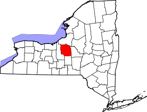 | |
| Towns | ||
| Villages | ||
| CDPs | ||
| Other hamlets |
| |
| Indian reservation | ||
| Footnotes | ‡This populated place also has portions in an adjacent county or counties | |