Fall River, Massachusetts
| Fall River, Massachusetts | ||
|---|---|---|
| City | ||
|
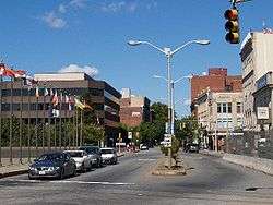
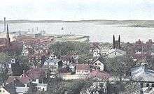
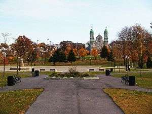
Downtown Fall River in 2007 | ||
| ||
| Nickname(s): "The Scholarship City," "The River", "Spindle City", "Where the River Falls" | ||
| Motto: "We'll Try" | ||
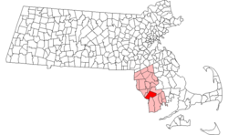 Location in Bristol County in Massachusetts | ||
 Fall River, Massachusetts Location in the United States | ||
| Coordinates: 41°42′05″N 71°09′20″W / 41.70139°N 71.15556°WCoordinates: 41°42′05″N 71°09′20″W / 41.70139°N 71.15556°W | ||
| Country | United States | |
| State | Massachusetts | |
| County | Bristol | |
| Settled | 1670 | |
| Incorporated | 1803 | |
| Government | ||
| • Type | Mayor-council | |
| • Mayor | Jasiel F. Correia II | |
| • City Council |
Shawn E. Cadime President Linda M. Pereira Vice President Richard Cabeceiras Joseph D. Camara Steven A. Camara Pam Laliberte-Lebeau Stephen R. Long Raymond A. Mitchell Cliff Ponte | |
| Area | ||
| • Total | 40.2 sq mi (104.2 km2) | |
| • Land | 33.1 sq mi (85.8 km2) | |
| • Water | 7.1 sq mi (18.4 km2) | |
| Elevation | 121 ft (37 m) | |
| Population (2010[1]) | ||
| • Total | 88,857 | |
| • Density | 2,682/sq mi (1,035.6/km2) | |
| Time zone | Eastern (UTC-5) | |
| • Summer (DST) | Eastern (UTC-4) | |
| ZIP code | 02720-02724 | |
| Area code(s) | 508 / 774 | |
| FIPS code | 25-23000 | |
| GNIS feature ID | 0612595 | |
| Website |
www | |
Fall River is a city in Bristol County, Massachusetts, United States. Fall River's population was 88,857 at the 2010 census,[2] making it the tenth-largest city in the state.
Located along the eastern shore of Mount Hope Bay at the mouth of the Taunton River, the city became famous during the 19th century as the leading textile manufacturing center in the United States. While the textile industry has long since moved on, its impact on the city's culture and landscape remains to this day. Fall River's official motto is "We'll Try," dating back to the aftermath of the Great Fire of 1843. It is also nicknamed "the Scholarship City" because Dr. Irving Fradkin founded Dollars for Scholars here in 1958.
Fall River is known for the Lizzie Borden case, Portuguese culture, its numerous 19th-century textile mills and Battleship Cove, the world's largest collection of World War II naval vessels and the home of the USS Massachusetts (BB-59). Fall River is also the only city in the United States to have its city hall located over an interstate highway.
History
Colonial period to 1800s
At the time of the establishment of the Plymouth Colony in 1620, the area that would one day become Troy City was inhabited by the Pokanoket Wampanoag tribe, headquartered at Mount Hope in what is now Bristol, Rhode Island. The "falling" river that the name Fall River refers to is the Quequechan River (pronounced "quick-a-shan" by locals) which flows through the city, dropping steeply into the bay. Quequechan is a Wampanoag word believed to mean "Falling River" or "Leaping/Falling Waters." During the 1960s, Interstate 195 was constructed through the city along the length of the Quequechan River. The portion west of Plymouth Avenue was routed underground through a series of box culverts, while much of the eastern section "mill pond" was filled in for the highway embankment.
In 1653, Freetown was settled at Assonet Bay by members of the Plymouth Colony, as part of Freeman's Purchase, which included the northern part of what is now Fall River. In 1683, Freetown was incorporated as a town within the colony. The southern part of what is now Fall River was incorporated as the town of Tiverton as part of the Massachusetts Bay Colony in 1694, a few years after the merger with Plymouth Colony. In 1746, in the settlement of a colonial boundary dispute between Rhode Island and Massachusetts, Tiverton was annexed to Rhode Island, along with Little Compton and what is now Newport County, Rhode Island. The boundary was then placed approximately at what is now Columbia Street.
In 1703, Benjamin Church, a hero of King Philip's War established a saw mill, grist mill, and a fulling mill on the Quequechan River. In 1714, Church sold his land, along with the water rights to Richard Borden of Tiverton and his brother Joseph. This transaction would prove to be extremely valuable 100 years later, helping to establish the Borden family as the leaders in the development of Fall River's textile industry.
During the 18th century the area consisted mostly of small farms and relatively few inhabitants. In 1778, the Battle of Freetown, was fought here during the American Revolutionary War, the townspeople put up a strong defense against a British force.
In 1803, Fall River was separated from Freetown and officially incorporated as its own town. A year later, Fall River changed its name to "Troy." The name "Troy" was used for 30 years and was officially changed back to Fall River on February 12, 1834. During this period, Fall River was governed by a three-member Board of Selectmen, until it became a City in 1854.
In July 1843, the first great fire in Fall River's history destroyed much of the town center, including the Atheneum, which housed the Skeleton in Armor which had been discovered in a sand bank in 1832 near what is now the corner of Hartwell and Fifth Street.
During this time, the southern part of what is now Fall River (south of Columbia Street) would remain part of Tiverton, Rhode Island. In 1856, the town of Tiverton, Rhode Island voted to split off its industrial northern section as Fall River, Rhode Island. In 1861, after decades of dispute, the United States Supreme Court moved the state boundary to what is now State Avenue, thereby creating a City of Fall River entirely within Massachusetts. (Also as part of this decision, Pawtucket, Massachusetts would become part of Pawtucket, Rhode Island.[3])
Industrial development and prosperity
The 19th century
The early establishment of the textile industry in Fall River grew out of the developments made in nearby Rhode Island beginning with Samuel Slater at Pawtucket in 1793. In 1811, Col. Joseph Durfee, the Revolutionary War veteran and hero of the Battle of Freetown in 1778 built the Globe Manufactory (a spinning mill) at the outlet of Cook Pond on Dwelly St. near what is now Globe Four Corners in the city's South End. (It was part of Tiverton, Rhode Island at the time.) While Durfee's mill was never very successful, it marked the beginning of the city's rise in the textile business.
The real development of Fall River's industry, however, would occur along the falling river from which it was named, about a mile north of Durfee's first mill. The Quequechan River, with its eight falls, combined to make Fall River the best tidewater privilege in southern New England. It was perfect for industrialization—big enough for profit and expansion, yet small enough to be developed by local capital without interference from Boston.[4]
The Fall River Manufactory was established by David Anthony and others in 1813. That same year, the Troy Cotton & Woolen Manufactory was also founded, by a group of investors led by Oliver Chace, from Swansea, who had worked as a carpenter for Samuel Slater in his early years. The Troy Mill opened in 1814, at the upper end of the falls.
In 1821, Colonel Richard Borden established the Fall River Iron Works, along with Maj. Bradford Durfee at the lower part of the Quequechan River. Durfee was a shipwright, and Borden was the owner of a grist mill. After an uncertain start, in which some early investors pulled out, the Fall River Iron Works was incorporated in 1825. The Iron Works began producing nails, bar stock, and other items such as bands for casks in the nearby New Bedford whaling industry. They soon gained a reputation for producing nails of high quality, and business flourished. In 1827, Col. Borden began regular steamship service to Providence, Rhode Island.[5]
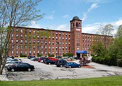
The American Print Works was established in 1835 by Holder Borden, uncle of Colonel Richard. With the leadership of the Borden family, the American Print Works (later known as the American Printing Company) became the largest and most important textile company in the city, employing thousands at its peak in the early 20th century. Richard Borden also constructed the Metacomet Mill in 1847, which today is the oldest remaining textile (cloth-producing) mill in the city, located on Anawan Street.
By 1845, the Quequechan's power had been all but maximized. The Massasoit Steam Mill was established in 1846, above the dam near the end of Pleasant Street. However, it would be another decade or so when improvements in the steam engine by George Corliss would enable the construction of the first large steam-powered mill in the city, the Union Mills in 1859.
The advantage of being able to import bales of cotton and coal to fuel the steam engines to Fall River's deep water harbor, and ship out the finished goods also by water, made Fall River the choice of a series of cotton mill magnates. The first railroad line serving Fall River, The Fall River Branch Railroad, was incorporated in 1844 and opened in 1845. Two years later, in 1847, the first regular steamboat service to New York City began. The Fall River Line as it came to be known operated until 1937, and for many years, was the preferred way to travel between Boston and Manhattan. The Old Colony Railroad and Fall River Railroad merged in 1854, forming the Old Colony and Fall River Railroad.
In 1854, Fall River was officially incorporated as a city, and had a population of about 12,000.[6] Its first mayor was James Buffington.
Fall River profited well from the American Civil War and was in a fine position to take advantage of the prosperity that followed. By 1868, it had surpassed Lowell as the leading textile city in America with over 500,000 spindles.
The boom in the 1870s
Then, during 1871 and 1872, a "most dramatic expansion" of the city occurred: 15 new corporations were founded, building 22 new mills throughout the city, while some of the older mills expanded. The city's population increased by 20,000 people during these two years, while overall mill capacity doubled to more than 1,000,000 spindles.
By 1876, the city had 1/6 of all New England cotton capacity and one-half of all print cloth production. The "Spindle City" as it became known, was second in the world to only Manchester, England.
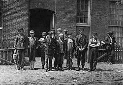
To house the thousands of new workers, mostly Irish and French Canadian immigrants during these years, over 12,000 units of company housing were built. Unlike the well-spaced boardinghouses of early Lowell or the tidy cottages of Rhode Island, worker housing in Fall River consisted of thousands of wood-framed multi-family tenements, usually three-floor "triple-deckers" with up to six apartments. Many more privately owned tenements supplemented the company housing.[7]
During the 19th century, Fall River became famous for the granite rock on which much of the city is built. Several granite quarries operated during this time, the largest of which was the Beattie Granite Quarry, near what is now North Quarry Street, near the corner of Locust.[8] Many of the mills in the city were built from this native stone, and it was highly regarded as a building material for many public buildings and private homes alike. The Chateau-sur-Mer mansion in Newport, Rhode Island is perhaps the best example of Fall River granite being used for private home construction.
While most of the mills "above the hill" were constructed from native Fall River granite, nearly all of their counterparts along the Taunton River and Mount Hope Bay were made of red brick. This was due to the high costs and impracticality associated with transporting the rock through the city and down the hill, where there were no rail lines because of the steep grades. (One notable exception is the Sagamore Mills on North Main Street, which were constructed from similar rock quarried in Freetown and brought to the site by rail.)
The 20th century
Fall River rode the wave of economic prosperity well into the early 20th century. During this time, the city boasted several fancy hotels, theaters, and a bustling downtown. As the city continually expanded during the late 19th century, its leaders built several fine parks, schools, streetcar lines, a public water supply, and sewerage system to meet the needs of its growing population.
The city evidently was prosperous enough at one point that when a system of call boxes was installed for the city fire and police departments, the city was able to special-order the insulators with markings unique to the city's system. The insulators for the police call box system were embossed "FALL RIVER / POLICE SIGNAL" and the ones for the fire department system were embossed "CITY FIRE ALARM".
From 1896 to 1912, Fall River was the headquarters of the E. P. Charlton & Company chain of five and ten cent stores. Founded at Fall River in 1890 by Seymour H. Knox and Earle Perry Charlton as the Knox & Charlton Five and Ten Cent Store, by the time of its merger with several other retailers to form the F. W. Woolworth Company in 1912, Charlton operated fifty-eight stores in the United States and Canada.
In 1920 the population of Fall River peaked at 120,485.[9]
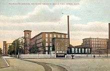
 North Main Street, c. 1910
 First Cotton Mill, built in 1811
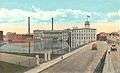 Printing Works, c. 1920
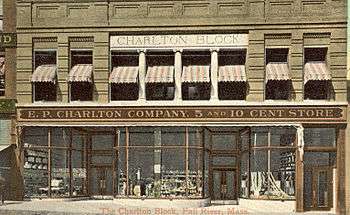 The Charlton Block, 1908
The cotton mills of Fall River had built their business largely on one product: print cloth. About 1910, the city's largest employer, the American Printing Company (APC), employed 6,000 people and was the largest company printer of cloth in the world. Dozens of other city mills solely produced cloth to be printed at the APC. The city's industry had all its eggs in one, very large basket.
World War I had provided a general increase in demand for textiles, and many of the mills of New England benefited during this time. The post-war economy quickly slowed, however, and production quickly outpaced demand. The Northern mills faced serious competition from their Southern counterparts due to factors such as lower labor and transportation costs, as well as the South's large investment in new machinery and other equipment. In 1923, Fall River faced the first wave of mill closures. Some mills merged and were able to limp along until the late 1920s. By the 1930s and the Great Depression, many more mills were out of business and the city was bankrupt. A few somehow managed to survive through World War II and into the 1950s.
The worst fire in Fall River's history occurred on the evening of February 2, 1928.[10] It began when workers were dismantling the recently vacated Pocasset Mill. During the night the fire spread quickly and wiped out a large portion of downtown. City Hall was spared but was badly damaged. Today, many of the structures near the corner of North Main and Bedford Street date from the early 1930s, as they were rebuilt soon after the fire.
The once mighty American Printing Company finally closed for good in 1934. In 1937, their huge plant waterfront on Water Street was acquired by the Firestone Tire & Rubber Company and soon employed 2,600 people. In October 1941, just a few weeks before the attack on Pearl Harbor, a huge fire broke out in the old 1860s' main building of the print works. The fire was a major setback to the U.S. war effort, as $15 million in raw rubber (30,000 lbs.) was lost in the inferno.[11]
With the demise of the textile industry, many of the city's mills were occupied by smaller companies, some in the garment industry, traditionally based in the New York City area but attracted to New England by the lure of cheap factory space and an eager workforce in need of jobs.[12] The garment industry survived in the city well into the 1990s but has also largely become a victim of globalization and foreign competition.[13]
Modern era
In the 1960s the city's landscape was drastically transformed with the construction of the Braga Bridge and Interstate 195, which cut directly through the heart of the city. In the wake of the highway building boom, the city lost some great pieces of its history. The Quequechan River was filled in and re-routed for much of its length. The historic falls, which had given the city its name, were diverted into underground culverts. A series of elevated steel viaducts was constructed as to access the new Braga Bridge. Many historic buildings were demolished, including the Old City Hall, the 150-year-old Troy Mills, the Second Granite Block (built after the 1928 fire), as well as other 19th century brick-and-mortar buildings near Old City Hall.
Constructed directly over Interstate 195, where its predecessor was, the new city hall was opened in 1976, after years of construction delays and quality control problems.[14] Built in the Brutalist style popular in the 1960s and 1970s, the new city hall drew complaints from city workers and residents almost immediately.
In 1970 the Valle's Steak House chain opened one if its landmark restaurants on William S. Canning Boulevard. The steak house was popular with Fall River residents but economic challenges caused the chain to close all of its restaurants in the 1980s.[15]
Also during the 1970s, several modern apartment high-rise towers were built throughout the city, many part of the Fall River Housing Authority. There were two built near Milliken Boulevard, two on Pleasant Street in Flint Village, another on South Main Street, and in the north end off Robeson Street. Today, these high-rises mostly house the elderly.
In 1978, the city opened the new B.M.C. Durfee High School in the north end, replacing the historic Rock Street masterpiece that had become overcrowded and outdated for use as a high school. The "new" Durfee is one of the largest high schools in Massachusetts.
Since about 1980, there has been a considerable amount of new development in the North end of the city, with many new single- and multi-family housing developments, particularly along North Main Street.
In 2010, Fall River was also ranked the 88th most dangerous city in the United States, largely due to a heroin epidemic with ties to the shipping ports in New Bedford.[16]
Geography
According to the United States Census Bureau, the city has a total area of 40.2 square miles (104.2 km2), of which 33.1 square miles (85.8 km2) is land and 7.1 square miles (18.4 km2), or 17.68%, is water.[2]
Water power from the Quequechan River and natural granite helped form and shape Fall River into the city it is today. Fall River granite is quarried here. The Quequechan River once flowed through downtown unrestricted, providing water power for the mills and, in the last 1⁄2 mile (0.8 km) of its length, down a series of eight steep waterfalls falling 128 feet (39 m) into the Taunton River at the head of the deep Mount Hope Bay.
Fall River was the only city on the East Coast of the United States to have had an exposed waterfall in part of its downtown area; it flowed less than 1⁄2 mile (0.8 km) into a sheltered harbor at the edge of downtown. Fall River has two large lakes (originally one lake) and a large portion of protected woodlands on the eastern part of the city, which is higher in elevation, with the Quequechan River draining out of the ponds and flowing 2.5 miles (4.0 km) through the heart of the city, emptying out an estimated 26 million US gallons (98×106 l) per day into the deep Mount Hope Bay/Taunton River estuary in the western part of the city.
The city lies on the eastern border of Mount Hope Bay, which begins at the mouth of the Taunton River starting south from the Charles M. Braga, Jr. Bridge. The greater portion of the city is built on hillsides rising quite abruptly from the water's edge to a height of more than 200 feet (60 m). From the summits of these hills the country extends back in a comparatively level table-land, on which a large section of the city now stands.
Two miles (3 km) eastward from the shore lies a chain of deep and narrow ponds, eight miles (13 km) long (13 km), with an average width of three-quarters of a mile, and covering an area of 3,500 acres (14 km2). These ponds are supplied by springs and brooks, draining a watershed of 20,000 acres (81 km2). The northern pond is the North Watuppa Pond, the city's main reservoir. The southern pond is the South Watuppa Pond. Where the two ponds meet is called the "The Narrows." East of the North Watuppa Pond is the Watuppa Reservation that includes several thousand acres of forest-land for water supply protection that extends north into the Freetown-Fall River State Forest, and east to the Copicut Reservoir. Copicut Pond is located on the border of Dartmouth in North Dartmouth's Hixville section that borders Fall River. Copicut Hill, the highest point in Fall River, is located between North Watuppa Pond and the Copicut Reservoir and has a summit elevation of greater than 404 feet (123 m) above sea level.[17]
The Quequechan River breaks out of its bed in the west part of the South Watuppa Pond, just west of The Narrows, and flows through the city (partially underground in conduits) where it falls to a channel leading to what is now Heritage State Park at Battleship Cove on the Taunton River. The Quequechan River originally flowed unconfined over an almost level course for more than a mile. In the last half-mile (800 m) of its progress it rushes down the hillside in a narrow, precipitous, rocky channel, creating the falls for which Fall River is named. In this distance the total fall is about 132 feet (40 m). and the volume of water 122 cubic feet (3.5 m3) per second.
Originally an attractive feature of the landscape, the Quequechan has seldom been visible since it was covered over by cotton mills and the Bay Colony Railroad line in the 19th century. As the Quequechan became an underground feature of the industrial landscape, it also became a sewer. In the 20th century the mills were abandoned and some of them burned, exposing the falls once more. Because of highway construction in the 1960s, the waterfalls were buried under Interstate 195, which crosses the Taunton River at Battleship Cove. Plans exist to "daylight" the falls, restore or re-create them, and build a green belt with a bicycle path along the Quequechan River.
In the south end, Cook Pond, also formerly known as Laurel Lake, is located east of the Taunton River and west of the South Watuppa Pond. The area between the modern day Cook and South Watuppa Ponds, east of the Taunton River and north of Tiverton, Rhode Island, was once referred to as "Pocasset Swamp" during King Philip's War in 1675–1676.
Partial list of neighborhoods
- Downtown
- Corky Row
- Highlands
- Lower Highlands (Bedford St up high street to Prospect St)
- Upper Highlands (Prospect St along President Ave up to Wilson Rd)
- Flint Village or "The Flint" (Fall River's East End or Eastside bounded south of Bedford St, bounded east of Quarry St.)
- Eastside (Route 24, Eastern Ave, Oak Grove Ave, President Ave, New Boston RD, Meridan Street,)
- Bogle Hill (Upper Pleasant St near Eastern Ave)
- Globe Village (Fall River's western part of the Southside west of Cook Pond, Broadway)
- South End (South of Interstate 195 including Globe and Mapelwood villages to R.I. border)
- Townsend Hill (South Main and Bay St Neighborhoods bordering Tiverton, R.I.)
- Maplewood Fall River's eastern part of the south End
- North End (north of Bedford Street Interstate 195 to Wilson rd bounded by highland ave, President Ave, BCC, New Boston Road)
Demographics
| Historical population | ||
|---|---|---|
| Year | Pop. | ±% |
| 1810 | 1,296 | — |
| 1820 | 1,594 | +23.0% |
| 1830 | 4,158 | +160.9% |
| 1840 | 6,738 | +62.0% |
| 1850 | 11,524 | +71.0% |
| 1860 | 14,026 | +21.7% |
| 1870 | 26,766 | +90.8% |
| 1880 | 48,961 | +82.9% |
| 1890 | 74,398 | +52.0% |
| 1900 | 104,863 | +40.9% |
| 1910 | 110,295 | +5.2% |
| 1920 | 120,485 | +9.2% |
| 1930 | 115,274 | −4.3% |
| 1940 | 115,428 | +0.1% |
| 1950 | 111,963 | −3.0% |
| 1960 | 99,942 | −10.7% |
| 1970 | 96,898 | −3.0% |
| 1980 | 92,574 | −4.5% |
| 1990 | 92,703 | +0.1% |
| 2000 | 91,938 | −0.8% |
| 2010 | 88,857 | −3.4% |
| 2014 | 88,712 | −0.2% |
| 2015 | 88,777 | +0.1% |
| * = population estimate. Source: United States Census records and Population Estimates Program data.[18][19][20][21][22][23][24][25][26][27][28] Source: | ||
According to the United States Census of 2010, the population of Fall River is 88,857. The largest racial groups within the city were 87.2% (83.4% Non-Hispanic) White, 3.5% African American, 2.5% Asian and 0.2% Native American and 7.4% Hispanic or Latino. 49% of residents are Luso American or have origins somewhere in the former Portuguese Empire. 37% of the population described themselves as being of Portuguese ancestry. The next largest groups by ancestry are French 12.4%, Irish 8.9%, Cape Verdean 8.1%, English 6.0%, French Canadian 5.9%, Puerto Rican 4.5%, and Italian 3.6%.[30]
Fall River and surrounding communities form a part of the Providence metropolitan area, which has an estimated population of 1,622,520.
In percentage terms Fall River has the largest Portuguese American population in the United States. However, the exact percentage of the population they make up is disputed. A 2005 study by the University of Massachusetts Dartmouth has given it at 49.6%[31] while other sources give it as 43.9%.[32]
The city has 38,759 households and 23,558 families. The population density was 2,963.7 per square mile (1,144.3/km²). There were 41,857 housing units at an average density of 1,349.3 per square mile (521.0/km²). Of the 38,759 households 29.9% had children under the age of 18 living with them, 40.3% were married couples living together, 16.5% had a female householder with no husband present, and 39.2% were non-families. 34.2% of all households were made up of individuals and 14.2% had someone living alone who was 65 years of age or older. The average household size was 2.32 and the average family size was 3.00.
In terms of age the population was spread out with 24.1% under the age of 18, 9.2% from 18 to 24, 29.8% from 25 to 44, 20.0% from 45 to 64, and 16.9% who were 65 years of age or older. The median age was 36 years. For every 100 females there were 87.7 males. For every 100 females age 18 and over, there were 82.9 males.
The median household income was $29,014, and the median family income was $37,671. Males had a median income of $31,330 versus $22,883 for females. The per capita income for the city was $16,118. About 14.0% of families and 17.1% of the population were below the poverty line, including 25.4% of those under age 18 and 17.4% of those age 65 or over.[30]
Income
Data is from the 2009-2013 American Community Survey 5-Year Estimates.[33][34][35]
| Rank | ZIP Code (ZCTA) | Per capita income |
Median household income |
Median family income |
Population | Number of households |
|---|---|---|---|---|---|---|
| Massachusetts | $35,763 | $66,866 | $84,900 | 6,605,058 | 2,530,147 | |
| Bristol County | $28,837 | $55,298 | $72,018 | 549,870 | 210,037 | |
| United States | $28,155 | $53,046 | $64,719 | 311,536,594 | 115,610,216 | |
| 1 | 02720 | $25,090 | $41,910 | $56,091 | 30,811 | 13,079 |
| Fall River | $21,257 | $33,211 | $42,962 | 88,811 | 38,258 | |
| 2 | 02721 | $19,321 | $30,180 | $38,133 | 26,141 | 10,943 |
| 3 | 02723 | $18,980 | $28,120 | $34,835 | 14,298 | 6,442 |
| 4 | 02724 | $18,827 | $27,390 | $39,246 | 16,769 | 7,561 |
Culture
Fall River retains a vibrant mix of cultures from around the globe. While the distinct ethnic neighborhoods formed in the late 19th and early 20th centuries have changed over the years, the legacy of immigrants who came to work in the mills can be found in the various parishes and restaurants throughout the city.
The city is host to many ethnic festivals throughout the year. The largest, the Great Holy Ghost Festival, occurs each August at Kennedy Park and attracts over 200,000 visitors, everywhere from Canada, to Portugal. The feast is held over a total of four days.[36]
Each summer, the city uses its waterfront at Heritage State Park and Battleship Cove for a Fourth of July fireworks display. For many years the waterfront also hosted the annual Fall River Celebrates America Festival, sponsored by the Fall River Chamber of Commerce. The event was suspended in 2010, due to lack of financial support. However, the Chamber hopes to have the event again in 2011, to mark its 100th anniversary.[37]
In recent years, different groups have made an effort to increase awareness in the arts in the city, using vacant mill space for studios and performance centers, such as the Narrows Center for the Arts on Anawan Street. A proposal is in place to revitalize the downtown area by the creation of an Arts District. Along with the art centers being established throughout the city, Fall River is also known throughout New England as a "City of Bands". Fall River has numerous Portuguese/Community Bands throughout the city that perform throughout the year.
Religion
Fall River remains a predominantly Roman Catholic city and is the seat of the Roman Catholic Diocese of Fall River, located at St. Mary's Cathedral on Second Street, formed in the 1850s by Irish immigrants. Also on Columbia Street is located Santo Christo Parish known as the Mother Church of the Portuguese Parishes in the Fall River Diocese. The Church was Established in 1892 to serve the local Portuguese community that Immigrated predominately from the Sao Miguel Island of Azores. Other imposing Catholic churches include St. Anne's Church at the top of Kennedy Park, Good Shepherd Church (formerly Saint Patrick's) in the South End, and the former Notre Dame de Lourdes in the Flint neighborhood, which was destroyed in a spectacular blaze on May 10, 1982. At the time of the city's peak population in 1920, there were over two dozen Catholic parishes existing throughout the city, with each ethnic enclave having its own parish. In recent years, the diocese has merged several parishes in the city, closing some, and renaming the united congregations, bringing the total number of parishes in the diocese to fifteen as of 2013.
Historically, the Highlands neighborhood was predominantly Protestant, with several churches in the area of North Main and Rock Streets, notably including the Central Congregational Church and the First Congregational Church, known for hosting many New England luminaries before its demise in a fire in the 1980s. Various other ethno-religious groups also live in the city, including a historic Jewish synagogue on High Street and many newer congregations throughout the city.
Recent arrivals from Cambodia, and India also maintain temples in the city such as Wat Udomsaharatanaram and BAPS Shri Swaminarayanwasi. With the addition of religious centers for Theravada Buddhism and Hinduism, the diversity of faith supports the spiritualism for the citizens of Fall River.
Government

City government and services
The city is led by the mayor-council form of government. There are nine at-large city councillors. The Mayor along with the City Administrator lead and manage the city's day-to-day operations.
The city's police department is consolidated into a large central police station. There are six fire stations located around the city. The Fire Headquarters is located on Commerce Drive, just across from the former Fall River Municipal Airport. There are four post offices in the city, located in Flint Village, the South End Branch (near Globe Corners), Highland Station and the central branch just behind Government Center, a post office modeled after the James Farley Post Office, the New York City main post office behind Penn Plaza. The central branch was named after the late Sgt. Robert Barrett in May 2011, a soldier born in the city, who died in Afghanistan in 2010. The post office will now be known as the "Robert Barrett Post Office." The city is also home to a Superior Court, a District Court and the new Bristol County Court House, located in the former B.M.C. Durfee High School building on Rock Street. A new District Court is at 186 South Main Street.
State and federal representation
Fall River is represented by three separate Massachusetts House of Representatives districts (one of which represents the majority of the city) and is represented by Carole Fiola (6th Bristol), Alan Silvia (7th Bristol), and Paul A. Schmid III (8th Bristol). The city is represented by Senator Michael Rodrigues (D-Fall River) in the First Bristol and Plymouth district, which includes the city and the towns of Freetown, Lakeville, Rochester, Somerset and Swansea.
Fall River is patrolled by the Third Barracks of Troop D of the Massachusetts State Police, based out of Dartmouth.
On the national level, the city is divided between two congressional districts. The city is represented by Joseph Kennedy III and Bill Keating.
| Voter registration and party enrollment as of February 1, 2015[38] | |||||
|---|---|---|---|---|---|
| Party | Number of voters | Percentage | |||
| Democratic | 24,018 | 52.75% | |||
| Republican | 3,125 | 6.86% | |||
| Unaffiliated | 18,079 | 39.71% | |||
| Minor Parties | 308 | 0.68% | |||
| Total | 45,530 | 100% | |||
Education
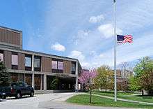
.jpg)
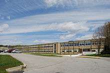
Public schools
The Fall River Public Schools operates public schools. The city has one public high school, B.M.C. Durfee High School, which has produced very notable alumni, including, but not limited to: James M. McGuire, a former Supreme Court Justice, Chris Herren, former NBA player for the Denver Nuggets and the Boston Celtics, and Humberto Sousa Medeiros, a Cardinal of the Roman Catholic Church and former Archbishop of Boston.
The city is also the home of Diman Regional Vocational Technical High School, which also serves the towns of Somerset, Swansea, and Westport. Famous chef Emeril Lagasse graduated from this high school, in the Culinary Arts Program that is still run today. The school's roots date back to the days of the Durfee Textile School, which branched out to include Diman. (The college, founded to promote the city's textile sciences, is now a part of University of Massachusetts Dartmouth.)
Private schools
In addition to public schools, there are several private and parochial schools in the city, including nine Catholic schools, two private schools, a Christian academy (East Gate Christian Academy), and Atlantis Charter School, a Pre-K through 8 charter school with a marine science-themed curriculum. The city is also home to Bishop Connolly High School, a Catholic high school named for Bishop James Louis Connolly, fourth Bishop of the Diocese of Fall River. Bishop Feehan was also in Fall River from 1961–1972.
Espirito Santo School opened on September 19, 1910. The majority of the students are ethnic Portuguese, and 70% of the students are bilingual.[39]
Higher education
The University of Massachusetts Dartmouth has two branches in the city: the Professional and Continuing Education Center located at 139 South Main Street (in the 1917 Cherry & Webb building), and the Advanced Technical & Manufacturing Center at the Narrows, on the former site of the Kerr Mills. The school traces half of its roots back to the city; the Bradford Durfee Textile School was founded there in 1899, with its original 1904 building on the corner of Durfee and Bank Streets still standing. The building was also the original home of Bristol Community College, founded in 1965 and now located at 777 Elsbree Street. BCC is a two-year college offering associate degrees as well transfer programs to four-year institutions. The Eastern Nazarene College offers Adult Studies/LEAD classes in Fall River as well. It also has GED programs and a recording studio, The Americo Miranda show is aired at the college.[40]
International relations
Fall River is twinned with:
 Ponta Delgada, The Azores - Portugal
Library
Fall River established its public library in 1860.[41][42] In fiscal year 2008, the city of Fall River spent 0.56% ($1,054,945) of its budget on its public library—some $11 per person.[43]
The main location of the Fall River Public Library is located at 104 North Main Street, within the Downtown Fall River Historic District. It opened in 1899, and was designed by architect Ralph Adams Cram in the Renaissance Revival style. It is constructed from native Fall River granite. The building underwent an extensive renovation during the late 1990s and early 2000s.
The public library system also includes two branches; the South End Branch located at 58 Arch Street, and the East End Branch located at 1386 Pleasant Street.[44]
Transportation
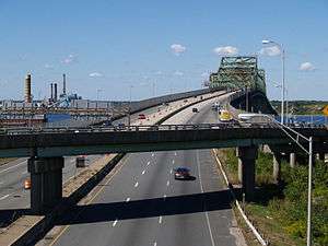
Fall River has always been considered a transportation hub for the South Coast and Mount Hope Bay areas, due to its location along the Taunton River. In addition to the Fall River Line (discussed in the "History" section), Slade's Ferry ran from Fall River to Somerset since the 17th century, connecting the two communities. In 1875, Slade's Ferry Bridge was opened, connecting the two cities for trolley lines as well as cart (and later, car) traffic. It was a two-tiered steel swing-span bridge, extending over 1,100 feet (340 m) from Remington Avenue to the intersection of Wilbur Avenue, Riverside Avenue and Brayton Avenue in Somerset. This bridge was in use until 1970, when it was closed and subsequently demolished. (The path of the bridge is now roughly marked by twin sets of power lines crossing the river.) In 1903, the state authorized a second bridge, the Brightman Street Bridge, a four lane, 922-foot (281 m) long drawbridge ending at its namesake street, which opened in 1908 and is still standing today. The third bridge to span the river in Fall River was the Charles M. Braga, Jr. Memorial Bridge. Started in 1959 and opened in the spring of 1966, the six-lane cantilever truss highway bridge spans 1.2 miles (1.9 km) and was part of the project to build Interstate 195.
By the 1980s, problems began to arise with the Brightman Street Bridge. It was often closed for repairs, which put much strain on local traffic, forced to take long detours across the nearby Braga Bridge. In 1983 plans were being made to build a new bridge 1,500 feet (460 m) north of the current one, which would directly link with Route 138. Plans were put on hold in 1989 due to Coast Guard concerns, but construction of the new span began in the late 1990s and continued until late 2011. Named the Veterans Memorial Bridge, in honor of all local veterans, it was formally dedicated on September 11, 2011, the tenth anniversary of 9/11.
Major highways
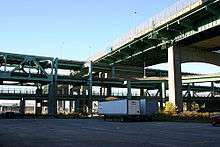
Interstate 195 is now the main point of entry for the city, entering via the Braga Bridge from Somerset and leaving over "The Narrows," a small strip of land between the North and South Watuppa Ponds that carries Interstate 195, Route 6 and Old Bedford Road into Fall River from Westport as the roads make their way east towards New Bedford and Cape Cod. The highway covers much of the old path parallel to the Bay Colony/New Bedford Cape Cod Railroad as well the original path of the Quequechan River, and has resulted in a unique situation—it is one of the few highways in the country with a city hall (officially known as "Fall River Government Center") standing directly on top of it. The tunnel which passes below Government Center was the site of an accident in March 1999, in which a cement ceiling tile, its supports worn away by corrosion, collapsed, landed on several cars but causing only minor injuries. The incident caused major traffic problems in the area, and bears a striking resemblance to the incident involving the I-90 tunnel collapse (a part of the Big Dig) in 2006.
In addition to Interstate 195, Fall River is also served by four other major routes, which include Route 6 (which passes over the Brightman Street Bridge going west before joining the city grid then continuing east into Westport); Route 24, a 2 Lane North/South divided highway linking Fall River to Boston and Newport; Route 79, another divided highway that begins at the Braga Bridge and continues northbound to Route 24; Route 138, which also enters the city via the Brightman Street Bridge before joining the city grid, passing southwards towards Aquidneck Island; and Route 81, which begins near the former site of the Quequechan River and travels south into Tiverton. Additionally, Route 177 clips the extreme southern part of the city for less than 0.25-mile (0.40 km) between Westport and Tiverton. Route 138, Route 24, I-195, and US 6 are based upon old Indian routes and trails.
Rail
The Fall River State Pier is still in operation, bringing goods into the city via boat and by a freight train line which travels north from the pier parallel to Route 79. Plans are in the works to add 2 commuter rail service lines known as the South Coast Rail "projects" to extend from Stoughton along the current Stoughton Line of the MBTA Commuter Rail Line, which would connect Fall River as well as Taunton and New Bedford to the MBTA rail system to points to and from Boston and other points around the state.
Bus
The city, along with New Bedford, shares ownership of the Southeastern Regional Transit Authority (SRTA), a bus line which covers much of the south coast.[45]
Air
Until approximately 1990, the Fall River Municipal Airport served as a general aviation airport for small planes and commuter flights to the Cape and Islands just north of the junction of Routes 79 and 24, but the airport has since closed, the land claimed for an industrial park. Commercial air service is served through T.F. Green Airport 13 miles west in Warwick, Rhode Island and at Logan International Airport 45 miles north in Boston, Massachusetts.
Soccer
Fall River has a rich soccer history. The game was first introduced to the city in the 1880s by the arrival of immigrants from Lancashire and Glasgow who worked in the local textile industry. In later decades the arrival of immigrants from Portugal helped to sustain the game's popularity. Between 1888 and 1892 teams from Fall River won the American Cup five times in succession. One of these teams, Fall River Rovers also won the 1917 National Challenge Cup. The star and captain of the team was local-born Thomas Swords who, in 1916, captained the United States in their first official international.
During the 1920s and early 1930s, Fall River Marksmen were one of the most successful soccer clubs in the United States and were American soccer champions on seven occasions. In 1932, another club, Fall River F.C., were also champions.
The Marksmen also won the National Challenge Cup four times. Among their most notable players were Billy Gonsalves and Bert Patenaude, who were both raised in Fall River. In 1930 they both played for the United States at the first ever soccer World Cup. Patenaude is also credited with scoring the first ever hat-trick in World Cup history. He scored all three goals in the United States' 3–0 victory over Paraguay.
During the 1940s, Ponta Delgada S.C. became one of the most successful amateur teams in the United States. In 1947 the team was selected en masse to represent the United States at the North American soccer championship. In 1950 two of their local born players, Ed Souza and John Souza, played at the World Cup and helped the United States defeat England, 1–0.[46]
On January 18, 2011 Andrew Sousa was drafted by New England Revolution, thus becoming the first ever Fall River native to play in Major League Soccer.
Points of interest
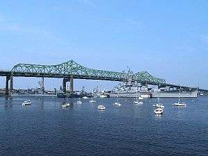
- Battleship Cove The world's largest historic naval ship exhibit featuring the USS Massachusetts
- Historic Lincoln Park Carousel[47] - Restored 1920 Carousel, located at Battleship Cove
- Fall River Heritage State Park The focal point of Fall River's waterfront.
- The Marine Museum at Fall River
- Freetown-Fall River State Forest
- The New Harbour Mall, which was, until recently, known for being the only mall in the U.S. whose anchors are Wal-Mart and Kmart. However, the Wal-Mart has since been relocated, leaving the future of the mall itself unclear.
- Kennedy Park, North Park and Ruggles Park, all designed by Frederick Law Olmsted
- Lizzie Borden Bed and Breakfast Museum, 230 2nd Street, Fall River, MA 02721.
- "Maplecroft," 306 French St., Fall River, MA 02720. Located in Fall River's Highlands neighborhood, this house was purchased by Lizzie Borden and her sister Emma in 1894. Although Emma left Fall River in 1905, this 14-room Queen Anne Victorian home remained Lizzie's home until her death and her brief funeral service (minus her body which was buried earlier) was held here.[48]
- Oak Grove Cemetery contains the graves of many famous residents, including Lizzie Borden and the Borden murder victims.
Notable people
- Lizzie Borden (1860–1927), tried and acquitted of the 1892 murder of her father and step-mother in Fall River. She is buried with them and the rest of their immediate family in Oak Grove Cemetery.
- David Glendenning Cogan (1908–1993), ophthalmologist
- Brandon Gomes, Major League Baseball player
- Leslie Gourse, jazz writer, was born here in 1939.[49]
- Chris Herren, professional basketball player (Denver Nuggets & Boston Celtics)
- Emeril Lagasse, celebrity chef
- Tom Lawlor, professional mixed martial artist
- Marc Megna, American and Canadian football player
- Ernest Moniz, the 13th and current U.S. Secretary of Energy
- Hank the Angry Drunken Dwarf (Henry Joseph Nasiff Jr.), entertainer
- Joe Raposo, songwriter for Sesame Street.
- Jerry Remy, former Major League Baseball player
- Chris Santos, celebrity chef
- Andrew Sousa, Professional soccer player
- George Stephanopoulos, Good Morning America co-host
- Tecia Torres, Professional mixed martial artist
- George Luz, World War II veteran, portrayed in the HBO miniseries Band of Brothers
- Louie Howe, Political advisor to President Franklin D. Roosevelt, who appointed spouse Grace Hartley Howe as Fall River, MA Postmaster, Mr & Mrs Howe are interred at Oak Grove Cemetery, Fall river, MA it is reported and documented that President Roosevelt personally attended Mr Howes Funeral services.
- Jason Tyler Roy, Big Brother 17 (U.S) and Big Brother: Over the Top contestant
See also
References
- ↑ 2010 Federal Census
- 1 2 "Geographic Identifiers: 2010 Demographic Profile Data (G001): Fall River city, Massachusetts". U.S. Census Bureau, American Factfinder. Retrieved February 5, 2013.
- ↑ Fall River, Rhode Island
- ↑ The Run of the Mill, Dunwell, Steve, 1978
- ↑ "The Fall River Iron Works Prospered After Shaky Start," Fall River Herald News, October 17, 1989
- ↑ Illustrated History of Fall River, 1903
- ↑ The Run of the Mill, Dunwell, Steve, 1978, p.105-110
- ↑ 2003 "Local Rock Vital in City's Construction," Herald News, February 26, 2003
- ↑ U.S. Census. 1940 Population Reports. p. 32
- ↑ Sailsinc.org Picture of the Worst Fire in Fall River's History
- ↑ Keeley Library Collection
- ↑ MHC Survey, 1982
- ↑ History of Fall River's Garment Industry
- ↑ Interstate 195-Massachusetts: Historic Overview
- ↑ "Valle's Steak House, opened in 1970 and demolished in 1984" (August 6, 2012) The Herald News (Fall River, Mass.)
- ↑ OS.cqpress.com
- ↑ U.S. Geological Survey Fall River, MA 7.5 by 15-minute quadrangle, 1985.
- ↑ "TOTAL POPULATION (P1), 2010 Census Summary File 1". American FactFinder, All County Subdivisions within Massachusetts. United States Census Bureau. 2010.
- ↑ "Massachusetts by Place and County Subdivision - GCT-T1. Population Estimates". United States Census Bureau. Retrieved July 12, 2011.
- ↑ "1990 Census of Population, General Population Characteristics: Massachusetts" (PDF). US Census Bureau. December 1990. Table 76: General Characteristics of Persons, Households, and Families: 1990. 1990 CP-1-23. Retrieved July 12, 2011.
- ↑ "1980 Census of the Population, Number of Inhabitants: Massachusetts" (PDF). US Census Bureau. December 1981. Table 4. Populations of County Subdivisions: 1960 to 1980. PC80-1-A23. Retrieved July 12, 2011.
- ↑ "1950 Census of Population" (PDF). Bureau of the Census. 1952. Section 6, Pages 21-10 and 21-11, Massachusetts Table 6. Population of Counties by Minor Civil Divisions: 1930 to 1950. Retrieved July 12, 2011.
- ↑ "1920 Census of Population" (PDF). Bureau of the Census. Number of Inhabitants, by Counties and Minor Civil Divisions. Pages 21-5 through 21-7. Massachusetts Table 2. Population of Counties by Minor Civil Divisions: 1920, 1910, and 1920. Retrieved July 12, 2011.
- ↑ "1890 Census of the Population" (PDF). Department of the Interior, Census Office. Pages 179 through 182. Massachusetts Table 5. Population of States and Territories by Minor Civil Divisions: 1880 and 1890. Retrieved July 12, 2011.
- ↑ "1870 Census of the Population" (PDF). Department of the Interior, Census Office. 1872. Pages 217 through 220. Table IX. Population of Minor Civil Divisions, &c. Massachusetts. Retrieved July 12, 2011.
- ↑ "1860 Census" (PDF). Department of the Interior, Census Office. 1864. Pages 220 through 226. State of Massachusetts Table No. 3. Populations of Cities, Towns, &c. Retrieved July 12, 2011.
- ↑ "1850 Census" (PDF). Department of the Interior, Census Office. 1854. Pages 338 through 393. Populations of Cities, Towns, &c. Retrieved July 12, 2011.
- ↑ "1950 Census of Population" (PDF). 1: Number of Inhabitants. Bureau of the Census. 1952. Section 6, Pages 21-7 through 21-09, Massachusetts Table 4. Population of Urban Places of 10,000 or more from Earliest Census to 1920. Retrieved July 12, 2011.
- ↑ "Census of Population and Housing". Census.gov. Retrieved June 4, 2015.
- 1 2 General Demographic Characteristics for Fall River
- ↑ University of Massachusetts Dartmouth pg. 8
- ↑ Epodunk.com
- ↑ "SELECTED ECONOMIC CHARACTERISTICS 2009-2013 American Community Survey 5-Year Estimates". U.S. Census Bureau. Retrieved 2015-01-12.
- ↑ "ACS DEMOGRAPHIC AND HOUSING ESTIMATES 2009-2013 American Community Survey 5-Year Estimates". U.S. Census Bureau. Retrieved 2015-01-12.
- ↑ "HOUSEHOLDS AND FAMILIES 2009-2013 American Community Survey 5-Year Estimates". U.S. Census Bureau. Retrieved 2015-01-12.
- ↑ O'Journal, August 18, 2006
- ↑ Fall River Celebrates America
- ↑ "Feb. 2015 MA Party Enrollment" (PDF). Retrieved 6 December 2015.
- ↑ "History of Espirito Santo School." Espirito Santo School. Retrieved on August 21, 2012.
- ↑ "ENC's Adult and Graduate Studies Program expands into satellite locations around the state". Nazarene Communications Network. December 18, 2008.
- ↑ C.B. Tillinghast. The free public libraries of Massachusetts. 1st Report of the Free Public Library Commission of Massachusetts. Boston: Wright & Potter, 1891.
- ↑ Fall River Public Library. Retrieved 2010-11-11
- ↑ July 1, 2007 through June 30, 2008; cf. The FY2008 Municipal Pie: What's Your Share? Commonwealth of Massachusetts, Board of Library Commissioners. Boston: 2009. Available: Municipal Pie Reports. Retrieved 2010-08-04
- ↑ Fall River Library Branches
- ↑ "Southeastern Regional Transit Authority" official Web site.
- ↑ Soccer in a Football World - The Story of America's Forgotten Game (2006) : David Wangerin amazon.com
- ↑ Battleshipcove.org
- ↑ http://www.heraldnews.com/news/x1364623121/Lizzie-Bordens-Maplecroft-estate-is-up-for-sale-again
- ↑ "Leslie Gourse, 65, Biographer of Jazz Artists". The New York Times. January 5, 2005.
External links
| Wikimedia Commons has media related to Fall River, Massachusetts. |
| Wikivoyage has a travel guide for Fall River, Massachusetts. |
| Wikisource has the text of the 1911 Encyclopædia Britannica article Fall River. |
- Fall River, MA Official Website
- The Herald News
- Battleship Cove Website
- Listen to the Fall River Police and Fire Live Online
- Live Weather from a Fall River Weather Station
- Heraldnews.com
- Greenfutures.org
- The First Congregational Church of Fall River
- Preservation Society of Fall River
- Article on Richard Borden
- Article on French Canadians in Fall River
- SouthCoastToday.com/FallRiver - local news and city information for Fall River, MA
- Wall & Gray. 1871 Atlas of Massachusetts. Fall River.
- Beers, D.G. 1872 Atlas of Essex County Map of Massachusetts Plate 5. Click on the map for a very large image. Also see detailed map of 1872 Essex County Plate 7.
- Fall River History, Old Newspaper Articles, Genealogy
Municipalities and communities of Bristol County, Massachusetts, United States | ||
|---|---|---|
| Cities | 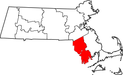 | |
| Towns | ||
| CDPs | ||
| Other villages | ||
| Ghost town | ||
Boston (capital) | |
| Topics |
|
| Society | |
| Regions | |
| Counties | |
| Cities |
|
| Topics | |||||||||||
|---|---|---|---|---|---|---|---|---|---|---|---|
| States | |||||||||||
| Major cities | |||||||||||
| State capitals | |||||||||||
| Transportation |
| ||||||||||
| |||||||||||