Fall River (Oregon)
| Fall River | |
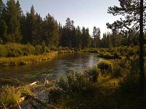 The Fall River in summer | |
| Country | United States |
|---|---|
| State | Oregon |
| County | Deschutes |
| Source | Deschutes National Forest[1] |
| - location | a spring about 3.8 mi (6.1 km) southeast of Lookout Mountain[2] |
| - elevation | 4,274 ft (1,303 m) [3] |
| - coordinates | 43°46′03″N 121°38′00″W / 43.76750°N 121.63333°W [4] |
| Mouth | Deschutes River (left bank) |
| - location | just downstream from La Pine State Park |
| - elevation | 4,175 ft (1,273 m) [3] |
| - coordinates | 43°47′18″N 121°30′41″W / 43.78833°N 121.51139°WCoordinates: 43°47′18″N 121°30′41″W / 43.78833°N 121.51139°W [4] |
| Length | 12 mi (19 km) [5] |
 Location of the mouth of the Fall River in Oregon | |
The Fall River is a tributary of the Deschutes River[6] in the Deschutes National Forest in Deschutes County, Oregon, United States.[4] The source is a spring approximately 2 miles (3 km) northwest of Pringle Falls. The river flows to the northeast and is about 12 miles (19 km) long.[5] Fly fishing is permitted.
There is a trail along the river, and also a campground about one mile downstream from the head of the river; a guard station at the head of the river can be rented.[7][8]
Fall River Falls is on the river within La Pine State Park.[9]
The Fall River also hosts the Fall River Hatchery, a state-run fish hatchery which raises rainbow trout, brook trout and cutthroat trout fingerling for stocking programs throughout the state.[10] The river has one named tributary, Indian Creek, which enters from the left above the hatchery.[11]
See also
References
- ↑ Round Mountain Quadrangle, Oregon (PDF) (Map). 1:24,000. 7.5-Minute Series (Topographic). Cartography by U.S. Forest Service. 21 March 2012. Retrieved 13 September 2014.
- ↑ The National Map 2.0 (Map). Cartography by U.S. Geological Survey. Retrieved 13 September 2014.
- 1 2 Source and mouth elevations derived from Google Earth search using GNIS coordinates.
- 1 2 3 "Fall River". Geographic Names Information System. United States Geological Survey. 28 November 1980. Retrieved 13 September 2014.
- 1 2 "Fall River Hatchery". The ODFW Visitors' Guide. Oregon Department of Fish and Wildlife. Retrieved 13 September 2014.
- ↑ "Fall River". U.S. Forest Service. Retrieved 11 September 2014.
- ↑ "Fall River Guard Station". Recreation.gov. Retrieved 11 September 2014.
- ↑ "Fall River Trail". Alltrails.com. Retrieved 11 September 2014.
- ↑ "Fall River Falls". Northwest Waterfall Survey. Retrieved 11 September 2014.
- ↑ "Fall River Hatchery". Oregon Department of Fish and Wildlife. Retrieved 11 September 2014.
- ↑ "United States Topographic Map". United States Geological Survey. Retrieved February 15, 2016 – via Acme Mapper.
External links
- Photo of the Fall River in winter from Wikimedia Commons