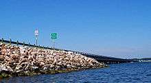
Farm to Market Road 1097
| ||||
|---|---|---|---|---|
| Route information | ||||
| Maintained by TxDOT | ||||
| Length: | 30.222 mi[1] (48.638 km) | |||
| Existed: | 1948[1] – present | |||
| Major junctions | ||||
| West end: |
| |||
|
| ||||
| East end: |
| |||
| Highway system | ||||
| ||||
Farm to Market Road 1097 (FM 1097) is a state highway in the U.S. State of Texas. FM 1097 originally began at FM 149 in Montgomery, Texas, and ends nearly thirty miles away at Highway 150.[1] Most of the road has only two lanes each direction. The speed limit ranges from 60 mph (97 km/h) to 35 mph (56 km/h). There are very few traffic lights on the highway.
History

Farm to Market Road 1097 was first designated on December 16, 1948. The highway traveled from an intersection with FM 149 north of Montgomery along its present route to an intersection with U.S. Route 75 in Willis. On July 22 of the next year, the designation was extended 8.9 miles (14.3 km) to the Walker County border. The road was extended 1.2 miles (1.9 km) eastward, to the highway's present eastern terminus, on November 20, 1951. On August 1, 1962, the highway was extended 6.9 miles (11.1 km) northwestward to its present northern terminus.[1]
Major junctions
| County | Location | mi[2] | km | Destinations | Notes |
|---|---|---|---|---|---|
| Montgomery | | 0.000 | 0.000 | CR 3142 (Johnson Road) | Western terminus |
| | 6.243 | 10.047 | Northern terminus of FM 149 concurrency | ||
| Montgomery | 6.744 | 10.853 | Southern terminus of FM 149 concurrency | ||
| Lake Conroe | 13.206– 14.471 | 21.253– 23.289 | Rotary Friendship Bridge | ||
| Montgomery | Willis | 20.471– 20.513 | 32.945– 33.012 | Exit 94 on I-45 | |
| 21.274– 21.349 | 34.237– 34.358 | Short concurrency through central Willis | |||
| Walker | | 30.222 | 48.638 | Eastern terminus | |
1.000 mi = 1.609 km; 1.000 km = 0.621 mi
| |||||
References
- 1 2 3 4 Texas Department of Transportation, Highway Designation File: Farm to Market Road No. 1097
- ↑ Statewide Planning Map (Map). Cartography by Transportation Planning and Programming Division. Texas Department of Transportation. Retrieved January 22, 2013.
