Fatausi
| Fatausi | |
|---|---|
| Village | |
|
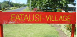
The Fatausi sign at the south end of the village bordering Fusi | |
| Motto: Fa'avae ile Atua | |
 Satellite image of eastern half of Savai'i island (left of photo) with tiny Apolima & Manono islands and the western tip of Upolu. (NASA photo, 2006) | |
| Coordinates: 13°50′S 171°45′W / 13.833°S 171.750°WCoordinates: 13°50′S 171°45′W / 13.833°S 171.750°W | |
| Country |
|
| District | Safotulafai |
| Elevation | 2 m (7 ft) |
| Time zone | SST (UTC+13) |
| • Summer (DST) | HST (UTC+14) |
| [1][2] | |
Fatausi is a village on the north east coast of Savai'i Island in the Independent State of Samoa.[3]
This small village sits between the villages of Fogapoa to the north and the larger village of Fusi to the south. These three villages and the village of Tuasivi further north together form the traditional sub-district of Safotulafai, an area of historical, cultural and political significance in Samoa's history.[4] Notably, it was the area which the 'Mau a Pule' resistance movement against colonial rule originated, which later evolved into the National Mau movement—leaders in achieving Samoa's political independence in 1962.
Safotulafai is also the capital of the Fa'asaleleaga political district, a major Malietoa area.
References
- ↑ "Weather Underground: Apia, Samoa".
- ↑ "Samoa Starts Daylight Saving Time in 2009". timeanddate.com. 28 November 2008. Retrieved 2009-08-03.
- ↑ Pacific Islands Legal Informations Institute. Retrieved 6 February 2012
- ↑ Samoa Bureau of Statistics.Retrieved 6 February 2012
This article is issued from Wikipedia - version of the 4/30/2013. The text is available under the Creative Commons Attribution/Share Alike but additional terms may apply for the media files.