Finnkongkeila
| Finnkongkeila | |
|---|---|
| Village | |
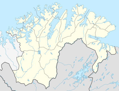 Finnkongkeila Location in Finnmark | |
| Coordinates: 70°54′38″N 28°27′11″E / 70.91056°N 28.45306°ECoordinates: 70°54′38″N 28°27′11″E / 70.91056°N 28.45306°E | |
| Country | Norway |
| Region | Northern Norway |
| County | Finnmark |
| District | Øst-Finnmark |
| Municipality | Gamvik |
| Elevation[1] | 43 m (141 ft) |
| Time zone | CET (UTC+01:00) |
| • Summer (DST) | CEST (UTC+02:00) |
Finnkongkeila was a fishing village in Gamvik Municipality in Finnmark county, Norway. The village was located on the eastern part of the Nordkinn Peninsula on the shores of the Tanafjorden. The village was abandoned in 1944 after the burning of the village during the German withdrawal from Finnmark during their retreat near the end of World War II.[2]
References
- ↑ "Finnkongkeila" (in Norwegian). yr.no. Retrieved 2013-02-22.
- ↑ Store norske leksikon. "Finnkongkeila" (in Norwegian). Retrieved 2013-02-22.
This article is issued from Wikipedia - version of the 3/23/2013. The text is available under the Creative Commons Attribution/Share Alike but additional terms may apply for the media files.