Formignana
| Formignana | |
|---|---|
| Comune | |
| Comune di Formignana | |
|
The central IV Novembre Square with the War Monument and the Saint Stephen church tower | |
 Formignana Location of Formignana in Italy | |
| Coordinates: 44°51′N 11°52′E / 44.850°N 11.867°ECoordinates: 44°51′N 11°52′E / 44.850°N 11.867°E | |
| Country | Italy |
| Region | Emilia-Romagna |
| Province / Metropolitan city | Province of Ferrara (FE) |
| Frazioni | Brazzolo |
| Area | |
| • Total | 22.3 km2 (8.6 sq mi) |
| Elevation | 3 m (10 ft) |
| Population (Dec. 2004) | |
| • Total | 2,898 |
| • Density | 130/km2 (340/sq mi) |
| Time zone | CET (UTC+1) |
| • Summer (DST) | CEST (UTC+2) |
| Postal code | 44035 |
| Dialing code | 0533 |
| Patron saint | Saint Stephen I, Pope and Martyr |
| Website | Official website |
.JPG)
Formignana is a comune (municipality) in the Province of Ferrara in the Italian region Emilia-Romagna, located about 60 kilometres (37 mi) northeast of Bologna and about 20 kilometres (12 mi) east of Ferrara. As of 31 December 2004, it had a population of 2,898 and an area of 22.3 square kilometres (8.6 sq mi).[1]
Formignana borders the following municipalities: Copparo, Ferrara, Jolanda di Savoia, Tresigallo.
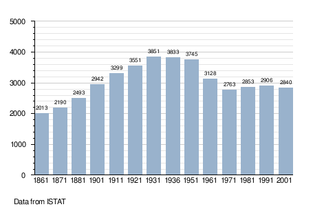
Demographic evolution
References
External links
This article is issued from Wikipedia - version of the 1/31/2015. The text is available under the Creative Commons Attribution/Share Alike but additional terms may apply for the media files.