Fort Portal
| Fort Portal Kabarole | |
|---|---|
.jpg) | |
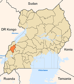
 Fort Portal Location in Uganda | |
| Coordinates: 00°39′16″N 30°16′28″E / 0.65444°N 30.27444°E | |
| Country |
|
| Region | Western Region |
| Sub-region | Toro sub-region |
| District | Kabarole District |
| Government | |
| • Mayor | Asaba Ruyonga |
| Elevation | 4,860 ft (1,480 m) |
| Population (2014 Census) | |
| • Total | 54,275[1] |
Fort Portal is a town in the Western Region of Uganda. It is the seat of both Kabarole District and the Toro Kingdom.
Location
Fort Portal is located about 180 kilometres (110 mi), north-west of Mbarara, the largest city in the Western Region.[2] This is approximately 297 kilometres (185 mi) by road, west of Kampala, Uganda's capital and largest city, on an all-tarmac two-lane highway.[3] The coordinates of the town are 0°39'16.0"N, 30°16'28.0"E (Latitude:0.654444; Longitude:30.274444).[4]
Population
According to the 2002 national census, the population of Fort Portal was about 41,000. In 2010, the Uganda Bureau of Statistics (UBOS) estimated the population at 46,300. In 2011, UBOS estimated the population at 47,100.[5] In August 2014, the national population census put the population at 54,275.[1]
Healthcare
Fort Portal is home to three hospitals. Fort Portal Regional Referral Hospital, a 300-bed public hospital administered by the Uganda Ministry of Health is the largest.[6] The next-largest is Holy Family Virika Hospital, a private hospital with a bed capacity of 155, owned by the Roman Catholic Diocese of Fort Portal.[7] The smallest of the hospitals is the 100-bed Kabarole Missionary Hospital, community hospital administered by the Church of Uganda.[8]
Education
The town houses two institutions of higher learning. The main campus of Mountains of the Moon University, a private university, is located in the center of town.[9] Also located within the town, is the main campus of Uganda Pentecostal University, a private university affiliated with the Pentecostal Movement.[10][11] St. Mary's Minor Seminary, a Catholic secondary school for prospective Catholic priests is also located in Fort Portal.[12]
See also
References
- 1 2 UBOS (27 August 2014). "The Population of The Regions of the Republic of Uganda And All Cities And Towns of More Than 15,000 Inhabitants". Citypopulation.de Quoting Uganda Bureau of Statistics (UBOS). Retrieved 22 February 2015.
- ↑ Globefeed.com (17 October 2016). "Distance between Main Post Office, Mbarara, Uganda and Post Office, Fort Portal, Uganda". Globefeed.com. Retrieved 17 October 2016.
- ↑ Globefeed.com (17 October 2016). "Distance between Post Office Building, Kampala Road, Kampala, Uganda and Post Office, Fort Portal, Uganda". Globefeed.com. Retrieved 17 October 2016.
- ↑ Google (17 October 2016). "Location of Fort Portal (Kabarole), Western Region, Uganda" (Map). Google Maps. Google. Retrieved 17 October 2016.
- ↑ "Estimated Population of Fort Portal In 2002, 2010 & 2011" (PDF). Uganda Bureau of Statistics. Retrieved 17 April 2014.
- ↑ Atuhaire, Scovia (10 August 2016). "Uganda: Drug Scarcity Hits Fort Portal Referral Hospital". Daily Monitor via AllAfrica.com. Kampala. Retrieved 17 October 2016.
- ↑ RCDFP (2014). "Overview of Holy Family Virika Hospital". Roman Catholic Diocese of Fort Portal (RCDFP). Retrieved 17 October 2016.
- ↑ KHCOU (17 October 2016). "Kabarole Hospital, Church of Uganda". Fort Portal: Kabarole Hospital, Church of Uganda (KHCOU). Retrieved 17 October 2016.
- ↑ UNAS (2014). "List of Accredited Universities In Uganda". Kampala: Uganda National Academy of Sciences (UNAS). Retrieved 17 October 2016.
- ↑ Natukunda, Carol (14 July 2007). "Four more universities approved". New Vision. Kampala. Retrieved 17 October 2016.
- ↑ Google (17 October 2016). "Location of the Main Campus of Uganda Pentecostal University" (Map). Google Maps. Google. Retrieved 17 October 2016.
- ↑ RCDFP (2014). "Catholic Diocese of Fort Portal: History and Growth". Fort Portal: Roman Catholic Diocese of Fort Portal (RCDFP). Retrieved 17 October 2016.
External links
| Wikivoyage has a travel guide for Fort Portal. |
Capital: Kabarole | ||
| Counties and sub-counties |
|  |
| Towns and villages |
| |
| Geography | ||
| Economy | ||
| Notable landmarks | ||
| Health | ||
| Education | ||
| Transport | ||
| Notable people | ||
Coordinates: 00°39′16″N 30°16′28″E / 0.65444°N 30.27444°E