Fortification Hill
| Fortification Hill | |
|---|---|
 | |
| Highest point | |
| Elevation | 3,720 feet (1,134 m) NAVD 88[1] |
| Prominence | 863 ft (263 m) [2] |
| Coordinates | 36°02′40″N 114°40′52″W / 36.044327039°N 114.681155314°WCoordinates: 36°02′40″N 114°40′52″W / 36.044327039°N 114.681155314°W [1] |
| Geography | |
 Fortification Hill
| |
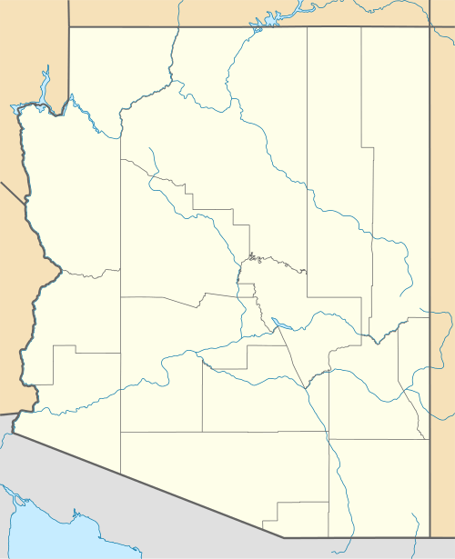
| Location | Mohave County, Arizona, U.S. |
| Parent range | Black Mountains (Arizona) |
| Topo map | USGS Hoover Dam |
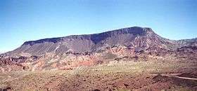
Fortification Hill is a prominence adjacent Lake Mead in the Lake Mead National Recreation Area; it is located at the northwest terminus region of the Black Mountains (Arizona), and specifically the north region of the Black Mountains. It is near a southern section of Lake Mead, and just northeast of Hoover Dam. It can easily be seen eastward across Las Vegas Bay or from the two northern mountain terminuses of Eldorado Mountains (Nevada), or the Black Mountains (Arizona).
The mountain prominence is plateau-like, or mesa-like with its highpoint at the southeast terminus, and sloping north and northwestwards toward Lake Mead. The prominence is 3,719 feet (1,134 m).[2]
The flat mountaintop, sloping northwards is composed of Tertiary basaltic lava flows.[3]
See also
References
- 1 2 "Fortification Hill". NGS data sheet. U.S. National Geodetic Survey. Retrieved 2016-08-16.
- 1 2 "Fortification Hill, Arizona". Peakbagger.com. Retrieved 2016-08-16.
- ↑ Geologic Highway Map of Arizona, from Geology: Arizona Geological Survey Map 26, 1988.
External links
- Larger photo from the trailhead. Peakbagger.com.
- Geologic History of Lake Mead National Recreation Area. USGS.
- "Fortification Hill". SummitPost.org.
- "Fortification Hill". Geographic Names Information System. United States Geological Survey.
| Wikimedia Commons has media related to |