Franconian Rezat
 | |
| The Franconian Rezat near Windsbach | |
| Location | Middle Franconia, Bavaria, Germany |
|---|---|
| Reference no. | DE: 242 |
| Length | 63.51 km [1] |
| Source | On the Franconian Heights northwest of Oberdachstetten 49°25′39″N 10°23′47″E / 49.42750°N 10.39639°ECoordinates: 49°25′39″N 10°23′47″E / 49.42750°N 10.39639°E |
| Source height | 452 m above sea level (NN) [2] |
| Confluence | with the Swabian Rezat in Georgensgmünd to form the Rednitz 49°11′17″N 11°01′20″E / 49.188194°N 11.02222°E |
| Mouth height | 342 m above sea level (NN) |
| Descent | 110 m |
| Basin | Rhine |
| Progression | Rednitz → Regnitz → Main → Rhine → North Sea |
| Catchment | 453.8 km² [3] |
| Discharge at Ansbach (26.3 % of the catchment) gauge[4] |
Record low: 20 l/s Average low: 158 l/s Average mid: 744 l/s Average high: 19.9 m³/s Record high: 60.0 m³/s (in 1941) |
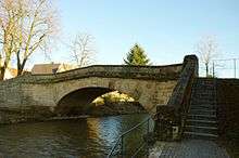 | |
| The Markgrafen Bridge at Windsbach | |
 | |
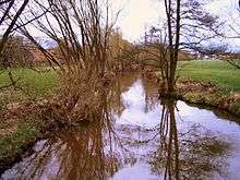
| The Franconian Rezat near Wassermungenau | |
 | |
| The Franconian Rezat near Georgensgmünd | |
The Franconian Rezat (German: Fränkische Rezat) is a 63,5 km long river in southern Germany. It is the western, left source river of the Rednitz. It rises in the Franconian Heights near Oberdachstetten. It flows generally east through the towns Lehrberg, Ansbach, Windsbach and Spalt. Together with the Swabian Rezat (Schwäbische Rezat), it forms the Rednitz in Georgensgmünd.
References
- ↑ Kartenservices der Bayrischen Landesamtes für Umwelt
- ↑ TOP 10 Bayern Nord
- ↑ Hochwasser-Aktionsplan Main
- ↑ Bayerischer Hochwassernachrichtendienst (as at: 6 September 2011)
This article is issued from Wikipedia - version of the 7/25/2016. The text is available under the Creative Commons Attribution/Share Alike but additional terms may apply for the media files.