Freiha
| Freiha | |
|---|---|
| Abandoned Settlement | |
 Freiha | |
| Coordinates: 25°59′43″N 51°01′35″E / 25.99528°N 51.02639°ECoordinates: 25°59′43″N 51°01′35″E / 25.99528°N 51.02639°E | |
| Country | Qatar |
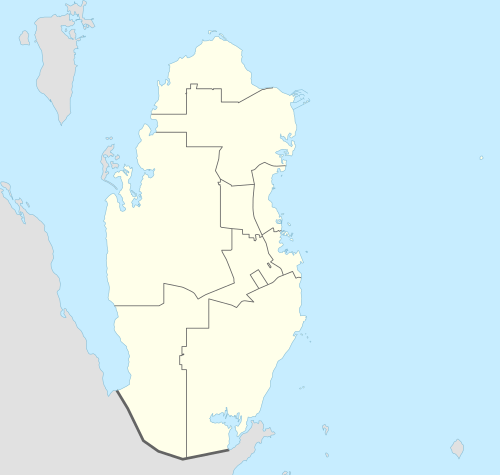
| Municipality | Madinat ash Shamal |
| Area | |
| • Total | 0.5 km2 (0.2 sq mi) |
Freiha, also called Furayhah, is a small deserted settlement on the north western coast of the Qatar peninsula in the Madinat ash Shamal municipality. It is located in the Zubarah region being 3 km north of Zubarah town,[1] and was founded by the Al Bin Ali tribe , main and principal Utub tribe in the first half of the eighteenth century along with the historical town of Zubarah,.[2][3][4][5][6][7]
The age and origin of the settlement is unknown, however excavations and historical documents suggest that it was at its peak in the 17th–18th century, almost certainly pre-dating its larger neighbour Al Zubarah. The village covers an area of approximately 50 hectares, extending for 700m north to south along the coast and approximately 200m east to west inland. It is sited around a shallow bay.
Al Bin Ali rule of Freiha
The Al Bin Ali, migrated from Kuwait and settled at Freiha and Zubarah in 1732,[2] founded and ruled these historical towns ,.[3][4][5][6][8]
The Al Bin Ali were the original dominant group controlling the Zubarah region including Freiha on the Qatar peninsula, they were a politically important group that moved backwards and forwards between Qatar and Bahrain,[9][10] originally the center of power of the Bani Utbah. The Al Bin Ali they were also known for their courage, persistence, and abundant wealth.[11]
The Al Bin Ali had a practically independent status in Bahrain and Qatar as a self-governing tribe. They used a flag with four red and three white stripes with seven triangles facing the west, called the Al-Sulami flag[12] in Bahrain, Qatar, Kuwait, and the Eastern province of the Kingdom of Saudi Arabia.
People of Freiha assisting their cousins in Zubarah during the siege by Nasr Al-Madhkur in 1783
A quarrel arose in 1782 between the inhabitants of Zubarah and Persian-ruled Bahrain. Zubarah natives traveled to Bahrain to buy some wood, but an altercation broke out and in the chaos an Utub sheikh's slave was killed. The Utub and other Arab tribes retaliated on 9 September by plundering and destroying Manama.[13] A battle was also fought on land between the Persians and the Arab tribes, in which both sides suffered casualties. The Zubarans returned to the mainland after three days with a seized Persian gallivat that had been used to collect annual treaty. On 1 October, Ali Murad Khan ordered the sheikh of Bahrain to prepare a counter-attack against Zubarah and sent him reinforcements from the Persian mainland.[14]
Bani Utbah's victory over Nasr Al-Madhkur at Zubarah in 1783
In 17 May 1783, war broke out between the Zubarah-based Al Bin Ali Bani Utbah tribe and the army of Nasr Al-Madhkur. Zubarah was originally the center of power of the Al Bin Ali Bani Utbah tribe, which was ruling Zubarah and the original dominant tribe in Zubarah.[3][4][5][6][15] About 2,000 Persian troops arrived in Bahrain by December; they then attacked Zubarah on 17 May 1783. After suffering a defeat, the Persians withdrew their arms and retreated to their ships. An Utub naval fleet from Kuwait arrived in Bahrain the same day and set Manama ablaze. The Persian forces returned to the mainland to recruit troops for another attack, but their garrisons in Bahrain were ultimately overrun by the Utub.[14]
It is well known that the strategist of this battle was Shaikh Nasr Al-Madhkur, his sword fell into the hands of Salama Bin Saif Al Bin Ali , Chief of Freiha, after his army collapsed and his forces were defeated.[16]
The Al Bin Ali , have kept the sword with them and they kept passing it from son to grandson until it was given as a gift to King Abdul Aziz Bin Faisal Al Saud and it can be seen today at the King AbdulAziz Museum in Riyadh, Capital of Saudi Arabia
The Original Utub Al Bin Ali conquered and expelled the Persians from Bahrain [17] after defeating them in the battle of Zubarah that took place in the year 1782 between the Al Bin Ali and the Army of Nasr Al-Madhkur Ruler of Bahrain and Bushire. The Bani Utbah was already present at Bahrain at that time, settling there during summer season and purchasing date palm gardens.
History
In J.G. Lorimer's Gazetteer of the Persian Gulf published in 1904, Freiha was described as a place 3 miles south of Al Khuwayr which had a few trading boats and approximately 150 inhabitants, most of whom were fishermen.[18]
Archaeology
The site was subjected to investigations by Qatari archaeologists in the 2005. More recently in 2009, the QMA, jointly with the University of Copenhagen, launched the Qatar Islamic Archaeology and Heritage Project (QIAH), a ten-year research, conservation and heritage initiative, to investigate sites in the Al Zubarah hinterland. The project is an initiative by the Qatar Museums Authority’s Chairperson H.E. Sheikha Al Mayassa bint Hamad bin Khalifa AlThani and Vice-Chairperson H.E. Sheikh Hassan bin Mohammad Al Thani. The QIAH project has carried out a complete topographic survey of the site of Freiha, allowing a map to be produced. This has led to a new series of excavations on the site, targeted at a central mosque, several domestic structures, and middens (rubbish dumps) surrounding the settlement.
Qal’at Freiha
One of the main features of the site is the partially excavated and conserved Qal’at Freiha, a fortified building measuring approximately 45m square, with evidence of corner towers in the Islamic style, excavated and conserved in 2005. Inside the fort a variety of domestic structures were found, including store rooms and date presses (madbassat).
Mosque
Close to the centre of the settlement, and the fort, the village’s second largest structure has been excavated. The architecture and alignment suggests that this building was a mosque. Elements such as a mihrab, minbar, a well for washing, and an open courtyard all mirror closely other later Qatari mosques.
Domestic architecture
The domestic structures of Freiha appear typical of the gulf region and the time period. They consist of small stone built rooms, frequently with small open courtyards attached to them. Where excavations have been carried out, these structures appear to undergo constant remodelling throughout their lifespan, often with small rooms and sub divisions being added. Finds evidence in the form of stone fishing weights, large amounts of fish bones and the presence of extensive tidal fish traps suggests a primarily marine based economy. It seems likely from archaeological evidence, that the first occupation of the site was in temporary structures, and shelters prior to more permanent, mud and then stone dwellings being built.
Burial sites
To the north and south of the settlement there are extensive burial sites, with several hundred human interments evident.
Rock art
In 1956, Geoffrey Bibby and Peter Glob discovered several hundred cup-marks carved in rock in Freiha. The sizes range from 5 to 23 cm and have a depth of 2 to 10 cm, with most being 5 cm in diameter and having a depth of 1 to 3 cm. Bibby and Glob noted that the cup-marks are similar to those found in Bahrain dating to the Dilmun period.[19] Several hand and footprints were also documented in Freiha.[20]
Geometrical designs were recorded at Freiha in four places. They measure 11 to 15 cm in width and 11 to 12 cm in height. Peter Glob believed that they were carved by an ancient fertility cult.[21][22] This theory was disputed by archaeologist Muhammad Abdul Nayeem, who believes that they are abstract symbols or tribal marks.[21]
References
- ↑ Bonnie James. "New tools to unearth Zubarah secrets" (PDF). miri.ku.dk. Gulf Times. Retrieved 9 June 2015.
- 1 2 تاريخ آل خليفة في البحرين - الشيخ عبدالله بن خالد آل خليفة والدكتور علي أبا حسين، الجزء الثاني، ص 18
- 1 2 3 Rihani, Ameen Fares (1930), Around the coasts of Arabia, Houghton Mifflin Company, page 297
- 1 2 3 Arabian Frontiers: The Story of Britain’s Boundary Drawing in the Desert, John C Wilkinson, p44
- 1 2 3 تاريخ نجد – خالد الفرج الدوسري – ص 239
- 1 2 3 قلائد النحرين في تاريخ البحرين تأليف ناصر بن جوهر بن مبارك الخيري، تقديم ودراسة عبدالرحمن بن عبدالله الشقير،2003، ص 215.
- ↑ المصالح البريطانية في الكويت حتى عام 1939، أحمد حسن جودة، ترجمة حسن النجار، مطبعة الارشاد، بغداد، 1979، ص 35
- ↑ المصالح البريطانية في الكويت حتى عام 1939، أحمد حسن جودة، ترجمة حسن النجار، مطبعة الارشاد، بغداد، 1979، ص 35
- ↑ Wilkinson, John Craven (1991). Arabia's frontiers: the story of Britain's boundary drawing in the desert. I.B. Tauris. p. 44.
- ↑ Rihani, Ameen Fares (1930). Around the coasts of Arabia. Houghton Mifflin Company. p. 297.
- ↑ Arabian Studies By R.B. Serjeant, R.L. Bidwell, p67
- ↑ Gazetteer of the Persian Gulf, Oman, and Central Arabia, Geographical, Volume 1, 1905
- ↑ Rahman, p. 51
- 1 2 Al-Qāsimī, Sulṭān ibn Muḥammad (1999). Power Struggles and Trade in the Gulf: 1620-1820. Forest Row. p. 168.
- ↑ المصالح البريطانية في الكويت حتى عام 1939، أحمد حسن جودة، ترجمة حسن النجار، مطبعة الارشاد، بغداد، 1979، ص 35
- ↑ Shaikh Hamad Bin Isa Al-Khalifa ,First Light: Modern Bahrain and its Heritage, 1994 p41
- ↑ the Precis Of Turkish Expansion On The Arab Littoral Of The Persian Gulf And Hasa And Katif Affairs. By J. A. Saldana; 1904, I.o. R R/15/1/724
- ↑ "'Persian Gulf Gazetteer Part II, Geographical and Descriptive Materials, Section II Western Side of the Gulf' [51v] (105/286)". Qatar Digital Library. Retrieved 23 July 2015.
- ↑ Abdul Nayeem, Muhammad (1998). Qatar Prehistory and Protohistory from the Most Ancient Times (Ca. 1,000,000 to End of B.C. Era). Hyderabad Publishers. p. 221. ISBN 9788185492049.
- ↑ Abdul Nayeem (1998), p. 258.
- 1 2 Abdul Nayeem (1998), p. 256.
- ↑ Glob, Peter (1957). "Prehistoric discoveries in Qatar". Kuml: 176.
External links
- Rees, G.; Walmsley, A. G.; Richter, T. (2011). "Investigations in the Zubarah Hinterland at Murayr and Furayhah, North-West Qatar". Proceedings of the Seminar for Arabian Studies 41: 309–316.
- Richter, T., ed. (2010). Qatar Islamic Archaeology and Heritage Project. End of Season Report. Stage 2, Season 1, 2009-2010. University of Copenhagen/Qatar Museums Authority.
- Richter, T.; Wordsworth, P. D.; Walmsley, A. G. (2011). "Pearlfishers, townsfolk, Bedouin and Shaykhs: economic and social relations in Islamic Al-Zubarah". Proceedings of the Seminar for Arabian Studies 41: 1–16.
- Walmsley, A.; Barnes, H.; Macumber, P. (2010). "Al-Zubarah and its hinterland, north Qatar: excavations and survey, spring 2009". Proceedings of the Seminar for Arabian Studies 40: 55–68.
Capital: Al Shamal | |
Census designated areas
| |
Unincorporated and abandoned areas
|