Froomsgate House, Bristol
| Froomsgate House | |
|---|---|
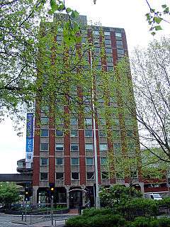 Seen from Lewin's Mead | |
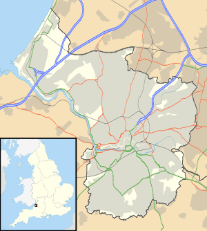 Shown within Bristol | |
| Alternative names | Fusion Tower |
| General information | |
| Status | Complete |
| Address | Rupert Street |
| Town or city | Bristol |
| Country | UK |
| Coordinates | 51°27′25″N 2°35′42″W / 51.457°N 2.595°WCoordinates: 51°27′25″N 2°35′42″W / 51.457°N 2.595°W |
| Completed | 1971[1] |
| Owner | Froomsgate House Realty Ltd[2] |
| Landlord | Hartnell Taylor Cook LLP[2] |
| Height | 63 m (207 ft)[1] |
| Technical details | |
| Floor count | 15[1] |
| Floor area | 1,368 m2 (14,730 sq ft)[3] |
| Lifts/elevators | 3[3] |
| Design and construction | |
| Main contractor | Laing Development[4] |
Froomsgate House is a 63 m (207 ft)[1] high student accommodation building in central Bristol, England, situated at the junction of Rupert Street with Lewin's Mead. Completed in 1971, it was previously a 15-storey office block but in 2014 it was converted into 480 bed student accommodation.[5] There are also three floors of car-parking.[6] The building has 1,368 m2 (14,730 sq ft) of office space, serviced by three lifts.[3] The building is owned by Froomsgate House Realty Ltd and managed by Hartnell Taylor Cook LLP.[2] The name derives from an ancient city gate by the River Frome which once stood on the site.[4] Notable tenants include the Crown Prosecution Service Southwest.[7]
On the first floor of the building is a mosaic mural map, the Froomsgate Map, executed by artist Phillipa Threlfall. This artwork was commissioned by the developer Laing Development owned by John Laing plc. The map depicts the surrounding area in 1673 as originally shown in James Millerd's map of that date. It is sited on the first floor as it was originally envisaged that Froomsgate House would be linked to other surrounding buildings by elevated walkways.[4]
See also
References
- 1 2 3 4 "Froomsgate House". Skyscrapernews.com. Retrieved 17 November 2011.
- 1 2 3 "Service Charge Report June 2009" (PDF). cushmanwakefieldinvestmentsales.co.uk. 2011. Retrieved 17 November 2011.
- 1 2 3 "Froomsgate House" (PDF). rbiassets.com. 2009. Retrieved 17 November 2011.
- 1 2 3 Threlfall, Philippa (2011). "1970's Murals - 1970 Froomsgate Map". philippathrelfall.com. Retrieved 17 November 2011.
- ↑ "Fusion Tower". Retrieved 7 May 2016.
- ↑ "Froomsgate House". emporis.com. 2011. Retrieved 17 November 2011.
- ↑ "CPS South West: Contact us". cps.gov.uk. 2011. Retrieved 17 November 2011.