Garriskil
| Garriskil | |
|---|---|
| Townland | |
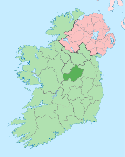
 Garriskil Location of Garriskil within County Westmeath in the Republic of Ireland | |
| Coordinates: 53°39′31″N 7°28′14″W / 53.65861°N 7.47056°WCoordinates: 53°39′31″N 7°28′14″W / 53.65861°N 7.47056°W | |
| Country |
|
| Province | Leinster |
| County | County Westmeath |
| Irish grid reference | N350677 |
Garriskil is a townland in County Westmeath, Ireland. It is located about 17.04 kilometres (11 mi) north–north–west of Mullingar.
Garriskil is one of 35 townlands of the civil parish of Street in the barony of Moygoish in the Province of Leinster. The townland covers 441.62 acres (1.7872 km2). The southern boundary of the townland is formed by the River Inny.
The neighbouring townlands are: Barradrum to the north, Clonkeen and Monagead to the east, Ballyharney to the south, Cappagh to the south–west and Culvin to the north–west.[1][2]
In the 1911 census of Ireland there were 4 houses[3] and 22 inhabitants[4] in the townland.
References
- ↑ Garriskil Townland, Co. Westmeath Townlands.ie Retrieved on 14 September 2015.
- ↑ Garriskil Townland, Co. Westmeath The IreAtlas Townland Data Base Retrieved on 14 September 2015.
- ↑ Houses in Garriskil. Census of Ireland 1911. Retrieved on 14 September 2015.
- ↑ Inhabitants in Garriskil. Census of Ireland 1911. Retrieved on 14 September 2015.
External links
- Map of Garriskil at openstreetmap.org
- Garriskil at the IreAtlas Townland Data Base
- Garriskil at Townlands.ie
- Garriskil at The Placenames Database of Ireland, Department of Arts, Heritage and the Gaeltacht
This article is issued from Wikipedia - version of the 9/14/2015. The text is available under the Creative Commons Attribution/Share Alike but additional terms may apply for the media files.