Gayhata Union
| Gayhata Union গয়হাটা ইউনিয়ন | |
|---|---|
|
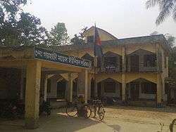
Gayhata Union Parishad Complex | |
 Gayhata Union Location of Gayhata Union in Bangladesh | |
| Coordinates: 24°04′05″N 89°50′22″E / 24.06814456151135°N 89.83941614627838°ECoordinates: 24°04′05″N 89°50′22″E / 24.06814456151135°N 89.83941614627838°E | |
| Country | Bangladesh |
| Division | Dhaka Division |
| District | Tangail District |
| Upazila | Nagarpur Upazila |
| Established on | 1984 |
| Government | |
| • Type | Union Council |
| • Chairman | Md Mostafizur Rahman Askor |
| Area | |
| • Total | 25.28 km2 (9.76 sq mi) |
| Elevation | 14 m (46 ft) |
| Population (2011) | |
| • Total | 30,613 |
| • Density | 1,200/km2 (3,100/sq mi) |
| Time zone | BST (UTC+6) |
| Postal code | 1936 |
| Website |
gayhataup |
Gayhata Union (Bengali: গয়হাটা ইউনিয়ন) is a union of Nagarpur Upazila, Tangail District, Bangladesh. It is situated 3 km west of Nagarpur and 27 km south of Tangail city.
Demographics
According to Population Census 2011 performed by Bangladesh Bureau of Statistics, The total population of Gayhata union is 30,613.There are 6,830 households in total.[1]
Education
The literacy rate of Gayhata Union is 48.1% (Male-50.4%, Female-45.9%).[2]
See also
References
- ↑ "Tangail Table C-01 : Area, Households, Population, Density by Residence and Community" (PDF). bbs.gov.bd. Retrieved 2016-03-01.
- ↑ "Tangail : C06 : Distribution of Population aged 7 years and above by Literacy, Sex, Residence and Community" (PDF). bbs.gov.bd. Retrieved 2016-02-25.
This article is issued from Wikipedia - version of the 11/2/2016. The text is available under the Creative Commons Attribution/Share Alike but additional terms may apply for the media files.