Girdle Toll

Coordinates: 55°37′12″N 4°39′41″W / 55.6201°N 04.6614°W
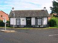
Girdle Toll is a small village on the outskirts of Irvine, North Ayrshire.
Geography
Girdle Toll is located east of the Stanecastle Roundabout located next to the Stanecastle Keep. This area of Irvine is 10 miles (16 km) from Prestwick Airport and only 23 miles (37 km) from the city of Glasgow. Nearby is Eglinton Country Park. The central part of Girdle Toll is located off of the Lochilbo Road and Girdle Toll; it previously formed part of the A736 route to Glasgow. The A736 now bypasses the area just to the west.
Transport
The area has several local bus services operated by two companies Stagecoach Western and Shuttle Buses.
- 13/113 - Stewarton - Kilmaurs - Cunninghamehead - Perceton - Girdle Toll - Irvine X
- 22 - Perceton - Girdle Toll - Irvine X - Castlepark
- 29 - Montgomerie Park - Girdle Toll - Middleton Road - Irvine X
- 125 - Montgomerie Park - Girdle Toll - Irvine X - Vineburgh - Redburn - Corsehill - Kilwinning X - Dalry - Kilbirnie - Beith Sunday Only
- X44 - Ardrossan - Saltcoats - Stevenston - Redburn - Irvine X - Girdle Toll - Torranyard - Auchentiber - Burnhouse - Lugton - Uplawmoor - Barrhead - Nitshill - Silverburn Centre - Glasgow Bothwell Street - Glasgow Buchanan Street Bus Station
Schools
- Annick Primary.
- Lawthorn Primary and Nursery.
- Stanecastle Nursery and school for special needs children.
- First Steps Nursery

.

Annick Primary school and Stanecastle Primary school are within the same grounds as each other, they are merely 100m apart from each other. The children from Annick Primary School occasionally visit Stanecastle from time to do activities with the special needs children. Annick Primary and Stanecastle are situated in the fields between Bensley Rise and Burns crescent. The schools were built in 1979.
Lawthorn Primary school is situated close to the Spar shop and pharmacy at the Littlestane roundabout at the top of the Girdle Toll Road, you pass it when you head along the old Glasgow road. Lawthorn Primary school was built in 2000 to relieve the slightly overcrowded Annick Primary school. It now has over double the number of pupils than Annick Primary has.
Local amenities, public houses and restaurants
- Beauty salon
- Lanfine Community Centre
- Girdle Toll Community Centre
- Costcutter
- Keystore
- Spar
- BP Garage
- John Reekie Pharmacy
- Lanfine Doctors Surgery
- Girdle Toll Bowling Club
- Girdle Toll Parish Church
- Gulab Indian Restaurant
- Sun King Chinese takeaway
- Fish and chip shop
- Lawthorn Farm Indian Restaurant
- Woodland nature reserve at Lawthorn pronounced Lawthorn by the locals - managed & owned by the Scottish Wildlife Trust.
The Gulab Indian Restaurant is located just off the Stanecastle Roundabout.
Annick Water

The Annick Water passes through Girdle Toll which also flows through Bourtreehill and passes by the outskirts of Eglinton Country Park. The river is well known for having a healthy stock of trout and salmon during the fishing season. The river is known to be mostly pollution free.
Irvine New Town Trail
Main article Irvine New Town Trail
The Irvine New Town Trail passes through Girdle Toll, it forms part of the British National Cycle Network with routes 7 and 73 forming part of the route. The route forms a ring around the town and passes through Eglinton Country Park, Kilwinning, Bourtreehill, Dreghorn and passes through the town centre of Irvine. It connects to route 7 which is used by locals cycling/walking to nearby Troon and Ayr.
History

Before Girdle Toll was developed by Irvine Development Corporation (IDC), Girdle Toll was just a row of houses next to large areas of farmland. In the 1970s and 1980s IDC decided to develop the land into a large housing area with local amenities. Girdle Toll has been growing since, the most recent area to have houses built was in 2001 when a small development was built next to Bryce Knox court.
Littlestane Loch, now mostly drained, was once located nearby, drained by the Red Burn and fed by drainage, rainfall and natural springs. Littlestane Farm stood at the top of the loch.
Prehistory
John Smith in 1895 records that the GIRDLE stood 3 furlongs to the south-west of Lawthorn Mound and appears to have been so well constructed that it was the admiration of everyone who saw it.[1] A Mr.Rodger, manager of Fergushill Colliry, recollected that the mound was about 30 feet in diameter and 3 feet high; surrounded by a turf dyke and a thorn fence, outside of which were a number of trees, mostly beech. The Girdle Mound was completely levelled circa 1860. This mound gave the name to the toll and then the area.[1]
See also
- Annick Water
- River Irvine
- Bourtreehill House
- Irvine New Town Trail
- Eglinton Castle
- Eglinton Country Park
References
External links
| Wikimedia Commons has media related to Girdle Toll. |