Gode
| Godē/ጎዴ Godey | |
|---|---|
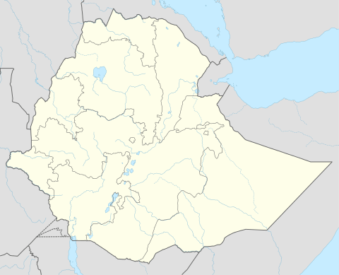 Godē/ጎዴ Location within Ethiopia | |
| Coordinates: 5°57′10″N 43°33′06″E / 5.952655°N 43.551579°ECoordinates: 5°57′10″N 43°33′06″E / 5.952655°N 43.551579°E | |
| Country | Ethiopia |
| Region | Somali |
| Zone | Gode |
| Population (2005) | |
| • Total | 68,342 |
| Time zone | EAT (UTC+3) |
Gode (Amharic: ጎዴ?; Somali: Godey) is a city in the Ethiopian part of the Ogaden. Located in the Gode Zone of the Somali Region, the city has a latitude and longitude of 5°57′N 43°27′E / 5.950°N 43.450°E. Gode was the capital of the Somali Region from late 1992, to appease the powerful Ogaden clan, until early 1994 when it was moved to Jijiga, which had a better infrastructure and access to communications facilities.[1]
Gode hosts an airport (IATA code GDE), with regular flights by Ethiopian Airlines. A bridge over the Shebelle River was constructed in 1968 next to this city.
History
Before the start of the Ogaden War, Gode was garrisoned by the 5th Brigade of the 4th Division, distributed around the town in five military camps.[2] Gode's capture near the end of July 1977 by the Western Somali Liberation Front allowed the Somali side to consolidate their hold on the Ogaden, and concentrate their forces on an advance that led to the capture of Jijiga.[3] Although Gode remained in Somali hands at the end of the Ogaden War, Ethiopian units under Brigadier-General Demisse Bulto, commander of the First Revolutionary Army, recovered Gode as part of Operation Lash by November 1980, and used the city as one of its three bases to successfully clear the rest of eastern Ethiopia of foreign Somali troops by 3 December.[4]
According to the historical notes of the Somali Army, Gode was liberated on July 24, 1977 by the regular Somali Army under the leadership of the then General Abdullahi Ahmed Irro and his deputy Major Abdulkadir Koosaar.[5][6]
In spite of unreserved support by Cuba and the Soviet Union, It took nearly 3-years for the Ethiopian Army to gain a full control of the Gode region long after the Somali Army has systematically withdrawn from the Southern Front in March 1978. The most remarkable strategic retreat of 6 Brigades of the Division 60 of Somalia's National Army involving massive movements of troops from Gode and Negeille in the Bali Sidamo Front. .[4]
Gode has been at the center of several recent famines: one in 1981; the next in 1991, which required the UN High Commission for Refugees to airlift food to 80,000 people stranded outside the town; and most recently in 2000, which had caused Gode to swell to a reported size of 100,000 inhabitants. This led John Graham to grimly remark in the Addis Observer, "The main claims to fame of Gode are not inspiring - they are famine and war."[2]
The mayor of the city in 1994, Muktar Aden Gedden, was murdered on 26 July. For several weeks afterwards it was still not clear who was responsible, as no individual or groups had taken responsibility or had been accused.[7]
Demographics
Based on 2005 figures from the Central Statistical Agency, Gode has an estimated total population of 68,342, of whom 39,479 were males and 28,863 were females.[8] Gode is the largest settlement in Gode woreda.
According to the 1997 national census, the city's total population was 45,755 of whom 26,081 were males and 19,674 were females. The ethnic breakdown was 100% Somali, and other. 11,044 inhabitants, or 24.1% of the population, were in school, of whom 2,766 were males and 1,563 were female; on the other hand, 35,478 or 77.5% were illiterate of whom 17,273 were male and 18,205 female.[9]
Climate
The climate is tropical in Gode. In winter there is much more rainfall in Gode than in summer. According to Köppen and Geiger climate is classified as As . The average annual temperature in Gode is 28.8 °C. The average annual rainfall is 325 mm.
| Climate data for Gode | |||||||||||||
|---|---|---|---|---|---|---|---|---|---|---|---|---|---|
| Month | Jan | Feb | Mar | Apr | May | Jun | Jul | Aug | Sep | Oct | Nov | Dec | Year |
| Average high °C (°F) | 35.8 (96.4) |
36.7 (98.1) |
37.5 (99.5) |
36.3 (97.3) |
35.0 (95) |
34.3 (93.7) |
33.5 (92.3) |
33.9 (93) |
35.4 (95.7) |
34.9 (94.8) |
34.8 (94.6) |
35.5 (95.9) |
35.3 (95.53) |
| Average low °C (°F) | 20.9 (69.6) |
21.4 (70.5) |
23.1 (73.6) |
23.4 (74.1) |
23.4 (74.1) |
23.1 (73.6) |
22.7 (72.9) |
22.5 (72.5) |
23.0 (73.4) |
22.4 (72.3) |
21.2 (70.2) |
20.3 (68.5) |
22.28 (72.11) |
| Average rainfall mm (inches) | 0 (0) |
5 (0.2) |
18 (0.71) |
102 (4.02) |
66 (2.6) |
1 (0.04) |
0 (0) |
0 (0) |
5 (0.2) |
73 (2.87) |
50 (1.97) |
5 (0.2) |
325 (12.81) |
| Source: Climate Data[10] | |||||||||||||
Notes
- ↑ Field Trip Report Jijiga, 22 to 29 April 1994, UNDP Emergencies Unit for Ethiopia report (accessed 20 December 2008)
- 1 2 "Local History in Ethiopia" The Nordic Africa Institute website (accessed 21 November 2007)
- ↑ I.M. Lewis, A Modern History of the Somali, fourth edition (Oxford: James Currey, 2002), p. 233
- 1 2 Gebru Tareke, "From Lash to Red Star: The Pitfalls of Counter-Insurgency in Ethiopia, 1980-82", Journal of Modern African Studies, 40 (2002), p. 471
- ↑ The Ogaden War (in Somali) http://www.mudugonline.com/Qoraalo/dagaalkii_ogaadeenya/d_o_casharkii45.htm
- ↑ Brothers-In-Arms http://wardheernews.com/Articles_2011/Oct/29_Brothers_in_Army_abdul.pdf
- ↑ Gode and Kalafo zones Region 5 (Somali), UNDP Emergencies Unit for Ethiopia report, dated 15 August 1994 (accessed 20 December 2008)
- ↑ CSA 2005 National Statistics, Table B.4
- ↑ The 1994 Population and Housing Census of Ethiopia: Results for Somali Region, vol.1, Tables 2.3, 2.14, 3.4 and 3.7. The 1994 Ethiopian National Census was delayed in the Somali Region until September 1997.
- ↑ "Climate Data : Ethiopia". Retrieved 28 May 2013.