Gomal River
| Gomal | |
| River | |
 | |
| Country | Afghanistan & Pakistan |
|---|---|
| province | Khyber Pakhtunkhwa |
| Region | South Waziristan Agency |
| Tributaries | |
| - left | Wana Khwar |
| - right | Zhob River |
| Source | Katawaz Region |
| Mouth | Indus River |
| - location | Dera Ismail Khan |
| Length | 400 km (249 mi) |
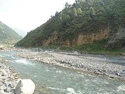
Gomal River (Urdu: دریائے گومل, Pashto: ګومل سیند، ګومل دریاب, Sanskrit: गोमती) is a 400 km long river in Afghanistan and Pakistan, which is mentioned in the Rigveda as Gomatī (full of water). The river lends its name to the Gomal University in Dera Ismail Khan and the like-named Gomal District in Paktika Province of Afghanistan.
Origin and Course of Flow
Gomal River's headwaters are located south-east of Ghazni. The springs which form the headwaters of the Gomal's main branch emerge above the fort at Babakarkol in Katawaz, a district inhabited by Ghilji Pashtuns from the Kharoti and Sulaimankhel clans, in Paktika Province.[1] The Gomal's other branch, the "Second Gomal", joins the main channel about 14 miles below its source.[2] The Gomal flows southeast through eastern Ghilji country for approximately 110 miles before it merges with the Zhob River, its major tributary, near Khajuri Kach.[3][4] It is about 100 miles from the Zhob River to the Indus River.
Within Pakistan, the Gomal river surrounds the South Waziristan agency and forms the boundary between Khyber-Pakhtunkhwa and Balochistan. From South Waziristan, the river enters the Gomal Valley in the district of Tank, Pakistan at a place known as Girdavi, Murtuza which is inhabited by the Miani tribe. It is mainly here that the water of Gomal is used to cultivate the lands in Gomal Valley through Zam System (Rod Kohi). The river passes then through the Damaan plain in Kulachi Tehsil and later on through Dera Ismail Khan Tehsil, It then joins the Indus River 20 miles south of Dera Ismail Khan.[4]
There is also a street in E-7, Islamabad called the "Gomal Road".
See also
- Gomal Zam Dam
- Gomal Pass
- Gomal District
- Gomal University
- Zhob River
- South Waziristan
- Paktika Province
Notes
- ↑ "Natural Geography of Pakistan: 5- Hydrology: 5-1- Rivers: Gomal River" ECO Geoscience Database
- ↑ MacGregor, Charles Metcalfe (1871) Central Asia, pt. 2: A Contribution Toward the Better Knowledge of the Topography, Ethnology, Resources, and History of Afghanistan Office of the Superintendent of Government Printing, Calcutta, OCLC 48604589 reprinted by Barbican Publishing Co., Petersfield, England, in 1995, p. 308
- ↑ MacGregor, pp. 308-9
- 1 2 Gazetteer of Afghanistan VI (Farah), fourth ed., Calcutta, 1908, p. 238
External links
| Wikisource has the text of the 1911 Encyclopædia Britannica article Gomal. |
Coordinates: 31°36′53″N 70°50′46″E / 31.61472°N 70.84611°E