Goose Creek (Snake River)
| Goose Creek | |
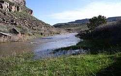 Goose Creek near Oakley, Idaho | |
| Country | United States |
|---|---|
| States | Idaho, Nevada, Utah |
| Counties | Cassia County, Idaho, Elko County, Nevada, Box Elder County, Utah |
| Source | |
| - location | Cassia Division of the Sawtooth National Forest, Cassia County, Idaho |
| - elevation | 7,239 ft (2,206 m) [1] |
| - coordinates | 42°10′29″N 114°17′31″W / 42.17472°N 114.29194°W [2] |
| Mouth | Snake River |
| - location | near Burley, Cassia County, Idaho |
| - elevation | 4,137 ft (1,261 m) [2] |
| - coordinates | 42°32′37″N 113°45′47″W / 42.54361°N 113.76306°WCoordinates: 42°32′37″N 113°45′47″W / 42.54361°N 113.76306°W [2] |
| Length | 123 mi (198 km) [3] |
| Basin | 1,120 sq mi (2,901 km2) [4] |
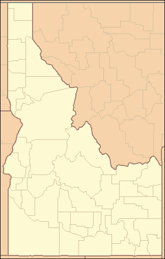 Location of the mouth of Goose Creek in Idaho | |
Goose Creek is a 123-mile (198 km) long[3] tributary of the Snake River. Beginning at an elevation of 7,239 feet (2,206 m)[1] in the Cassia Division of the Sawtooth National Forest in southwestern Cassia County, Idaho, it flows south into Elko County, Nevada and loops back around into Cassia County, briefly crossing Box Elder County, Utah in the process.[5] It is impounded by Oakley Dam several miles south of Oakley, Idaho, forming Lower Goose Creek Reservoir. All of the creek's water is stored for irrigation, so its channel from the reservoir to its mouth near Burley, Idaho is dry and largely obliterated by agriculture.[6] Goose Creek has a 1,120-square-mile (2,901 km2) watershed.[4] The California Trail followed Goose Creek from a point just north of the Idaho/Utah border southwest across northwestern Utah to Little Goose Creek in northeastern Elko County, Nevada.[7]
_about_16.8_miles_east_of_Little_Goose_Creek_in_Elko_County%2C_Nevada.JPG)
See also
- List of rivers of Idaho
- List of longest streams of Idaho
- List of rivers of Nevada
- List of rivers of Utah
References
- 1 2 Source elevation derived from Google Earth search using GNIS source coordinates.
- 1 2 3 "Goose Creek". Geographic Names Information System. United States Geological Survey. June 21, 1979. Retrieved February 7, 2013.
- 1 2 "National Hydrography Dataset". United States Geological Survey. Retrieved February 7, 2013. Note: approximation; course is largely obliterated by agriculture past Lower Goose Creek Reservoir.
- 1 2 "Goose Creek Subbasin Assessment and Total Maximum Daily Loads" (PDF). Idaho Department of Environmental Quality. December 22, 2003. Retrieved February 7, 2013.
- ↑ Idaho Road and Recreation Atlas (Map) (2nd ed.). 1:250,000. Benchmark Maps. 2010. pp. 84–85. ISBN 978-0-929591-06-3. OCLC 567571371.
- ↑ "Goose Creek Water Quality Monitoring Report" (PDF). Idaho Association of Soil Conservation Districts. March 2006. p. 1. Retrieved July 17, 2013.
- ↑ "California Trail". Trails West. Retrieved October 24, 2014.
| Wikimedia Commons has media related to Goose Creek (Snake River). |