Gorah Salathian
| Gurha Slathian Gurha Slathia | |
|---|---|
| village | |
| Nickname(s): Chittorgarh (Hindi: चित्तौड़गढ़) of j&k. | |
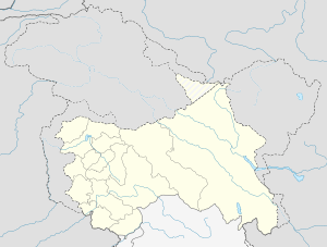 Gurha Slathian  Gurha Slathian Location in Jammu and Kashmir, India | |
| Coordinates: 32°38′03″N 75°01′29″E / 32.634232°N 75.024788°ECoordinates: 32°38′03″N 75°01′29″E / 32.634232°N 75.024788°E | |
| Country |
|
| State | Jammu and Kashmir |
| District | Jammu |
| Population (2001) | |
| • Total | 4,121 |
| Languages | |
| • Official | dogri |
| Time zone | IST (UTC+5:30) |
Gurah Slathia is a village and a notified area as homeland of j&k's rajput in Jammu district in the Indian state of Jammu and Kashmir.
Demographics
As of 2001 India census,[1] Gurah Slathia had a population of 4121. Males constitute 51% of the population and females 49%. Gurah Slathia has an average literacy rate of 82%, higher than the national average of 59.5%: male literacy is 86%, and female literacy is 77%. In Gurah Slathia, 10% of the population is under 6 years of age.
References
- ↑ "Census of India 2001: Data from the 2001 Census, including cities, villages and towns (Provisional)". Census Commission of India. Archived from the original on 2004-06-16. Retrieved 2008-11-01.
This article is issued from Wikipedia - version of the 11/22/2016. The text is available under the Creative Commons Attribution/Share Alike but additional terms may apply for the media files.