Gouberville
For the French diarist, see Gilles de Gouberville.
| Gouberville | |
|---|---|
|
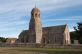
The church of Notre-Dame | |
 Gouberville | |
|
Location within Normandy region  Gouberville | |
| Coordinates: 49°41′14″N 1°18′55″W / 49.6872°N 1.3153°WCoordinates: 49°41′14″N 1°18′55″W / 49.6872°N 1.3153°W | |
| Country | France |
| Region | Normandy |
| Department | Manche |
| Arrondissement | Cherbourg |
| Canton | Val-de-Saire |
| Intercommunality | Communauté de communes de Saint-Pierre-Église |
| Government | |
| • Mayor (2014–2020) | Régis Lericheux |
| Area1 | 2.79 km2 (1.08 sq mi) |
| Population (2006)2 | 130 |
| • Density | 47/km2 (120/sq mi) |
| Time zone | CET (UTC+1) |
| • Summer (DST) | CEST (UTC+2) |
| INSEE/Postal code | 50211 / 50330 |
| Elevation |
0–38 m (0–125 ft) (avg. 16 m or 52 ft) |
|
1 French Land Register data, which excludes lakes, ponds, glaciers > 1 km² (0.386 sq mi or 247 acres) and river estuaries. 2 Population without double counting: residents of multiple communes (e.g., students and military personnel) only counted once. | |
Gouberville is a former commune in the Manche department in north-western France. On 1 January 2016, it was merged into the new commune of Vicq-sur-Mer.[1]
See also
References
- ↑ Arrêté préfectoral 4 December 2015 (French)
| Wikimedia Commons has media related to Gouberville. |
This article is issued from Wikipedia - version of the 3/31/2016. The text is available under the Creative Commons Attribution/Share Alike but additional terms may apply for the media files.