Graafstroom (former municipality)
| Graafstroom | |||
|---|---|---|---|
| Former municipality | |||
| |||
 | |||
| Coordinates: 51°53′N 4°48′E / 51.88°N 4.80°ECoordinates: 51°53′N 4°48′E / 51.88°N 4.80°E | |||
| Country | Netherlands | ||
| Province | South Holland | ||
| Municipality | Molenwaard | ||
| Area(2006) | |||
| • Total | 69.32 km2 (26.76 sq mi) | ||
| • Land | 67.11 km2 (25.91 sq mi) | ||
| • Water | 2.21 km2 (0.85 sq mi) | ||
| Population (1 January 2007) | |||
| • Total | 9,757 | ||
| • Density | 145/km2 (380/sq mi) | ||
| Source: CBS, Statline. | |||
| Time zone | CET (UTC+1) | ||
| • Summer (DST) | CEST (UTC+2) | ||
| Website | www.graafstroom.nl | ||


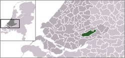
Graafstroom (![]() pronunciation ) is a former municipality in the western Netherlands, in the province of South Holland, and the region of Alblasserwaard. The former municipality had a population of 9,697 in 2004, and covered an area of 69.32 km² (26.76 mile²) of which 2.21 km² (0.85 mile²) was water. Since 2013 Graafstroom has been a part of the new municipality of Molenwaard.
pronunciation ) is a former municipality in the western Netherlands, in the province of South Holland, and the region of Alblasserwaard. The former municipality had a population of 9,697 in 2004, and covered an area of 69.32 km² (26.76 mile²) of which 2.21 km² (0.85 mile²) was water. Since 2013 Graafstroom has been a part of the new municipality of Molenwaard.
The former municipality of Graafstroom consisted of the following population centres: Bleskensgraaf en Hofwegen, Brandwijk, Goudriaan, Molenaarsgraaf, Ottoland, Oud-Alblas, and Wijngaarden.
External links
- Official website
- Basic data
- Statistics in Dutch (pdf) - with (towards the end) a map showing the neighborhoods and (a few pages further) the population figures etc. as well as the grouping into quarters
- Arriva Region West: - select bus line 151
This article is issued from Wikipedia - version of the 3/10/2013. The text is available under the Creative Commons Attribution/Share Alike but additional terms may apply for the media files.