Grade II* listed buildings in Norwich

There are over 20,000 Grade II* listed buildings in England. This page is a list of these buildings in the city of Norwich in the county Norfolk.

Buildings

Name Location Type Completed [note 1]Date designated Grid ref.[note 2]
Geo-coordinates
Entry number [note 3]Image
Augustine Steward's House Norwich House 17th century 26 February 1954 TG2332108860
52°37′53″N 1°17′55″E / 52.631518°N 1.298591°E / 52.631518; 1.298591 (Augustine Steward's House)
1372527
Henry Bacon's House, Colegate Norwich Apartment 1986 26 February 1954 TG2303309030
52°37′59″N 1°17′40″E / 52.633162°N 1.294458°E / 52.633162; 1.294458 (Henry Bacon's House, Colegate)
1051320
Bethel Hospital Norwich Psychiatric Hospital 1986 8 April 1986 TG2272108455
52°37′41″N 1°17′22″E / 52.62813°N 1.289468°E / 52.62813; 1.289468 (Bethel Hospital)
1051362
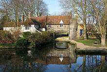
Bishop Bridge Norwich Bridge c.1340 26 February 1954 TG2399308991
52°37′57″N 1°18′31″E / 52.632417°N 1.308592°E / 52.632417; 1.308592 (Bishop Bridge)
1205642
Bishop Renold's Chapel
(Bishop Reynolds Chapel)
Norwich Library 1954 26 February 1954 TG2349208987
52°37′57″N 1°18′04″E / 52.632588°N 1.301199°E / 52.632588; 1.301199 (Bishop Renold's Chapel
(Bishop Reynolds Chapel)
)
1206255
Bishop Salmon's Porch Norwich Great Hall Early 14th century 26 February 1954 TG2350109018
52°37′58″N 1°18′05″E / 52.632862°N 1.301353°E / 52.632862; 1.301353 (Bishop Salmon's Porch)
1051329
Church of St Andrew Eaton, Norfolk Church 15th century 26 February 1954 TG2025405966
52°36′24″N 1°15′05″E / 52.606796°N 1.251423°E / 52.606796; 1.251423 (Church of St Andrew)
1206191
Church of St Catherine Mile Cross, Norwich Church 1933-1935 21 August 2006 TG2195110923
52°39′02″N 1°16′47″E / 52.650595°N 1.279769°E / 52.650595; 1.279769 (Church of St Catherine)
1391746
Church of St John and All Saints Lakenham, Norwich Church 15th century 26 February 1954 TG2335406088
52°36′24″N 1°17′50″E / 52.606626°N 1.297206°E / 52.606626; 1.297206 (Church of St John and All Saints)
1372796
City Hall including Police Station Norwich Town Hall 1932-38 29 January 1971 TG2284408475
52°37′42″N 1°17′29″E / 52.628259°N 1.291296°E / 52.628259; 1.291296 (City Hall including Police Station)
1210484
Cotman House Norwich Apartment 1954 26 February 1954 TG2341809076
52°38′00″N 1°18′01″E / 52.633417°N 1.300168°E / 52.633417; 1.300168 (Cotman House)
1051854
Cringleford Bridge Norwich Road Bridge 1520 19 October 1951 TG1998305952
52°36′24″N 1°14′51″E / 52.60678°N 1.247418°E / 52.60678; 1.247418 (Cringleford Bridge)
1050565
Dolphin Inn Norwich Bishops Palace/Health Centre 1587(?) 26 February 1954 TG2195009766
52°38′25″N 1°16′44″E / 52.640211°N 1.278977°E / 52.640211; 1.278977 (Dolphin Inn)
1372818
Earlham Hall and attached Outbuildings Earlham, Norwich House Late 16th century 26 February 1954 49°46′01″N 7°33′26″W / 49.766806°N 7.55716°W / 49.766806; -7.55716 (Earlham Hall and attached Outbuildings) 1051296
Friends Meeting House Norwich Chapel 1826 26 February 1954 TG2280208656
52°37′48″N 1°17′27″E / 52.6299°N 1.290798°E / 52.6299; 1.290798 (Friends Meeting House)
1051780
General Post Office Museum Norwich Timber Framed House 15th century 21 September 1970 TG2306208713
52°37′49″N 1°17′41″E / 52.630305°N 1.294672°E / 52.630305; 1.294672 (General Post Office Museum)
1051892
Haydn House Norwich House 18th century 26 February 1954 TG2367008868
52°37′53″N 1°18′13″E / 52.631446°N 1.303744°E / 52.631446; 1.303744 (Haydn House)
1280233
Holkham House Norwich Apartment 1954 26 February 1954 TG2253108686
52°37′49″N 1°17′13″E / 52.630281°N 1.286821°E / 52.630281; 1.286821 (Holkham House)
1206535
Howard's House Norwich House 17th century 26 February 1954 TG2346808307
52°37′35″N 1°18′01″E / 52.626495°N 1.300386°E / 52.626495; 1.300386 (Howard's House)
1372824
Inverleith Norwich Courtyard House 1908-9 11 February 2004 TG2199407045
52°36′57″N 1°16′40″E / 52.615772°N 1.277799°E / 52.615772; 1.277799 (Inverleith)
1391059
Lazar House Norwich Library 1954 26 February 1954 TG2356510413
52°38′43″N 1°18′12″E / 52.645356°N 1.303241°E / 52.645356; 1.303241 (Lazar House)
1051828
Manor House Norwich House 1578 26 February 1954 TG2375207444
52°37′07″N 1°18′14″E / 52.618632°N 1.30399°E / 52.618632; 1.30399 (Manor House)
1051379
Norfolk Terrace and attached Walkways at the University of East Anglia University of East Anglia, Norwich Hall of Residence 1964-1968 16 October 2003 TG1923407406
52°37′12″N 1°14′14″E / 52.620133°N 1.237339°E / 52.620133; 1.237339 (Norfolk Terrace and attached Walkways at the University of East Anglia)
1390647
Nos. 39 & 41, St Andrew's Street (the Festival House) Norwich Public House 19th century 5 June 1972 TG2311308756
52°37′50″N 1°17′44″E / 52.63067°N 1.295453°E / 52.63067; 1.295453 (Nos. 39 & 41, St Andrew's Street (the Festival House))
1372492
Nos. 31-35, Magdalen Street and Gurney Court Norwich House 1986 26 February 1954 TG2317809190
52°38′04″N 1°17′48″E / 52.634539°N 1.296705°E / 52.634539; 1.296705 (Nos. 31-35, Magdalen Street and Gurney Court)
1051188
Octagon Chapel Norwich Presbyterian Chapel 1756 26 February 1954 TG2308009071
52°38′01″N 1°17′43″E / 52.633511°N 1.295179°E / 52.633511; 1.295179 (Octagon Chapel)
1280186
Old Post Office Yard behind No. 19 Bedford Street to right of Carriage Arch Norwich House 15th century 15 October 1970 TG2307308670
52°37′48″N 1°17′41″E / 52.629915°N 1.294805°E / 52.629915; 1.294805 (Old Post Office Yard behind No. 19 Bedford Street to right of Carriage Arch)
1205180
Precinct Wall Norwich Cathedral Close 13th century 5 June 1972 TG2343109027
52°37′59″N 1°18′01″E / 52.632972°N 1.300327°E / 52.632972; 1.300327 (Precinct Wall)
1051331
Printing Museum, Jarrold's Printing Works Norwich Warehouse C20 8 April 1986 TG2341309260
52°38′06″N 1°18′01″E / 52.63507°N 1.300219°E / 52.63507; 1.300219 (Printing Museum, Jarrold's Printing Works)
1211208
Pykerell's House Norwich Hall House 15th century 26 February 1954 TG2280509090
52°38′02″N 1°17′28″E / 52.633794°N 1.291135°E / 52.633794; 1.291135 (Pykerell's House)
1290996
Red Lion Public House Eaton, Norwich Inn Late 17th century 26 February 1954 TG2018906119
52°36′30″N 1°15′02″E / 52.608195°N 1.250567°E / 52.608195; 1.250567 (Red Lion Public House)
1372802
Remains of Monastic Infirmary Norwich Monastery 1175-1200 5 June 1972 TG2351008812
52°37′52″N 1°18′05″E / 52.63101°N 1.301347°E / 52.63101; 1.301347 (Remains of Monastic Infirmary)
1051313
Royal Arcade Norwich Shop C20 5 June 1972 TG2302708474
52°37′41″N 1°17′38″E / 52.628175°N 1.293994°E / 52.628175; 1.293994 (Royal Arcade)
1205148
Sainsbury Centre, Attached Walkway, Underground Loading Bay, and Retaining Walls to Loading Bay Access Road at the University of Norwich Art Gallery 1977 19 December 2012 TG1906307438
52°37′14″N 1°14′05″E / 52.620489°N 1.234839°E / 52.620489; 1.234839 (Sainsbury Centre, Attached Walkway, Underground Loading Bay, and Retaining Walls to Loading Bay Access Road at the University of)
1409810
St Catherine's Close Norwich House 1780 26 February 1954 TG2307907956
52°37′25″N 1°17′40″E / 52.623504°N 1.294412°E / 52.623504; 1.294412 (St Catherine's Close)
1051385
St Helen's House Norwich House 18th century 5 June 1972 TG2366309052
52°37′59″N 1°18′14″E / 52.633101°N 1.303766°E / 52.633101; 1.303766 (St Helen's House)
1051366
Suffolk Terrace and adjoining Walkway and Stairs to Rear at the University of East Anglia University of East Anglia, Norwich Hall of Residence 1964-1968 16 October 2003 TG1943007413
52°37′12″N 1°14′25″E / 52.620116°N 1.240234°E / 52.620116; 1.240234 (Suffolk Terrace and adjoining Walkway and Stairs to Rear at the University of East Anglia)
1390646
Telephone House Norwich Office 1906 5 June 1972 TG2270308593
52°37′46″N 1°17′21″E / 52.629375°N 1.289295°E / 52.629375; 1.289295 (Telephone House)
1372484
The Briton's Arms Norwich Restaurant 1954 26 February 1954 TG2319308827
52°37′53″N 1°17′48″E / 52.631274°N 1.296681°E / 52.631274; 1.296681 (The Briton's Arms)
1372804
The Louis Marchesi Public House Norwich Public House/cafe 1986 26 February 1976 TG2331008887
52°37′54″N 1°17′54″E / 52.631765°N 1.298447°E / 52.631765; 1.298447 (The Louis Marchesi Public House)
1210774
Tower and Adjoining Retaining Wall to Rear of No. 58, Bracondale Norwich Tower House Pre 17th century 26 February 1954 TG2378407395
52°37′05″N 1°18′16″E / 52.61818°N 1.304429°E / 52.61818; 1.304429 (Tower and Adjoining Retaining Wall to Rear of No. 58, Bracondale)
1280541
Undercroft beneath No. 3, Queen Street Norwich Undercroft Medieval 5 June 1972 TG2327408694
52°37′48″N 1°17′52″E / 52.630048°N 1.297786°E / 52.630048; 1.297786 (Undercroft beneath No. 3, Queen Street)
1291066
War Memorial and War Memorial Garden Terrace Norwich War memorial 1927 30 September 1983 TG2291008511
52°37′42″N 1°17′33″E / 52.628269°N 1.292567°E / 52.628269; 1.292567 (War Memorial and War Memorial Garden Terrace)
1051857
Pulls Ferry Norwich Water Gate 15th century 26 February 1954 TG2389708758
52°37′49″N 1°18′25″E / 52.630366°N 1.307018°E / 52.630366; 1.307018 (Pulls Ferry)
1206380
11–15 Fye Bridge Street Norwich House 19th century 26 February 1954 TG2320509057
52°38′00″N 1°17′49″E / 52.633334°N 1.297013°E / 52.633334; 1.297013 (11–15 Fye Bridge Street)
1025094
No 1, The Close Norwich Office 1954 26 February 1954 TG2339908751
52°37′50″N 1°17′59″E / 52.630508°N 1.299668°E / 52.630508; 1.299668 (No 1, The Close)
1051333
No 2, The Close Norwich House 1702 26 February 1954 TG2340708736
52°37′49″N 1°17′59″E / 52.63037°N 1.299776°E / 52.63037; 1.299776 (No 2, The Close)
1206337
Nos 3 & 4, The Close Norwich Barn 17th century 26 February 1954 TG2343608716
52°37′49″N 1°18′01″E / 52.630178°N 1.30019°E / 52.630178; 1.30019 (Nos 3 & 4, The Close)
1051334
No 5, The Close Norwich Barn 17th century 26 February 1954 TG2344808721
52°37′49″N 1°18′01″E / 52.630218°N 1.300371°E / 52.630218; 1.300371 (No 5, The Close)
1206349
No 6, The Close Norwich House 16th century 26 February 1954 TG2347308734
52°37′49″N 1°18′03″E / 52.630325°N 1.300748°E / 52.630325; 1.300748 (No 6, The Close)
1051335
No 7, The Close Norwich House Late 18th century 26 February 1954 TG2354108768
52°37′50″N 1°18′06″E / 52.630602°N 1.301774°E / 52.630602; 1.301774 (No 7, The Close)
1051336
Nos 8 & 9, The Close Norwich House Late 18th century 26 February 1954 TG2356208771
52°37′50″N 1°18′08″E / 52.63062°N 1.302086°E / 52.63062; 1.302086 (Nos 8 & 9, The Close)
1372760
Nos 10–12, The Close Norwich House 16th century 26 February 1954 TG2358608772
52°37′50″N 1°18′09″E / 52.630619°N 1.302441°E / 52.630619; 1.302441 (Nos 10–12, The Close)
1280248
No 14a, The Close Norwich House 17th century 5 June 1972 TG2362508742
52°37′49″N 1°18′11″E / 52.630334°N 1.302995°E / 52.630334; 1.302995 (No 14a, The Close)
1051337
No 16, The Close Norwich House Pre 1850 26 February 1954 TG2367008752
52°37′49″N 1°18′13″E / 52.630405°N 1.303666°E / 52.630405; 1.303666 (No 16, The Close)
1206365
No 17, The Close Norwich House 1972 5 June 1972 TG2365808770
52°37′50″N 1°18′13″E / 52.630572°N 1.303501°E / 52.630572; 1.303501 (No 17, The Close)
1372761
No 18, The Close Norwich House Late 18th century 5 June 1972 TG2367008770
52°37′50″N 1°18′13″E / 52.630567°N 1.303678°E / 52.630567; 1.303678 (No 18, The Close)
1206370
No 25, The Close Norwich House 1647 26 February 1954 TG2389308748
52°37′49″N 1°18′25″E / 52.630277°N 1.306952°E / 52.630277; 1.306952 (No 25, The Close)
1372762
No 26, The Close Norwich House Early 19th century 26 February 1954 TG2372508781
52°37′50″N 1°18′16″E / 52.630643°N 1.304497°E / 52.630643; 1.304497 (No 26, The Close)
1372763
No 27, The Close Norwich House 1954 26 February 1954 TG2371408790
52°37′51″N 1°18′16″E / 52.630728°N 1.304341°E / 52.630728; 1.304341 (No 27, The Close)
1206385
No 28, The Close Norwich House 1954 26 February 1954 TG2370708790
52°37′51″N 1°18′15″E / 52.630731°N 1.304237°E / 52.630731; 1.304237 (No 28, The Close)
1051341
No 29, The Close Norwich House C16/C17 5 June 1972 TG2368408785
52°37′51″N 1°18′14″E / 52.630696°N 1.303895°E / 52.630696; 1.303895 (No 29, The Close)
1206389
No 30, The Close Norwich House 1954 26 February 1954 TG2366908793
52°37′51″N 1°18′13″E / 52.630774°N 1.303679°E / 52.630774; 1.303679 (No 30, The Close)
1051301
No 31 The Close Norwich House 1954 26 February 1954 TG2365308804
52°37′51″N 1°18′12″E / 52.630879°N 1.30345°E / 52.630879; 1.30345 (No 31 The Close)
1372782
Nos 32 & 33, The Close Norwich House 1682 26 February 1954 TG2364008802
52°37′51″N 1°18′12″E / 52.630866°N 1.303257°E / 52.630866; 1.303257 (Nos 32 & 33, The Close)
1051302
No 34, The Close Norwich Brewhouse 18th century 26 February 1954 TG2364008824
52°37′52″N 1°18′12″E / 52.631064°N 1.303272°E / 52.631064; 1.303272 (No 34, The Close)
1372783
Nos 35a, 35b and 35c, The Close Norwich Apartment By 1972 5 June 1972 TG2367408854
52°37′53″N 1°18′14″E / 52.631319°N 1.303794°E / 52.631319; 1.303794 (Nos 35a, 35b and 35c, The Close)
1051303
No 36, The Close Norwich House 17th century 5 June 1972 TG2368008860
52°37′53″N 1°18′14″E / 52.63137°N 1.303887°E / 52.63137; 1.303887 (No 36, The Close)
1051304
Nos 37 and 38, The Close Norwich House 1633 5 June 1972 TG2369208863
52°37′53″N 1°18′15″E / 52.631392°N 1.304066°E / 52.631392; 1.304066 (Nos 37 and 38, The Close)
1372784
No 39, The Close Norwich House 17th century 5 June 1972 TG2369908864
52°37′53″N 1°18′15″E / 52.631398°N 1.30417°E / 52.631398; 1.30417 (No 39, The Close)
1051305
No 40, The Close Norwich House 17th century 26 February 1954 TG2370508877
52°37′53″N 1°18′15″E / 52.631513°N 1.304267°E / 52.631513; 1.304267 (No 40, The Close)
1372785
No 41, The Close Norwich House Early 18th century 5 June 1972 49°46′01″N 7°33′26″W / 49.766806°N 7.55716°W / 49.766806; -7.55716 (No 41, The Close) 1051306
Nos 43 & 44, The Close Norwich House Late 17th century 26 February 1954 TG2366708981
52°37′57″N 1°18′14″E / 52.632462°N 1.303777°E / 52.632462; 1.303777 (Nos 43 & 44, The Close)
1051307
No 45, The Close Norwich Bakery Early 19th century 5 June 1972 TG2368008889
52°37′54″N 1°18′14″E / 52.631631°N 1.303906°E / 52.631631; 1.303906 (No 45, The Close)
1206406
No 46, The Close Norwich House Early 19th century 26 February 1954 TG2367908872
52°37′53″N 1°18′14″E / 52.631478°N 1.30388°E / 52.631478; 1.30388 (No 46, The Close)
1372786
No 49, The Close Norwich House C14/C15 26 February 1954 TG2366108863
52°37′53″N 1°18′13″E / 52.631405°N 1.303608°E / 52.631405; 1.303608 (No 49, The Close)
1051308
No 50, The Close Norwich House 17th century 26 February 1954 TG2364808856
52°37′53″N 1°18′12″E / 52.631348°N 1.303412°E / 52.631348; 1.303412 (No 50, The Close)
1206417
Nos 51–55, The Close Norwich House 15th century 26 February 1954 TG2360508847
52°37′53″N 1°18′10″E / 52.631285°N 1.302771°E / 52.631285; 1.302771 (Nos 51–55, The Close)
1051309
No 56, The Close Norwich House 16th century 26 February 1954 TG2357708846
52°37′53″N 1°18′08″E / 52.631287°N 1.302358°E / 52.631287; 1.302358 (No 56, The Close)
1051310
No 65, The Close Norwich House 16th century 5 June 1972 TG2348508794
52°37′51″N 1°18′03″E / 52.630858°N 1.300966°E / 52.630858; 1.300966 (No 65, The Close)
1372787
Nos 67a, 67b, 67c and 68, The Close Norwich Clergy House 15th century 26 February 1954 TG2344608801
52°37′51″N 1°18′01″E / 52.630937°N 1.300395°E / 52.630937; 1.300395 (Nos 67a, 67b, 67c and 68, The Close)
1206435
No 71, The Close Norwich House Early 17th century 5 June 1972 TG2336608858
52°37′53″N 1°17′57″E / 52.631482°N 1.299254°E / 52.631482; 1.299254 (No 71, The Close)
1280207
No 73, The Close Norwich Office Early 19th century 5 June 1972 TG2338708806
52°37′52″N 1°17′58″E / 52.631006°N 1.299528°E / 52.631006; 1.299528 (No 73, The Close)
1280208
71, Botolph Street Norwich Shop C20 8 April 1986 TG2293909461
52°38′13″N 1°17′36″E / 52.637069°N 1.293362°E / 52.637069; 1.293362 (71, Botolph Street)
1051372
13–17 St Giles Street Norwich Shop 19th century 5 June 1972 TG2283408578
52°37′45″N 1°17′28″E / 52.629187°N 1.291218°E / 52.629187; 1.291218 (13–17 St Giles Street)
1372482
35, St Giles Street Norwich House Late C16/Early 17th century 26 February 1954 TG2273908588
52°37′46″N 1°17′23″E / 52.629316°N 1.289823°E / 52.629316; 1.289823 (35, St Giles Street)
1290649
46, St Giles Street Norwich House 19th century 5 June 1972 TG2267808576
52°37′45″N 1°17′20″E / 52.629233°N 1.288915°E / 52.629233; 1.288915 (46, St Giles Street)
1051841
48, St Giles Street Norwich House 19th century 26 February 1954 TG2266408576
52°37′45″N 1°17′19″E / 52.629239°N 1.288709°E / 52.629239; 1.288709 (48, St Giles Street)
1051842
56–60, King Street Norwich Public House/Shops (Da Vinci hairdressers) 19th century 26 February 1954 49°46′01″N 7°33′26″W / 49.766806°N 7.55716°W / 49.766806; -7.55716 (56–60, King Street) 1051240
91, King Street Norwich House Late 15th century 5 June 1972 TG2345008336
52°37′36″N 1°18′01″E / 52.626762°N 1.30014°E / 52.626762; 1.30014 (91, King Street)
1051235
125, 125a and 127, King Street Norwich Shop C20 26 February 1954 TG2357308161
52°37′31″N 1°18′07″E / 52.625141°N 1.301836°E / 52.625141; 1.301836 (125, 125a and 127, King Street)
1217899
168, King Street Norwich House C20 26 February 1954 TG2360908034
52°37′26″N 1°18′08″E / 52.623986°N 1.302281°E / 52.623986; 1.302281 (168, King Street)
1051205
170 & 172, King Street Norwich House 17th century 26 February 1954 TG2361808020
52°37′26″N 1°18′09″E / 52.623857°N 1.302404°E / 52.623857; 1.302404 (170 & 172, King Street)
1051206
9, Surrey Street Norwich House 1764 26 February 1954 TG2299808129
52°37′30″N 1°17′36″E / 52.62509°N 1.293334°E / 52.62509; 1.293334 (9, Surrey Street)
1051830
11 & 13, Elm Hill Norwich House Early 18th century 8 April 1986 TG2320608829
52°37′53″N 1°17′49″E / 52.631287°N 1.296874°E / 52.631287; 1.296874 (11 & 13, Elm Hill)
1298580
28 & 30, Elm Hill Norwich Shop C20 26 February 1954 TG2321508890
52°37′55″N 1°17′49″E / 52.631831°N 1.297048°E / 52.631831; 1.297048 (28 & 30, Elm Hill)
1206720
34 & 36, Elm Hill Norwich House (Flint and yellow rendering) 1954 26 February 1954 TG2323108924
52°37′56″N 1°17′50″E / 52.632129°N 1.297307°E / 52.632129; 1.297307 (34 & 36, Elm Hill)
1051270
41 & 43, Elm Hill Norwich Courtyard House Early 19th century 26 February 1954 TG2322908891
52°37′55″N 1°17′50″E / 52.631834°N 1.297255°E / 52.631834; 1.297255 (41 & 43, Elm Hill)
1372805
18, Colegate Norwich House Early 18th century 26 February 1954 TG2311909031
52°37′59″N 1°17′45″E / 52.633136°N 1.295727°E / 52.633136; 1.295727 (18, Colegate)
1372773
20, Colegate Norwich House Early 17th century 26 February 1954 TG2310109022
52°37′59″N 1°17′44″E / 52.633062°N 1.295455°E / 52.633062; 1.295455 (20, Colegate)
1051283
65 Pottergate Norwich Apartment 1972 5 June 1972 TG2269008706
52°37′49″N 1°17′21″E / 52.630395°N 1.28918°E / 52.630395; 1.28918 (65 Pottergate)
1051938
38 & 40 Bethel Street Norwich House 18th century 5 June 1972 TG2272508480
52°37′42″N 1°17′22″E / 52.628352°N 1.289544°E / 52.628352; 1.289544 (38 & 40 Bethel Street)
1051399
42–48, Bethel Street Norwich Wall C20 8 April 1986 TG2270708489
52°37′42″N 1°17′21″E / 52.62844°N 1.289284°E / 52.62844; 1.289284 (42–48, Bethel Street)
1372714
2, Redwell Street Norwich Shop 19th century 8 April 1986 TG2321208702
52°37′49″N 1°17′49″E / 52.630145°N 1.296877°E / 52.630145; 1.296877 (2, Redwell Street)
1051881
7, Princes Street Norwich Office 1954 26 February 1954 TG2317908766
52°37′51″N 1°17′47″E / 52.630733°N 1.296433°E / 52.630733; 1.296433 (7, Princes Street)
1220186
9, Princes Street Norwich Office 1954 26 February 1954 TG2318608768
52°37′51″N 1°17′48″E / 52.630748°N 1.296538°E / 52.630748; 1.296538 (9, Princes Street)
1051913
20, Princes Street Norwich Restaurant C20 26 February 1954 TG2327508829
52°37′53″N 1°17′52″E / 52.631259°N 1.297892°E / 52.631259; 1.297892 (20, Princes Street)
1051911
5, Bedford Street Norwich Shop 1972 5 June 1972 TG2302608655
52°37′47″N 1°17′39″E / 52.629799°N 1.294101°E / 52.629799; 1.294101 (5, Bedford Street)
1205170
15, Bedford Street Norwich Shop 16th century 5 June 1972 TG2305608654
52°37′47″N 1°17′40″E / 52.629778°N 1.294543°E / 52.629778; 1.294543 (15, Bedford Street)
1051390
52 & 54, Bishopgate Norwich House 17th century 5 June 1972 TG2387708984
52°37′57″N 1°18′25″E / 52.632402°N 1.306876°E / 52.632402; 1.306876 (52 & 54, Bishopgate)
1205621
4, Tombland Norwich House 18th century 26 February 1954 TG2331308784
52°37′51″N 1°17′54″E / 52.630839°N 1.298422°E / 52.630839; 1.298422 (4, Tombland)
1290353
5 & 5a, Tombland Norwich House Mid 18th century 26 February 1954 TG2330908795
52°37′51″N 1°17′54″E / 52.63094°N 1.29837°E / 52.63094; 1.29837 (5 & 5a, Tombland)
1051808
8, Tombland Norwich House/Tombland Bookshop Pre 18th century 5 June 1972 TG2333208825
52°37′52″N 1°17′55″E / 52.631199°N 1.29873°E / 52.631199; 1.29873 (8, Tombland)
1210760
1 and 3 Timberhill Norwich House 17th century 28 March 1972 TG2310308329
52°37′37″N 1°17′42″E / 52.626842°N 1.295017°E / 52.626842; 1.295017 (1 and 3 Timberhill)
1372475
2 Charing Cross Norwich Shop C20 5 June 1972 TG2293008744
52°37′50″N 1°17′34″E / 52.630638°N 1.292746°E / 52.630638; 1.292746 (2 Charing Cross)
1372734
22 and 24 Lower Goat Lane Norwich Wall C20 5 June 1972 TG2285508654
52°37′47″N 1°17′30″E / 52.629861°N 1.291579°E / 52.629861; 1.291579 (22 and 24 Lower Goat Lane)
1218739
7 St Faith's Lane Norwich House 17th century 5 June 1972 TG2369108621
52°37′45″N 1°18′14″E / 52.629221°N 1.303887°E / 52.629221; 1.303887 (7 St Faith's Lane)
1220856
3 and 4 Haymarket Norwich House 18th century 26 February 1954 TG2299308414
52°37′40″N 1°17′36″E / 52.62765°N 1.293452°E / 52.62765; 1.293452 (3 and 4 Haymarket)
1209850
6, 9 and 10 Ninham's Court Norwich House 16th century 5 June 1972 TG2259108522
52°37′44″N 1°17′15″E / 52.628784°N 1.287596°E / 52.628784; 1.287596 (6, 9 and 10 Ninham's Court)
1051924
2–9 Octagon Court Norwich Flats 1986 26 February 1954 TG2305509047
52°38′00″N 1°17′41″E / 52.633306°N 1.294794°E / 52.633306; 1.294794 (2–9 Octagon Court)
1051929
19–21, Bedford Street Norwich Shop C20 15 October 1970 TG2307708661
52°37′47″N 1°17′41″E / 52.629832°N 1.294858°E / 52.629832; 1.294858 (19–21, Bedford Street)
1372711
27–30, Gentleman's Walk Norwich House 17th century 26 May 1954 TG2299608452
52°37′41″N 1°17′37″E / 52.62799°N 1.293522°E / 52.62799; 1.293522 (27–30, Gentleman's Walk)
1051245
24, Gentleman's Walk Norwich House Mid 19th century 5 June 1972 TG2299308479
52°37′42″N 1°17′37″E / 52.628233°N 1.293496°E / 52.628233; 1.293496 (24, Gentleman's Walk)
1051244

Notes

  1. The date given is the date used by Historic England as significant for the initial building or that of an important part in the structure's description.
  2. Sometimes known as OSGB36, the grid reference is based on the British national grid reference system used by the Ordnance Survey.
  3. The "List Entry Number" is a unique number assigned to each listed building and scheduled monument by Historic England.

Media related to Grade II* listed buildings in Norfolk, England at Wikimedia Commons

This article is issued from Wikipedia - version of the 11/27/2016. The text is available under the Creative Commons Attribution/Share Alike but additional terms may apply for the media files.