Graignes-Mesnil-Angot
| Graignes-Mesnil-Angot | |
|---|---|
|
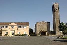
The church of Saint-Michel and the town hall | |
 Graignes-Mesnil-Angot | |
|
Location within Normandy region  Graignes-Mesnil-Angot | |
| Coordinates: 49°14′21″N 1°12′01″W / 49.2392°N 1.2003°WCoordinates: 49°14′21″N 1°12′01″W / 49.2392°N 1.2003°W | |
| Country | France |
| Region | Normandy |
| Department | Manche |
| Arrondissement | Saint-Lô |
| Canton | Saint-Jean-de-Daye |
| Intercommunality | Communauté de communes de la région de Daye |
| Government | |
| • Mayor (2008–2014) | Denis Small |
| Area1 | 18.35 km2 (7.08 sq mi) |
| Population (2006)2 | 783 |
| • Density | 43/km2 (110/sq mi) |
| Time zone | CET (UTC+1) |
| • Summer (DST) | CEST (UTC+2) |
| INSEE/Postal code | 50216 / 50620 |
| Elevation | 0–37 m (0–121 ft) |
|
1 French Land Register data, which excludes lakes, ponds, glaciers > 1 km² (0.386 sq mi or 247 acres) and river estuaries. 2 Population without double counting: residents of multiple communes (e.g., students and military personnel) only counted once. | |
Graignes-Mesnil-Angot is a commune in the Manche department in north-western France.
It was formed on 28 February 2007 by the merger of Graignes and Le Mesnil-Angot.[1]
See also
References
- ↑ http://www.legifrance.gouv.fr/WAspad/UnTexteDeJorf?numjo=INTB0700167A Official Journal no. 56 (dated 7 March 2007), p. 4378, text no. 26
| Wikimedia Commons has media related to Graignes-Mesnil-Angot. |
This article is issued from Wikipedia - version of the 3/5/2015. The text is available under the Creative Commons Attribution/Share Alike but additional terms may apply for the media files.