Gravina Island Highway
| Gravina Island Highway | |
|---|---|
| Highway to Nowhere | |
| Route information | |
| Maintained by AkDOT&PF | |
| Length: | 3.2 mi[1] (5.1 km) |
| Existed: | September 2008[2] – present |
| Major junctions | |
| South end: | Dead end point where original Gravina Island Bridge would have connected |
| North end: | Access road to Ketchikan International Airport near Ketchikan |
| Location | |
| Boroughs: | Ketchikan Gateway |
| Highway system | |
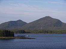
The Gravina Island Highway is a 3.2-mile-long (5.1 km) gravel highway located on Gravina Island, in the Ketchikan Gateway Borough of the U.S. state of Alaska. The highway was part of a project that would connect Gravina Island, specifically, the Ketchikan International Airport, to the city of Ketchikan. The Gravina Island Bridge, which would have connected the highway to Ketchikan was cancelled, but the highway was built. Because the highway does not pass or connect anything of importance, it has been nicknamed the Highway to Nowhere.
Route description
The Gravina Island Highway begins at a cul-de-sac on the coast of Gravina island, at the point where the originally proposed bridge would have spanned.[3] The highway then proceeds westward, as a two-lane, unpaved gravel road. After a short length, the road turns northward, passing a few small lakes, and a large forest. The roadway continues northwest, passing several small creeks, a small pond, and an unpaved private driveway. The highway then crosses over the Government Creek via the Government Creek Bridge, a 143-foot-long (44 m), two-lane, concrete-constructed bridge over the creek.[4][5] The highway continues northwest, traveling near the coast for several miles, continuing through forests, before crossing Gravina Creek via the Gravina Creek Bridge, a 63-foot-long (19 m), two-lane, concrete-constructed bridge traveling over the creek.[4][5] The road travels northwest for about another 0.1 miles (0.16 km), before intersecting a two-lane, gravel access road to the international airport. The Gravina Island Highway officially ends here, as does state maintenance, but a gravel road continues northwest.[6]
History
In the early 1980s, the state of Alaska began a study to create an improved connection between Gravina Island and Revillagigedo Island.[7] The study was conducted to find an easy and effective way for transport between the two islands, in order to allow the city of Ketchikan to expand to the developmental land on Gravina Island.[8] In 2006, Sarah Palin stated that she supported the idea to create a bridge to Gravina Island, and a highway to connect the bridge to the Airport.[1]
Major junctions
The entire route is in Ketchikan Gateway Borough.
| Location | mi[1] | km | Destinations | Notes | |
|---|---|---|---|---|---|
| | 0.0 | 0.0 | Cul-de-sac dead end | Southern terminus | |
| | 3.2 | 5.1 | Ketchikan International Airport Access Road | North end of Gravina Island Highway naming | |
| 1.000 mi = 1.609 km; 1.000 km = 0.621 mi | |||||
See also
- Gravina Island Bridge the proposed $398 million "bridge to nowhere".
References
- 1 2 3 Hayasaki, Erika (September 19, 2008). "Palin said yes to a road to nowhere". Los Angeles Times. Retrieved May 30, 2012.
- ↑ "Palin Admin. Oversaw $26 Million Road to 'Nowhere'". The Daily Beast. September 16, 2008. Retrieved April 20, 2012.
- ↑ Lende, Heather. "Alaska's Road to Nowhere". The New York Times. Retrieved April 20, 2012.
- 1 2 Bridge Design Section (2009). "2009 Bridge Inventory Report" (PDF). Alaska Department of Transportation & Public Facilities. p. 164. Retrieved April 20, 2012.
- 1 2 "Bridge Statistics for Ketchikan, Alaska (AK) - Condition, Traffic, Stress, Structural Evaluation, Project Costs". City-Data.com. Retrieved April 20, 2012.
- ↑ Google (May 30, 2012). "Map of Gravina Island Highway" (Map). Google Maps. Google. Retrieved May 30, 2012.
- ↑ Forgey, Pat (January 19, 2010). "Audit criticizes Gravina spending". Juneau Empire. Retrieved May 30, 2012.
- ↑ Williams, Jr., Lew M. (February 6, 2002). "My Turn: Gravina Island, the only way to go". Retrieved May 30, 2012.
External links
- Gravina Access Project at the AkDOT&PF
- Gravina Island Road at Alaska Bridges and Roads to Nowhere