Grayvoronsky District
| Grayvoronsky District Грайворонский район (Russian) | |
|---|---|
.svg.png) Location of Grayvoronsky District in Belgorod Oblast | |
| Coordinates: 50°29′N 35°40′E / 50.483°N 35.667°ECoordinates: 50°29′N 35°40′E / 50.483°N 35.667°E | |
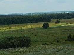 Agricultural land in Grayvoronsky District | |
.svg.png) |
.svg.png) |
|
| |
| Location | |
| Country | Russia |
| Federal subject | Belgorod Oblast[1] |
| Administrative structure (as of June 2008) | |
| Administrative center | town of Grayvoron[2] |
| Inhabited localities:[3] | |
| Cities/towns | 1 |
| Rural localities | 39 |
| Municipal structure (as of March 2011) | |
| Municipally incorporated as | Grayvoronsky Municipal District[4] |
| Municipal divisions:[4] | |
| Urban settlements | 1 |
| Rural settlements | 12 |
| Statistics | |
| Area | 853.80 km2 (329.65 sq mi)[5] |
| Population (2010 Census) | 29,137 inhabitants[6] |
| • Urban | 21.4% |
| • Rural | 78.6% |
| Population (2015 est.) | 29,544 inhabitants[5] |
| Density | 34.13/km2 (88.4/sq mi)[7] |
| Time zone | MSK (UTC+03:00)[8] |
| Official website | |
| Grayvoronsky District on WikiCommons | |
Grayvoronsky District (Russian: Грайворонский райо́н) is an administrative district (raion), one of the twenty-one in Belgorod Oblast, Russia.[1] Municipally, it is incorporated as Grayvoronsky Municipal District.[4] It is located in the west of the oblast. The area of the district is 853.8 square kilometers (329.7 sq mi).[5] Its administrative center is the town of Grayvoron.[2] Population: 29,137 (2010 Census);[6] 31,567 (2002 Census).[9] The population of Grayvoron accounts for 21.4% of the district's total population.[6]
Geography
Grayvoronsky District sits at the southwest corner of Belgorod Oblast, on the border with Ukraine. It is bordered on the south and west by Kharkiv Oblast and Sumy Oblast (both of Ukraine), on the north by Krasnogvardeysky District, Belgorod Oblast and Rakityansky District, and on the east by Borisovsky District. The administrative center of the district is the town of Grayvoron.[10] The district is 50 km west of the city of Belgorod, and is 55 km northwest of the Ukrainian city of Kharkiv.
The terrain is hilly plain averaging 200 meters above sea level; the district lies on the Orel-Kursk plateau of the Central Russian Upland. The major river through the district is the Vorskla River, which flows east to west through the district, eventually to join the Dnieper River.
References
Notes
- 1 2 Law #248
- 1 2 Государственный комитет Российской Федерации по статистике. Комитет Российской Федерации по стандартизации, метрологии и сертификации. №ОК 019-95 1 января 1997 г. «Общероссийский классификатор объектов административно-территориального деления. Код 14 232», в ред. изменения №259/2014 от 12 декабря 2014 г.. (State Statistics Committee of the Russian Federation. Committee of the Russian Federation on Standardization, Metrology, and Certification. #OK 019-95 January 1, 1997 Russian Classification of Objects of Administrative Division . Code 14 232, as amended by the Amendment #259/2014 of December 12, 2014. ).
- ↑ Resolution #P/21-21-4
- 1 2 3 Law #159
- 1 2 3 "Grayvoronsky" (in Russian). Federal State Statistics Service, Russian Federation. Retrieved August 27, 2016.
- 1 2 3 Russian Federal State Statistics Service (2011). "Всероссийская перепись населения 2010 года. Том 1" [2010 All-Russian Population Census, vol. 1]. Всероссийская перепись населения 2010 года (2010 All-Russia Population Census) (in Russian). Federal State Statistics Service. Retrieved June 29, 2012.
- ↑ The value of density was calculated automatically by dividing the 2010 Census population by the area specified in the infobox. Please note that this value is only approximate as the area specified in the infobox does not necessarily correspond to the area of the entity proper or is reported for the same year as the population.
- ↑ Правительство Российской Федерации. Федеральный закон №107-ФЗ от 3 июня 2011 г. «Об исчислении времени», в ред. Федерального закона №271-ФЗ от 03 июля 2016 г. «О внесении изменений в Федеральный закон "Об исчислении времени"». Вступил в силу по истечении шестидесяти дней после дня официального опубликования (6 августа 2011 г.). Опубликован: "Российская газета", №120, 6 июня 2011 г. (Government of the Russian Federation. Federal Law #107-FZ of June 31, 2011 On Calculating Time, as amended by the Federal Law #271-FZ of July 03, 2016 On Amending Federal Law "On Calculating Time". Effective as of after sixty days following the day of the official publication.).
- ↑ Russian Federal State Statistics Service (May 21, 2004). "Численность населения России, субъектов Российской Федерации в составе федеральных округов, районов, городских поселений, сельских населённых пунктов – районных центров и сельских населённых пунктов с населением 3 тысячи и более человек" [Population of Russia, Its Federal Districts, Federal Subjects, Districts, Urban Localities, Rural Localities—Administrative Centers, and Rural Localities with Population of Over 3,000] (XLS). Всероссийская перепись населения 2002 года [All-Russia Population Census of 2002] (in Russian). Retrieved August 9, 2014.
- ↑ "General Information" (in Russian). Borisovsky District. Retrieved August 31, 2016.
Sources
- Белгородская областная Дума. Закон №248 от 15 декабря 2008 г. «Об административно-территориальном устройстве Белгородской области», в ред. Закона №213 от 4 июля 2013 г. «О внесении изменения в Закон Белгородской области "Об административно-территориальном устройстве Белгородской области"». Вступил в силу по истечении 10 дней со дня официального опубликования за исключением положений, для которых предусмотрены иные сроки вступления в силу. Опубликован: "Белгородские известия", №219-220, 19 декабря 2008 г. (Belgorod Oblast Duma. Law #248 of December 15, 2008 On the Administrative-Territorial Structure of Belgorod Oblast, as amended by the Law #213 of July 4, 2013 On Amending the Law of Belgorod Oblast "On the Administrative-Territorial Structure of Belgorod Oblast". Effective as of 10 days after the day of the official publication; except for the portions for which other effective dates are specified.).
- Белгородская областная Дума. Постановление №П/21-21-4 от 8 ноября 2007 г. «О перечнях населённых пунктов Белгородской области», в ред. Постановления №П/47-25-5 от 28 мая 2015 г. «О внесении изменения в Постановление Белгородской областной Думы от 8 ноября 2007 г. №П/21-21-4 "О перечнях населённых пунктов Белгородской области"». Опубликован: "Сборник нормативных правовых актов Белгородской области", №116, ноябрь 2007 г. (Belgorod Oblast Duma. Resolution #P/21-21-4 of November 8, 2007 On the Registries of the Inhabited Localities of Belgorod Oblast, as amended by the Resolution #P/47-25-5 of May 28, 2015 On Amending Resolution #P/21-21-4 of Belgorod Oblast Duma of November 8, 2007 "On the Registries of the Inhabited Localities of Belgorod Oblast". ).
- Белгородская областная Дума. Закон №159 от 20 декабря 2004 г. «Об установлении границ муниципальных образований и наделении их статусом городского, сельского поселения, городского округа, муниципального района», в ред. Закона №244 от 4 декабря 2013 г. «О внесении изменения в статью 12 Закона Белгородской области "Об установлении границ муниципальных образований и наделении их статусом городского, сельского поселения, городского округа, муниципального района"». Вступил в силу по истечении 10 дней со дня официального опубликования. Опубликован: "Белгородские известия", №218–220, 24 декабря 2004 г. (Belgorod Oblast Duma. Law #159 of December 20, 2004 On Establishing the Borders of the Municipal Formations and on Granting Them a Status of Urban, Rural Settlement, Urban Okrug, Municipal District, as amended by the Law #244 of December 4, 2013 On Amending Article 12 of the Law of Belgorod Oblast "On Establishing the Borders of the Municipal Formations and on Granting Them a Status of Urban, Rural Settlement, Urban Okrug, Municipal District". Effective as of the day which is 10 days after the official publication.).
External links
| Cities and towns | ||
|---|---|---|
| Administrative districts | ||