Greenfield Hill Historic District
|
Greenfield Hill Historic District | |
|
Greenfield Hill Congregational Church | |
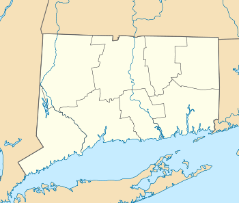  | |
| Location | Roughly bounded by the Merritt Parkway., Burr Street., Redding Rd., Hulls Farm Rd and Hill Farm Rd., Greenfield Hill, Connecticut |
|---|---|
| Coordinates | 41°10′25″N 73°17′28″W / 41.17361°N 73.29111°WCoordinates: 41°10′25″N 73°17′28″W / 41.17361°N 73.29111°W |
| Area | 175 acres (71 ha) |
| Built | 1750 |
| NRHP Reference # | 71000899[1] |
| Added to NRHP | March 11, 1971 |
The Greenfield Hill Historic District is a historic district that was listed on the U.S. National Register of Historic Places (NRHP) in 1971.[1]
It includes 27 contributing buildings over 175 acres (0.71 km2) in the neighborhood of Greenfield Hill, Connecticut.[1]
It includes 38 principal houses or structures and 20 secondary structures, and a windmill.[2]:2 The district includes small streets around the Greenfield Hill Green but has a highly irregular shape extending south. It is drawn to include older, historic homes and to exclude newer, less-historic properties to the north of the green and around the listed area.[2]
The district includes the Bronson Windmill, which is separately NRHP-listed.
The district, along with Southport Historic District and Fairfield Historic District is somewhat governed by Fairfield's Historic District Commission.
Significant properties in the district include:[2]
- Timothy Dwight Park, site of historic academy of Timothy Dwight IV
- Old Cemetery on Bronson
- 1650 Meetinghouse Lane, originally a saltbox home from c. 1750 that was later remodeled extensively. Associated with Abraham Baldwin and with Joel Barlow
- Old Cemetery, on Bronson Road
- 105 Meetinghouse Lane, owned by Zalmon Bradley
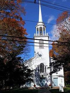
- Greenfield Hill Congregational Church
- "Old Salt Box at 1081 Hillside", a saltbox structure that was a shop, a home, and in which the academy was started
- 3244 Bronson Road
- 3171 Bronson Road, gambrel-roofed
- 2829 Bronson Road, which served during 1901-15 as clubhouse of Greenfield Hill Country Club, but which also is associated with agriculture shows, including one showing 52 oxen in 1906, that illustrated agricultural basis of the area
- 55 Meetinghouse Lane
- 3105 Bronson Road, the windmill
See also
- Greenfield Hill Grange No. 133, a separately NRHP-listed property also in Greenfield Hill but outside the district
- National Register of Historic Places listings in Fairfield County, Connecticut
References
- 1 2 3 National Park Service (2009-03-13). "National Register Information System". National Register of Historic Places. National Park Service.
- 1 2 3 Constance Luyster (1970). "National Register of Historic Places Inventory-Nomination: Greenfield Hill Historic District" (PDF). National Park Service. and Accompanying six photos, from 1951 and 1970
| Topics | |
|---|---|
| Lists by states |
|
| Lists by insular areas | |
| Lists by associated states | |
| Other areas | |
| |