Greenhills Historic District
|
Greenhills Historic District | |
|
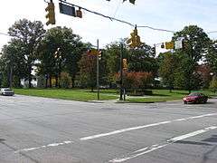
Intersection in the middle of the district | |
  | |
| Location | Roughly Damon Rd., Enfield St., Farragut Rd., Flanders Ln., Winton Rd., Andover Rd., Burley Cir., and Cromwell Rd., Greenhills, Ohio |
|---|---|
| Coordinates | 39°15′50″N 84°31′28″W / 39.26389°N 84.52444°WCoordinates: 39°15′50″N 84°31′28″W / 39.26389°N 84.52444°W |
| Area | 300 acres (120 ha) |
| Architectural style | Colonial Revival, Modern Movement and International Style |
| NRHP Reference # | 88003066[1] |
| Added to NRHP | January 12, 1989 |
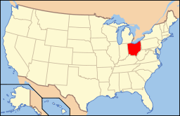
Greenhills Historic District is a registered historic district in Greenhills, Ohio, USA, listed in the National Register of Historic Places on January 12, 1989. It contains 730 contributing buildings. The historic area of Greenhills was originally built by the federal government during the 1930s as one of three "Greenbelt Communities", (Greenbelt, Maryland and Greendale, Wisconsin were also part of this project).[2]
Historic uses
- Single dwelling
- Multiple dwelling
- Specialty store
- Civic
- School
Notes
- ↑ National Park Service (2009-03-13). "National Register Information System". National Register of Historic Places. National Park Service.
- ↑ , Greenhills Historical Society website

This article is issued from Wikipedia - version of the 11/25/2016. The text is available under the Creative Commons Attribution/Share Alike but additional terms may apply for the media files.