Gun (Staffordshire)
For other uses, see Gun Hill, East Sussex; Gun Hill Signal Station; Gun Hill Road (Bronx); and Gun Hill (film).
| Gun Hill | |
|---|---|
| Highest point | |
| Elevation | 373 m (1,224 ft) |
| Prominence | 168 m (551 ft) |
| Parent peak | Shining Tor |
| Listing | Marilyn |
| Geography | |
| Location | Staffordshire, England |
| Parent range | Peak District |
| OS grid | SJ970615 |
| Topo map | OS Landranger 119 |
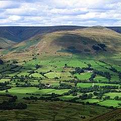
Gun is an undistinguished hill at the southern end of the Peak District. The hill is mainly moorland with some small wooded areas. Gun is often overlooked by walkers who prefer the neighbouring peaks of The Roaches, Hen Cloud and Ramshaw rocks. However it still features typical moorland scenery and some pleasant hill walking. The hill overlooks the town of Leek in the Staffordshire Moorlands which is an ideal base for visiting the Peak District National Park.[1] The hill often features in the itinerary of the Tour of Britain cycle race.
Gun has the Summits on the Air reference G/SP-013
References
- ↑ Kent, Jeff, Staffordshire's 1,000-Foot Peaks, Witan Books, 2013, ISBN 978-0-9927505-0-3.
Coordinates: 53°09′02″N 2°02′47″W / 53.15063°N 2.04631°W
This article is issued from Wikipedia - version of the 8/4/2016. The text is available under the Creative Commons Attribution/Share Alike but additional terms may apply for the media files.