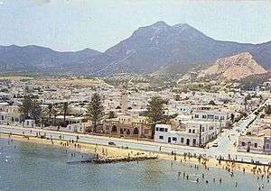
Hammam-Lif
| Hammam-Lif | |
|---|---|
 | |
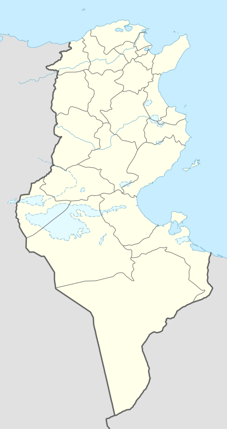 Hammam-Lif Location in Tunisia | |
| Coordinates: 36°44′N 10°20′E / 36.733°N 10.333°E | |
| Country |
|
| Governorate | Ben Arous Governorate |
| Population (2014) | |
| • Total | 42,518 |
| Time zone | CET (UTC1) |
Hammam-Lif (Arabic: حمام الأنف, pronounced hammam linf) is a coastal town about 20 km south-east of Tunis, the capital of Tunisia. It has been known since antiquity for its thermal springs originating in Mount Bou Kornine.
History
Naro, which means fire, was Hammam-Lif's Punic name. In 1883, the French captain Ernest De Prudhomme discovered in his Hammam-lif residence the first archeological ruins of an ancient synagogue that once stood in Hammam-Lif in 3rd-5th century AD.
In the late 19th century, Hammam-Lif, and the rest of Tunisia were conquered by France and incorporated into the French empire. Tunisia gained independence in 1956. During the French occupation, Hammam-Lif was also conquered by Nazi Germany from November 1942 until May 1943. Hammam-Lif was once the home of Italian, Greek and Jewish communities, especially before the end of French occupation.
Hammam-Lif's most interesting site is probably Dar El Bey, which was the residence of Ali II Bey, the 4th bey of Tunis.
Sport
The local football team Club Sportif de Hammam-Lif won the Tunisian championship in 1952, 1954, 1955, 1956 and won the Tunisian Cup in 1946, 1947, 1948, 1949, 1950, 1985, 2001
Notable people
- Ahmed Achour (1945-), conductor and composer
References
External links
- Information and pictures
- CSHL: Hammam-Lif's soccer team
Coordinates: 36°44′N 10°20′E / 36.733°N 10.333°E