Handnesøya
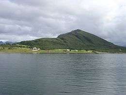 View of the island (from the south) | |
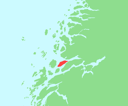 Location in Nordland | |
| Geography | |
|---|---|
| Location | Nordland, Norway |
| Coordinates | 66°15′45″N 13°02′27″E / 66.2624°N 13.0409°ECoordinates: 66°15′45″N 13°02′27″E / 66.2624°N 13.0409°E |
| Area | 34.4 km2 (13.3 sq mi) |
| Length | 13 km (8.1 mi) |
| Width | 4 km (2.5 mi) |
| Highest elevation | 599 m (1,965 ft) |
| Highest point | Stokkatinden |
| Administration | |
| County | Nordland |
| Municipality | Nesna |
Handnesøya is an island in the municipality of Nesna in Nordland county, Norway. The 34.4-square-kilometre (13.3 sq mi) island lies between the islands of Tomma and Hugla and the mainland, along the Sjona fjord. The mountainous island has a very narrow flat area on the east and west sides where the island's residents live. There is a ferry connection to Nesna and Tomma from the village of Handnesneset on the southern tip of the island. Handnesøya Chapel is located in the village of Saura on the western side of the island.[1]
See also
References
- ↑ Store norske leksikon. "Handnesøya" (in Norwegian). Retrieved 2012-01-20.
This article is issued from Wikipedia - version of the 11/18/2016. The text is available under the Creative Commons Attribution/Share Alike but additional terms may apply for the media files.