Hansen Glacier
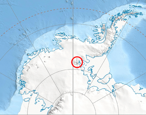
Hansen Glacier (78°21′S 84°33′W / 78.350°S 84.550°WCoordinates: 78°21′S 84°33′W / 78.350°S 84.550°W) is a tributary glacier 10 nautical miles (19 km) long, flowing northeast from Mount Tuck between Veregava Ridge and Doyran Heights to join Dater Glacier west of Dickey Peak, in the Sentinel Range of the Ellsworth Mountains in Antarctica. It was first mapped by the United States Geological Survey from surveys and U.S. Navy air photos, 1957–59, and was named by the Advisory Committee on Antarctic Names for Herbert L. Hansen, a meteorologist at South Pole Station in 1957.[1]
Maps
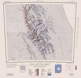
- Vinson Massif. Scale 1:250 000 topographic map. Reston, Virginia: US Geological Survey, 1988.
- Antarctic Digital Database (ADD). Scale 1:250000 topographic map of Antarctica. Scientific Committee on Antarctic Research (SCAR), 1993–2016.
References
- ↑ "Hansen Glacier". Geographic Names Information System. United States Geological Survey. Retrieved 2012-05-21.
![]() This article incorporates public domain material from the United States Geological Survey document "Hansen Glacier" (content from the Geographic Names Information System).
This article incorporates public domain material from the United States Geological Survey document "Hansen Glacier" (content from the Geographic Names Information System).