Hansot
| Hansot Anhot | |
|---|---|
| village | |
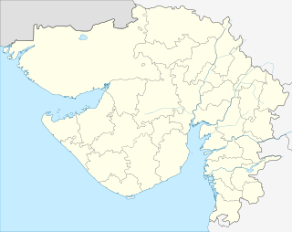 Hansot Location in Gujarat, India | |
| Coordinates: 21°35′0″N 72°48′0″E / 21.58333°N 72.80000°ECoordinates: 21°35′0″N 72°48′0″E / 21.58333°N 72.80000°E | |
| Country |
|
| State | Gujarat |
| District | Bharuch |
| Population | |
| • Total | 12,525 |
| Languages | |
| • Official | Gujarati, Hansoti Urdu, Hindi |
| Time zone | IST (UTC+5:30) |
| Telephone code | 912646 |
| Nearest city | Ankleshwar |
| Lok Sabha constituency | Bharuch |
| Vidhan Sabha constituency | Vagra |
| Website |
hansot |
Hansot is a village in Bharuch district, Gujarat, India, & was originally called "Hansnagri" during the British Era; it is situated about 15 miles (24 km) south west of Bharuch on the south bank of the Narmada River.[1] The village and the surrounding taluka were acquired by the British in 1775, & subsequently returned to the local princely rulers in 1783, being finally incorporated into the Broach district of the Bombay Presidency in 1803.[1]
Hansot was once a small village known as Hansnagari. Soon, it grew into a town. Now it stands as a Taluka with a population of about fifteen thousand of which six thousand are Muslims, and who are thus entitled Hansotis. The Hansotis are a cosmopolitan array of ethnicities. Hansoti surnames are multi-layered reflecting their complex histories, and include amongst others, Shaikh (Sheikh), Pathan, Malek (Malik), Patel and Chauhan. (See Hansot Plates [2]). Hansotis are thus by heritage & geographical origin Gujarati Muslims.
It has modern amenities including Electricity, Telephone, Bus Station, Primary and Higher Secondary Schools, Hospitals, libraries, etc. It has two main communities - Muslims and Hindus. The main attraction in Hansot is the dargah (Tomb) of a great Muslim sufi Sheikh known as Hazrat Mansur Shah Urf Chotumiyan (RA). A yearly Urs (Death Anniversary) attracts up to 350,000 people of all faiths. The people seek shelter in the complex of the dargah and are fed throughout the course of 3 days.
Farming is the main occupation and a large number of people migrate to find jobs. Since, the Narmada river is nearby, Hansot is also famous for its Fish in Bharuch District.
It is located around 20 km from where the Narmada river merges with the Arabian sea. It is the largest Village between Surat and Ankleshwar. Ankleshwar is located 20 km. West from Hansot (Ankleshwar is Asia's largest industrial estate, and one of 190 industrial complexes in Gujarat's "Golden Corridor". The Golden Corridor, so called because of the money brought by rapid development, is an industrial belt running from Vapi at the southern end of Gujarat to Mahesana, about 270 miles to the North). Surat city is 51 km. West from Hansot.
Hansot is also a Taluka consisting of 52 villages. Taluka means Jurisdiction. So, several areas come under Hansot Taluka.[3]
Famous People
- Bibi Turk [4] Confidant of Mughal Shahzadi (Princess) Jahan Ara, polymath, tax officer and humanitarian.
- Farooq Shaikh Indian actor (Bollywood and theatre), philanthropist and popular T.V. presenter.
- Abdulahad Malik Cricketer for Rajasthan Royals.
Culture
After a hard day's work, the men traditionally retired to rest, often signified by adoption of the Lungi. This indicates southern Arabian or Malay influences.
A romantic passion for racing horses on the days of Eid, from the ancient historic Eid Gah [5] and across the beaches washed by the Arabian Sea. This indicates Arabian and Mughal influences.
The language is a venerable archaic proto-Urdu, being neither completely in the camp of standard northern Delhi Urdu nor southern Dakhni Urdu. It is said by some to belong to the middle zone i.e. "Bombay Urdu", as with related cognates.[6] The language has defiantly retained Arabic and Turkic words, neither of which exist in many later Urdu standardisations. It also has picked up words from regional Indic languages, from northern to southern regions. As Hansotis are often seen as a rather independent and clannish community, with words being altered, the services of the professional academic would not go amiss.
Words: Sabāh, Kāti, Kāikélyèh, Baydāh, Choolāh, Gokhlay.
History
For the period, Gregorian centuries 16, 17 & 18,[7]
In Ain-i-Akbari, It is mentioned as a mahal headquarters, and a port of sarkar Broach.
In Mirat-i-Ahmadi, It is mentioned as a mahal headquarters.
References
- 1 2 "Hansot", Imperial Gazetteer of India, 13, Oxford: Clarendon, 1908, pp. 25–26.
- ↑ Sharma, Dasharatha : "Early Chauhan Dynasties" (1959) by S.Chand & Co. Page 14
- ↑ "About Hansot", Hansot.com.
- ↑ Page 77 http://environmentclearance.nic.in/writereaddata/EIA/10092014HDX1RCBVFINALEIAReportofMsKriforIndustriesPvtLtd.pdf
- ↑ http://mw2.google.com/mw-panoramio/photos/medium/64510307.jpg
- ↑ http://journals.cambridge.org/action/displayAbstract?fromPage=online&aid=3806140
- ↑ http://ir.inflibnet.ac.in:8080/jspui/bitstream/10603/60564/12/12_chapter%205.pdf