Harringay railway station
| Harringay | |
|---|---|
 | |
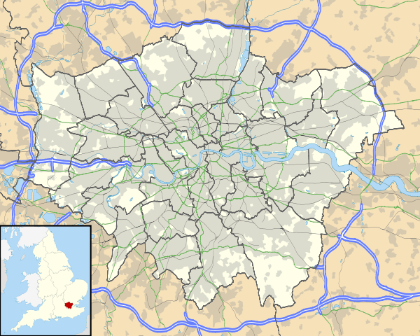 Harringay Location of Harringay in Greater London | |
| Location | Harringay |
| Local authority | London Borough of Haringey |
| Managed by | Great Northern |
| Owner | Network Rail |
| Station code | HGY |
| DfT category | D |
| Number of platforms | 2 |
| Fare zone | 3 |
| OSI |
Harringay Green Lanes |
| National Rail annual entry and exit | |
| 2002–03 | 0.388 million[2] |
| 2004–05 |
|
| 2005–06 |
|
| 2006–07 |
|
| 2007–08 |
|
| 2008–09 |
|
| 2009–10 |
|
| 2010–11 |
|
| 2011–12 |
|
| 2012–13 |
|
| 2013–14 |
|
| 2014–15 |
|
| Key dates | |
| 1 May 1885[3] | Opened |
| Other information | |
| Lists of stations | |
| External links | |
| WGS84 | 51°34′37″N 0°06′19″W / 51.577°N 0.1052°WCoordinates: 51°34′37″N 0°06′19″W / 51.577°N 0.1052°W |
|
| |
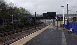
Harringay railway station (also known as Harringay West for part of its history[4]) is a railway station located off Wightman Road in Harringay, north London. It is on the East Coast Main Line between Finsbury Park and Hornsey and opened on 1 May 1885.[3] Harringay is managed and served by Great Northern.[5]
History
A formal agreement to build a station at Harringay was made between the British Land Company and the Great Northern Railway in April 1884.[4] The Land Company needed the station to serve housing it was building to the east of the railway line on the site of Harringay House, so it contributed £3,500 to the cost and agreed to bear the working costs of the station for an initial period. Contracts to build the station (including the footbridge) and a road bridge over the Tottenham & Hampstead line went to S.W. Pattinson of Ruskington for £8,000 and £3,999 respectively in August the same year.[5]
The station was constructed with an up platform as an island serving the up main and up slow, and a single-sided down platform serving the down slow only. A 300-foot-long footbridge (91 m) was constructed to give access to the station. It stretched from a station approach road off Wightman Road to the west side of the cutting, where Quernmore Road would eventually be built some fifteen years later. A booking office was built on the footbridge above the platforms.[4]
The station opened to passenger traffic on 1 May 1885[6] with a staff complement of a station master, two assistant clerks, two ticket collectors, and three porters. Although it had been agreed that the station would be named Harringay Park, the GNR public timetable from May 1885 shows that station was in fact named Harringay from the outset.[6] A goods yard was built to the east of the line, but the exact date it opened for public traffic is not recorded.[4]
In 1900 a second down slow passenger line was added and the down platform was made an island and widened along its entire length.[4]
The 1885 booking office building suffered fire damage in the 1960s and had been almost entirely removed by 1969.[5] It was replaced by a small timber shack, which still serves as a ticket office today.
The station was renamed Harringay West on 18 June 1951, but reverted to Harringay on 27 May 1971.[4][6]
In 1975 the platform layout was altered with the west sides of both acting as single sided platforms.[5] A replacement waiting room/canopy block was provided on each.[5]
Since 1976 under British Rail only the central part of the footbridge, and the girders built to carry the old booking office building, remain from the 1885 station structure.
Under plans approved in 1897, the station was to be served by the Great Northern and Strand Railway (GN&SR), a tube railway supported by the GNR which would have run underground beneath the GNR's tracks from Alexandra Palace to Finsbury Park and then into central London. The GN&SR stations on each side would have been the same as the main line stations. The GN&SR route and stations north of Finsbury Park were cancelled in 1902 when the GN&SR was taken over by Charles Yerkes' consortium, which planned to merge it with the Brompton & Piccadilly Circus Railway to form the Great Northern, Piccadilly and Brompton Railway from Finsbury Park to Hammersmith (now part of the London Underground's Piccadilly line).[7]
Facilities
Oyster pay as you go was introduced at this station on 2 January 2010.[8]
The ticket office opening hours are:
- Monday - Friday: 06:05 - 14:35
- Saturday: 07:05 - 15:35
- Sundays: Closed.[5]
In Autumn 2008, a new SHERE self-service ticket machine, accepting both cash and credit cards, was installed here and at other local FCC stations.[5]
The station has four electronic timetables: one per platform, one inside the ticket office and one outside the ticket office (for when it is closed); the station is also fitted with a hearing loop.
There is a basic waiting room and sheltered area on each platform with some bench seating. The station has cycle access but no wheelchair access.[9]
A payphone is situated just outside the station on Quernmore Road.
Services
Trains run southbound to Moorgate. Trains run northbound to Potters Bar, Hatfield, Welwyn Garden City, Gordon Hill, Hertford North, Stevenage, Hitchin and Letchworth. Services are operated by Great Northern.[10]
The typical off-peak service is:
- 6tph (trains per hour) to Moorgate
- 3tph to Welwyn Garden City, via Potters Bar
- 3tph to Hertford North railway station, with 1tph extended to Letchworth Garden City via Stevenage[5]
On Saturdays and Sundays the service is:
- 4tph to Moorgate
- 2tph to Welwyn Garden City Station, via Potters Bar railway station
- 2tph to Hertford North railway station, with 1tph extended to Stevenage.[5]
Connections
London Buses routes 29, 141, 341, W5 serve the station.[9][11]
Infrastructure
Trains calling at Harringay use the low-speed rail tracks in front of the platforms; there are five more tracks passing through and around the vicinity of the station. Two of these are used for high-speed Virgin Trains East Coast, Hull Trains, Grand Central and other Great Northern services, and the other three are used for freight services. Occasionally, when these lines are busy, the low-speed tracks are used for the faster services.[12]
During the week, trains use dual-voltage class 313 EMUs because these are the only units cleared to run to Moorgate.[13]
In popular culture
A supersized ticket stub, featuring the words 'Harringay West' (and Kings Cross), features prominently in the background of a promotional film of The Beatles' Ticket To Ride, filmed on 23 November 1965 at Twickenham Film Studios.
The station is used as a location in the 2009 film London River.
Route
| Preceding station | |
Following station | ||
|---|---|---|---|---|
| Great Northern | ||||
| Future Development | ||||
| Finsbury Park | Thameslink Thameslink |
Hornsey | ||
| Abandoned Plans | ||||
| Preceding station | Following station | |||
| Finsbury Park towards Strand |
Great Northern & Strand | Hornsey towards Wood Green | ||
References
- ↑ "Out of Station Interchanges" (XLS). Transport for London. May 2011. Archived from the original on 20 October 2012.
- 1 2 3 4 5 6 7 8 9 10 11 12 "Station usage estimates". Rail statistics. Office of Rail Regulation. Please note: Some methodology may vary year on year.
- 1 2 John Young's "Great Northern Suburban"
- 1 2 3 4 5 6 Peter Kay, The Great Northern Main Line in London - Harringay Station, The London Railway Record, Issue 56, July 2008, North London Railway Historical Society, Connor & Butler
- 1 2 3 4 5 6 7 8 9 Harringay Train Station, First Capital Connect website.
- 1 2 3 Butt 1995, p. 114
- ↑ Badsey-Ellis, Antony (2005). London's Lost Tube Schemes. Capital Transport. pp. 77 and 138. ISBN 1-85414-293-3.
- ↑ Oyster Card and National Rail, National Rail Enquiries Website
- 1 2 National Rail Enquiries Website
- ↑ Harringay Train Station, Thameslink website.
- ↑ TfL Bus route map
- ↑ Joe Brown (2006). London Railway Atlas. Ian Allan Publishing.
- ↑ Meet the Directors, First Capital Connect website
- Butt, R.V.J. (October 1995). The Directory of Railway Stations: details every public and private passenger station, halt, platform and stopping place, past and present (1st ed.). Yeovil: Patrick Stephens Ltd. ISBN 1-85260-508-1. R508.
- Jowett, Alan (2000). Jowett's Nationalised Railway Atlas (1st ed.). Penryn, Cornwall: Atlantic Transport Publishers.
External links
| Wikimedia Commons has media related to Harringay railway station. |
- Train times and station information for Harringay railway station from National Rail
- Local Bus Map
- National Rail
- Google maps view of western entrance to station bridge from Quernmore Road
- Harringay Online's Harringay Timeline
- Pictures of the station and its environs on the Harringay Flickr group