Hassi Bel Guebour
| Hassi Bel Guebour | |
|---|---|
| Village | |
 Hassi Bel Guebour | |
| Coordinates: DZ 28°41′21″N 6°30′21″E / 28.68917°N 6.50583°ECoordinates: DZ 28°41′21″N 6°30′21″E / 28.68917°N 6.50583°E | |
| Country |
|
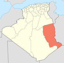
| Province | Illizi Province |
| District | In Amenas District |
| Commune | Bordj Omar Driss[1] |
| Elevation | 327 m (1,073 ft) |
| Time zone | CET (UTC+1) |
Hassi Bel Guebour (also written Hassi Bel Guebbor) is a village in the commune of Bordj Omar Driss,[1] in In Amenas District, Illizi Province, Algeria. It is located at the intersection of the N3 national highway and the local road to Bordj Omar Driss.[2]
References
- 1 2 "Décret n° 84-365, fixant la composition, la consistance et les limites territoriale des communes. Wilaya d'El Oued" (PDF) (in French). Journal officiel de la République Algérienne,. 19 December 1984. p. 1554. Archived from the original (PDF) on 2 March 2013 or before. Retrieved 2 March 2013. Check date values in:
|archive-date=(help) - ↑ "Hassi Bel Guebbour, Illizi, Algeria". Google Maps. Retrieved 28 May 2013.
Neighbouring towns and cities
 |
Ghardaïa El Goléa (Ghardaïa) |
Ouargla Gassi Touil (Ouargla) |
Debdeb | |
| Foggaret Ezzaouia (Tamanrasset) In Salah (Tamanrasset) |
|
Ohanet In Amenas | ||
| ||||
| | ||||
| Bordj Omar Driss Tamanrasset |
Illizi |
This article is issued from Wikipedia - version of the 5/28/2013. The text is available under the Creative Commons Attribution/Share Alike but additional terms may apply for the media files.