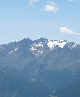
Hintere Eggenspitze
| Hintere Eggenspitze | |
|---|---|
 | |
| Highest point | |
| Elevation | 3,443 m (11,296 ft) |
| Prominence | 475 metres (1,558 ft) |
| Coordinates | 46°28′44″N 10°46′37″E / 46.47889°N 10.77694°ECoordinates: 46°28′44″N 10°46′37″E / 46.47889°N 10.77694°E |
| Geography | |
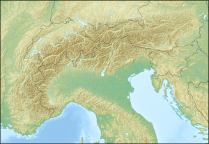 Hintere Eggenspitze Location in the Alps | |
| Location | South Tyrol / Trentino (both Italy) |
| Parent range | Ortler Alps |
| Climbing | |
| First ascent | 30 July 1868 by Julius Payer and Johann Pinggera |
The Hintere Eggenspitze (Italian: Cima Sternai; German: Hintere Eggenspitze) is a mountain in the Ortler Alps on the border between South Tyrol and Trentino, Italy.
References
- Peter Holl: Alpenvereinsführer Ortleralpen, 9. Auflage, München 2003, ISBN 3-7633-1313-3
- Eduard Richter (Redaktion): Die Erschließung der Ostalpen, II. Band, Verlag des Deutschen und Oesterreichischen Alpenvereins, Berlin, 1894
- Casa Editrice Tobacco, Udine: Carta topografica 1:25.000, Blatt 045, Laces / Latsch, Val Martello / Martell, Silandro / Schlanders
This article is issued from Wikipedia - version of the 11/10/2015. The text is available under the Creative Commons Attribution/Share Alike but additional terms may apply for the media files.