Hintere Schwärze
| Hintere Schwärze | |
|---|---|
 Hintere Schwarze in summer 2005 | |
| Highest point | |
| Elevation | 3,628 m (11,903 ft) |
| Prominence | 805 m (2,641 ft) |
| Parent peak | Weißkugel (Wildspitze) |
| Coordinates | 46°46′24″N 10°54′53″E / 46.77333°N 10.91472°ECoordinates: 46°46′24″N 10°54′53″E / 46.77333°N 10.91472°E |
| Geography | |
| Location | Tyrol, Austria / South Tyrol, Italy |
| Parent range | Ötztal Alps |
| Climbing | |
| First ascent | 10 Sep 1867 by E. Pfeiffer, B. Klotz, J. Scheiber |
| Easiest route | Glacier ascent over the west flank |

Hintere Schwärze
Location in Austria
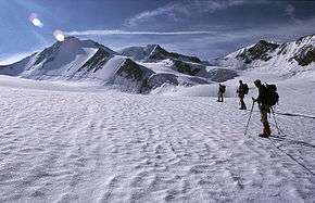
Hintere Schwärze (German pronunciation: [ˈhɪntəʀə ˈʃvɛʁʦə]; Italian: Cima Nera) is a mountain on the border between Austria and Italy. At 3,628 metres (11,903 ft), it is the fourth highest peak in the Ötztal Alps.
North face of Hintere Schwärze, June 2002
This article is issued from Wikipedia - version of the 6/1/2016. The text is available under the Creative Commons Attribution/Share Alike but additional terms may apply for the media files.