Hopedale Village Historic District
|
Hopedale Village Historic District | |
|
Hopedale Unitarian Parish | |
  | |
| Location | Hopedale, Massachusetts |
|---|---|
| Coordinates | 42°7′49″N 71°32′12″W / 42.13028°N 71.53667°WCoordinates: 42°7′49″N 71°32′12″W / 42.13028°N 71.53667°W |
| Area | 804 acres (325 ha) |
| Built | 1856 |
| Architect | Cook, Robert Allen; Manning, Warren Harvey |
| Architectural style | Colonial Revival, Tudor Revival |
| NRHP Reference # | [1] |
| Added to NRHP | June 12, 2002 |
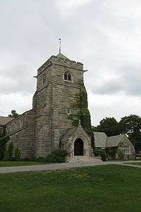
The Hopedale Village Historic District encompasses much of the historic 19th century industrial village center of Hopedale, Massachusetts. Its main focus is the mill complex of the Draper Company at Hopedale and Freedom Streets; the district includes much of northern Hopedale, extending along Dutcher and Freedom Streets, and including the mill pond. It extends to the south just beyond Mendon Street, including properties on that street from the Milford line west to Hopedale Cemetery.[2] The district was added to the National Register of Historic Places in 2002.[1] The district has been included as part of the Blackstone River Valley National Historical Park.
See also
References
- 1 2 National Park Service (2008-04-15). "National Register Information System". National Register of Historic Places. National Park Service.
- ↑ "NRHP nomination for Hopedale Village Historic District". Commonwealth of Massachusetts. Retrieved 2014-03-27.
| Topics |  | ||||||||||||||||||||||||||||||
|---|---|---|---|---|---|---|---|---|---|---|---|---|---|---|---|---|---|---|---|---|---|---|---|---|---|---|---|---|---|---|---|
| Lists by county | |||||||||||||||||||||||||||||||
| Lists by city |
| ||||||||||||||||||||||||||||||
| Other lists | |||||||||||||||||||||||||||||||
| |||||||||||||||||||||||||||||||
This article is issued from Wikipedia - version of the 11/27/2016. The text is available under the Creative Commons Attribution/Share Alike but additional terms may apply for the media files.