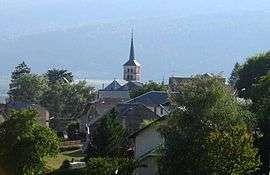
Hotonnes
| Hotonnes | |
|---|---|
 | |
 Hotonnes | |
|
Location within Auvergne-Rhône-Alpes region  Hotonnes | |
| Coordinates: 45°59′53″N 5°41′38″E / 45.998°N 5.694°ECoordinates: 45°59′53″N 5°41′38″E / 45.998°N 5.694°E | |
| Country | France |
| Region | Auvergne-Rhône-Alpes |
| Department | Ain |
| Arrondissement | Belley |
| Canton | Hauteville-Lompnes |
| Intercommunality | Valromey |
| Government | |
| • Mayor (2008–2014) | Jacques Vincent-Falquet |
| Area1 | 28.7 km2 (11.1 sq mi) |
| Population (2008)2 | 300 |
| • Density | 10/km2 (27/sq mi) |
| Time zone | CET (UTC+1) |
| • Summer (DST) | CEST (UTC+2) |
| INSEE/Postal code | 01187 / 01260 |
| Elevation |
636–1,338 m (2,087–4,390 ft) (avg. 736 m or 2,415 ft) |
|
1 French Land Register data, which excludes lakes, ponds, glaciers > 1 km² (0.386 sq mi or 247 acres) and river estuaries. 2 Population without double counting: residents of multiple communes (e.g., students and military personnel) only counted once. | |
Hotonnes is a former commune in the Ain department in eastern France. On 1 January 2016, it was merged into the new commune Haut-Valromey.[1]
Population
| Historical population | ||
|---|---|---|
| Year | Pop. | ±% |
| 1793 | 836 | — |
| 1800 | 973 | +16.4% |
| 1806 | 982 | +0.9% |
| 1821 | 1,071 | +9.1% |
| 1831 | 958 | −10.6% |
| 1836 | 998 | +4.2% |
| 1841 | 1,005 | +0.7% |
| 1846 | 1,029 | +2.4% |
| 1851 | 987 | −4.1% |
| 1856 | 1,030 | +4.4% |
| 1861 | 1,044 | +1.4% |
| 1866 | 1,053 | +0.9% |
| 1872 | 1,043 | −0.9% |
| 1876 | 989 | −5.2% |
| 1881 | 931 | −5.9% |
| 1886 | 901 | −3.2% |
| 1891 | 852 | −5.4% |
| 1896 | 904 | +6.1% |
| 1901 | 879 | −2.8% |
| 1906 | 807 | −8.2% |
| 1911 | 747 | −7.4% |
| 1921 | 547 | −26.8% |
| 1926 | 492 | −10.1% |
| 1931 | 477 | −3.0% |
| 1936 | 444 | −6.9% |
| 1946 | 424 | −4.5% |
| 1954 | 376 | −11.3% |
| 1962 | 322 | −14.4% |
| 1968 | 266 | −17.4% |
| 1975 | 233 | −12.4% |
| 1982 | 231 | −0.9% |
| 1990 | 268 | +16.0% |
| 1999 | 295 | +10.1% |
| 2008 | 300 | +1.7% |
See also
References
- ↑ Arrêté préfectoral 29 September 2015 (French)
| Wikimedia Commons has media related to Hotonnes. |
This article is issued from Wikipedia - version of the 2/8/2016. The text is available under the Creative Commons Attribution/Share Alike but additional terms may apply for the media files.