Houtteville
| Houtteville | |
|---|---|
|
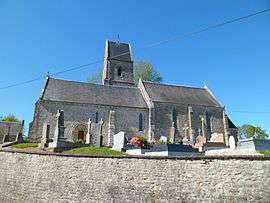
The church of Saint-Jean-Baptiste | |
 Houtteville | |
|
Location within Normandy region  Houtteville | |
| Coordinates: 49°20′21″N 1°21′39″W / 49.3392°N 1.3608°WCoordinates: 49°20′21″N 1°21′39″W / 49.3392°N 1.3608°W | |
| Country | France |
| Region | Normandy |
| Department | Manche |
| Arrondissement | Cherbourg |
| Canton | Carentan |
| Intercommunality | Baie du Cotentin |
| Government | |
| • Mayor (2008–2014) | Michèle Josset |
| Area1 | 4.51 km2 (1.74 sq mi) |
| Population (2006)2 | 91 |
| • Density | 20/km2 (52/sq mi) |
| Time zone | CET (UTC+1) |
| • Summer (DST) | CEST (UTC+2) |
| INSEE/Postal code | 50250 / 50250 |
| Elevation |
1–37 m (3.3–121.4 ft) (avg. 120 m or 390 ft) |
|
1 French Land Register data, which excludes lakes, ponds, glaciers > 1 km² (0.386 sq mi or 247 acres) and river estuaries. 2 Population without double counting: residents of multiple communes (e.g., students and military personnel) only counted once. | |
Houtteville is a former commune in the Manche department in north-western France. On 1 January 2016, it was merged into the commune of Picauville.[1]
Heraldry
.svg.png) |
The arms of Houtteville are blazoned : Per fess, sable and Or. |
See also
References
- ↑ Arrêté préfectoral 23 December 2015 (French)
| Wikimedia Commons has media related to Houtteville. |
This article is issued from Wikipedia - version of the 4/4/2016. The text is available under the Creative Commons Attribution/Share Alike but additional terms may apply for the media files.