Huamashraju
| Huamashraju | |
|---|---|
| Yanahuacra, Rajo Colta | |
 | |
| Highest point | |
| Elevation | 5,434 m (17,828 ft) |
| Coordinates | 9°31′30″S 77°23′06″W / 9.52500°S 77.38500°WCoordinates: 9°31′30″S 77°23′06″W / 9.52500°S 77.38500°W |
| Geography | |
 Huamashraju Peru | |
| Location | Peru, Ancash Region |
| Parent range | Andes, Cordillera Blanca |
| Climbing | |
| First ascent | 1954, J. Cabana and A. Soriano[1] |
Huamashraju,[2][3][1] Wamashraju,[4] (possibly from Quechua rahu snow, ice, mountain with snow),[5] Yanahuacra[3] (possibly from Quechua yana black, waqra horn, "black horn") or Rajo Colta[6] is a mountain in the Cordillera Blanca in the Andes of Peru, about 5,434 metres (17,828 ft) high.[2][3][6] It is situated in the Ancash Region, Huaraz Province, Huaraz District. Huamashraju lies east of the town of Huaraz, west of Huantsán and northwest of Shaqsha and Cashan.
Gallery
-

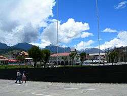
Huamashraju as seen from Huaraz
-
Ranrapalca (in the distance), Rima Rima, Churup (middle, left), Qullapaqu and Huamashraju as seen from Huaraz
-

Ranrapalca (on the left), Huamashraju, Kashan, Shaqsha (center) and Huantsán (on the right) as seen from the southwest
See also
References
- 1 2 "Huamashraju". www.montanasperuanas.com. Retrieved 2016-06-22.
- 1 2 Alpenvereinskarte 0/3b. Cordillera Blanca Süd (Peru). 1:100 000. Oesterreichischer Alpenverein. 2005. ISBN 3-937530-05-3.
- 1 2 3 Neate, Jill (1994). "Peru". Mountaineering in the Andes (PDF). RGS-IBG Expedition Advisory Centre. p. 14. ISBN 0-907649-64-5.
- ↑ Ricker, John (1977). Yuraq Janka: A Guide to the Peruvian Andes. The Mountaineers Books. pp. 109–111.
- ↑ babylon.com
- 1 2 Peru 1:100 000, Recuay (20-i). IGN (Instituto Geográfico Nacional - Perú).
This article is issued from Wikipedia - version of the 7/7/2016. The text is available under the Creative Commons Attribution/Share Alike but additional terms may apply for the media files.